How to get to Snodgrass Music by bus?
Click on the bus route to see step by step directions with maps, line arrival times and updated time schedules.
From Codman Square, Boston
78 minFrom Granite Links Golf Club at Quarry Hills, Quincy
79 minFrom Best Western Adams Inn Quincy - Boston, Quincy
52 minFrom Ramada Boston, Boston
78 minFrom John F. Kennedy Presidential Library And Museum, Boston
111 minFrom UMass Boston Campus Center, Boston
134 minFrom Boston Scientific, Quincy
70 minFrom Dorchester District Court, Boston
78 minFrom Milton, MA, Milton
73 minFrom JFK Library, Boston
111 min
How to get to Snodgrass Music by train?
Click on the train route to see step by step directions with maps, line arrival times and updated time schedules.
How to get to Snodgrass Music by subway?
Click on the subway route to see step by step directions with maps, line arrival times and updated time schedules.
From Codman Square, Boston
75 minFrom Best Western Adams Inn Quincy - Boston, Quincy
62 minFrom Ramada Boston, Boston
84 minFrom John F. Kennedy Presidential Library And Museum, Boston
77 minFrom UMass Boston Campus Center, Boston
78 minFrom Dorchester District Court, Boston
73 minFrom Milton, MA, Milton
107 minFrom JFK Library, Boston
77 min
Bus stops near Snodgrass Music in Braintree Town
Train stations near Snodgrass Music in Braintree Town
Subway station near Snodgrass Music in Braintree Town
- Braintree, 44 min walk,VIEW
Bus lines to Snodgrass Music in Braintree Town
What are the closest stations to Snodgrass Music?
The closest stations to Snodgrass Music are:
- Quincy Ave @ E Howard St is 400 yards away, 5 min walk.
- Commercial St Opp Erickson St is 501 yards away, 6 min walk.
- Braintree is 3491 yards away, 42 min walk.
- Weymouth Landing/East Braintree is 4149 yards away, 49 min walk.
Which bus lines stop near Snodgrass Music?
These bus lines stop near Snodgrass Music: 215, 225.
Which train line stops near Snodgrass Music?
GREENBUSH (#1061 | Greenbush)
Which subway line stops near Snodgrass Music?
RED LINE (Ashmont/Braintree)
What’s the nearest bus station to Snodgrass Music in Braintree Town?
The nearest bus station to Snodgrass Music in Braintree Town is Quincy Ave @ E Howard St. It’s a 5 min walk away.
What time is the first subway to Snodgrass Music in Braintree Town?
The RED LINE is the first subway that goes to Snodgrass Music in Braintree Town. It stops nearby at 5:09 AM.
What time is the last subway to Snodgrass Music in Braintree Town?
The RED LINE is the last subway that goes to Snodgrass Music in Braintree Town. It stops nearby at 2:00 AM.
What time is the first train to Snodgrass Music in Braintree Town?
The FALL RIVER/NEW BEDFORD is the first train that goes to Snodgrass Music in Braintree Town. It stops nearby at 5:27 AM.
What time is the last train to Snodgrass Music in Braintree Town?
The KINGSTON is the last train that goes to Snodgrass Music in Braintree Town. It stops nearby at 12:25 AM.
What time is the first bus to Snodgrass Music in Braintree Town?
The 225 is the first bus that goes to Snodgrass Music in Braintree Town. It stops nearby at 5:14 AM.
What time is the last bus to Snodgrass Music in Braintree Town?
The 225 is the last bus that goes to Snodgrass Music in Braintree Town. It stops nearby at 12:50 AM.
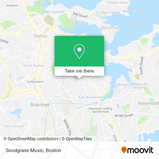
See Snodgrass Music, Braintree Town, on the map
Public Transit to Snodgrass Music in Braintree Town
Wondering how to get to Snodgrass Music in Braintree Town? Moovit helps you find the best way to get to Snodgrass Music with step-by-step directions from the nearest public transit station.
Moovit provides free maps and live directions to help you navigate through your city. View schedules, routes, timetables, and find out how long does it take to get to Snodgrass Music in real time.
Looking for the nearest stop or station to Snodgrass Music? Check out this list of stops closest to your destination: Quincy Ave @ E Howard St; Commercial St Opp Erickson St; Braintree; Weymouth Landing/East Braintree.
Bus: 215, 225, 236.Train: GREENBUSH, CAPEFLYER, FALL RIVER/NEW BEDFORD, KINGSTON.Subway: RED LINE.
Want to see if there’s another route that gets you there at an earlier time? Moovit helps you find alternative routes or times. Get directions from and directions to Snodgrass Music easily from the Moovit App or Website.
We make riding to Snodgrass Music easy, which is why over 1.7 million users, including users in Braintree Town, trust Moovit as the best app for public transit. You don’t need to download an individual bus app or train app, Moovit is your all-in-one transit app that helps you find the best bus time or train time available.
For information on prices of bus, subway and train, costs and ride fares to Snodgrass Music, please check the Moovit app.
Use the app to navigate to popular places including to the airport, hospital, stadium, grocery store, mall, coffee shop, school, college, and university.
Snodgrass Music Address: 3 Skyline Dr street in Braintree Town
- PGZ Junk Removal,
- Quirk Chevrolet,
- Nicholls Landscaping,
- Top Pot,
- Jordan Locksmith,
- BELD (Braintree Electric Light Department),
- Scott The Locksmith Liec,
- Quirk Works Subaru,
- Moose Lodge,
- Fast ATM,
- Valvoline Instant Oil Change,
- Interstate Batteries,
- Foursquare Church,
- Sr Auto Design,
- U-Haul,
- Quirk HYUNDAI,
- DUNKIN',
- Ramos Construction,
- Interstate Batteries,
- Cap Painting Corporation
Places Near Snodgrass Music (Braintree Town)
- Faneuil Hall, Boston,
- Quincy Market, Boston,
- House Of Blues, Boston,
- Td Garden, Boston,
- Boston Convention & Exhibition Center, Boston,
- North End, Boston,
- Boston Children's Hospital, Boston,
- Prudential Center, Boston,
- Boston Medical Center, Boston,
- Cheers, Boston,
- Castle Island, Boston,
- Leader Bank Pavilion (Leader Bank Pavillion), Boston,
- Wang Theater, Boston,
- Seaport District, Boston,
- Massachusetts General Hospital, Boston,
- Boston Common, Boston,
- Isabella Stewart Gardner Museum, Boston,
- Mgm Music Hall, Boston,
- Museum Of Science, Boston,
- Wilbur Theatre, Boston
How to get to popular places in Boston with public transit
Get around Braintree Town by public transit!
Traveling around Braintree Town has never been so easy. See step by step directions as you travel to any attraction, street or major public transit station. View bus and train schedules, arrival times, service alerts and detailed routes on a map, so you know exactly how to get to anywhere in Braintree Town.
When traveling to any destination around Braintree Town use Moovit's Live Directions with Get Off Notifications to know exactly where and how far to walk, how long to wait for your line, and how many stops are left. Moovit will alert you when it's time to get off — no need to constantly re-check whether yours is the next stop.
Wondering how to use public transit in Braintree Town or how to pay for public transit in Braintree Town? Moovit public transit app can help you navigate your way with public transit easily, and at minimum cost. It includes public transit fees, ticket prices, and costs. Looking for a map of Braintree Town public transit lines? Moovit public transit app shows all public transit maps in Braintree Town with all Bus, Train, Subway and Ferry routes and stops on an interactive map.
Boston has 4 transit type(s), including: Bus, Train, Subway and Ferry, operated by several transit agencies, including MBTA, Southeastern Regional Transit Authority, MetroWest Regional Transit Authority, Rhode Island Public Transit Authority, WRTA, Lowell Regional Transit Authority, Merrimack Valley Transit, Montachusett Regional Transit Authority, Cape Cod Regional Transit Authority, Brockton Area Transit Authority, Martha's Vineyard Transit Authority, the WAVE - Nantucket Regional Transit Authority, GATRA, Cape Ann Transportation Authority and Massport