How to get to Sofft Shoes Co. by bus?
Click on the bus route to see step by step directions with maps, line arrival times and updated time schedules.
How to get to Sofft Shoes Co. by train?
Click on the train route to see step by step directions with maps, line arrival times and updated time schedules.
Bus stops near Sofft Shoes Co. in Boston
Train station near Sofft Shoes Co. in Boston
- Lawrence, 39 min walk,VIEW
Bus lines to Sofft Shoes Co. in Boston
What are the closest stations to Sofft Shoes Co.?
The closest stations to Sofft Shoes Co. are:
- North Main Street & Frye Circle is 273 yards away, 4 min walk.
- Main Street & William Street is 574 yards away, 7 min walk.
- Doctors Park is 1372 yards away, 17 min walk.
- Lawrence is 3326 yards away, 39 min walk.
Which bus line stops near Sofft Shoes Co.?
2 (Main And School)
Which train line stops near Sofft Shoes Co.?
HAVERHILL (#232 | North Station)
What’s the nearest bus station to Sofft Shoes Co. in Boston?
The nearest bus station to Sofft Shoes Co. in Boston is North Main Street & Frye Circle. It’s a 4 min walk away.
What time is the first train to Sofft Shoes Co. in Boston?
The HAVERHILL is the first train that goes to Sofft Shoes Co. in Boston. It stops nearby at 4:51 AM.
What time is the last train to Sofft Shoes Co. in Boston?
The HAVERHILL is the last train that goes to Sofft Shoes Co. in Boston. It stops nearby at 12:38 AM.
What time is the first bus to Sofft Shoes Co. in Boston?
The 2 is the first bus that goes to Sofft Shoes Co. in Boston. It stops nearby at 5:11 AM.
What time is the last bus to Sofft Shoes Co. in Boston?
The 2 is the last bus that goes to Sofft Shoes Co. in Boston. It stops nearby at 9:34 PM.
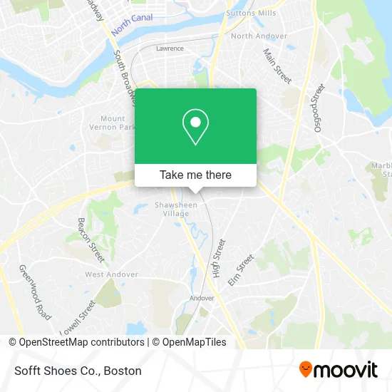
See Sofft Shoes Co., Boston, on the map
Public Transit to Sofft Shoes Co. in Boston
Wondering how to get to Sofft Shoes Co. in Boston? Moovit helps you find the best way to get to Sofft Shoes Co. with step-by-step directions from the nearest public transit station.
Moovit provides free maps and live directions to help you navigate through your city. View schedules, routes, timetables, and find out how long does it take to get to Sofft Shoes Co. in real time.
Looking for the nearest stop or station to Sofft Shoes Co.? Check out this list of stops closest to your destination: North Main Street & Frye Circle; Main Street & William Street; Doctors Park; Lawrence.
Bus: 2, 21, 26, 3.Train: HAVERHILL.
Want to see if there’s another route that gets you there at an earlier time? Moovit helps you find alternative routes or times. Get directions from and directions to Sofft Shoes Co. easily from the Moovit App or Website.
We make riding to Sofft Shoes Co. easy, which is why over 1.7 million users, including users in Boston, trust Moovit as the best app for public transit. You don’t need to download an individual bus app or train app, Moovit is your all-in-one transit app that helps you find the best bus time or train time available.
For information on prices of bus and train, costs and ride fares to Sofft Shoes Co., please check the Moovit app.
Use the app to navigate to popular places including to the airport, hospital, stadium, grocery store, mall, coffee shop, school, college, and university.
Sofft Shoes Co. Address: 100 Brickstone Sq street in Boston
- The Start Group,
- Beyondtrust,
- Andover Landing,
- Cla Cliftonlarsonallen,
- Ventures,
- Apex Communications,
- Lifeatalku,
- Raid Inc,
- Randstad,
- Wimberly,
- Chris Cares Merrimack Valley Real Estate - Chris Lefebvre Exp Realty,
- Beacon Energy Solutions,
- Griswold Special Care,
- Donovan Technical Staffing,
- Bookstore,
- The New England Patriots,
- Certapro Painters,
- Generations Law Group,
- Boston Neurobehavioral Associates,
- Northrop Grumman
Places Near Sofft Shoes Co. (Boston)
- House Of Blues, Boston,
- Prudential Center, Boston,
- Boston Convention & Exhibition Center, Boston,
- Wang Theater, Boston,
- Seaport District, Boston,
- Td Garden, Boston,
- Leader Bank Pavilion (Leader Bank Pavillion), Boston,
- Museum Of Science, Boston,
- North End, Boston,
- Castle Island, Boston,
- Boston Medical Center, Boston,
- Boston Children's Hospital, Boston,
- Boston Common, Boston,
- Quincy Market, Boston,
- Massachusetts General Hospital, Boston,
- Faneuil Hall, Boston,
- Wilbur Theatre, Boston,
- Cheers, Boston,
- Isabella Stewart Gardner Museum, Boston,
- Mgm Music Hall, Boston
How to get to popular places in Boston with public transit
Get around Boston by public transit!
Traveling around Boston has never been so easy. See step by step directions as you travel to any attraction, street or major public transit station. View bus and train schedules, arrival times, service alerts and detailed routes on a map, so you know exactly how to get to anywhere in Boston.
When traveling to any destination around Boston use Moovit's Live Directions with Get Off Notifications to know exactly where and how far to walk, how long to wait for your line, and how many stops are left. Moovit will alert you when it's time to get off — no need to constantly re-check whether yours is the next stop.
Wondering how to use public transit in Boston or how to pay for public transit in Boston? Moovit public transit app can help you navigate your way with public transit easily, and at minimum cost. It includes public transit fees, ticket prices, and costs. Looking for a map of Boston public transit lines? Moovit public transit app shows all public transit maps in Boston with all Bus, Train, Subway and Ferry routes and stops on an interactive map.
Boston has 4 transit type(s), including: Bus, Train, Subway and Ferry, operated by several transit agencies, including MBTA, Southeastern Regional Transit Authority, MetroWest Regional Transit Authority, Rhode Island Public Transit Authority, WRTA, Lowell Regional Transit Authority, Merrimack Valley Transit, Montachusett Regional Transit Authority, Cape Cod Regional Transit Authority, Brockton Area Transit Authority, Martha's Vineyard Transit Authority, the WAVE - Nantucket Regional Transit Authority, GATRA, Cape Ann Transportation Authority and Massport