See Soldier's Tower, Toronto, on the map
Directions to Soldier's Tower (Toronto) with public transportation
The following transit lines have routes that pass near Soldier's Tower
 Bus:
Bus: - Train:
- Subway:
How to get to Soldier's Tower by bus?
Click on the bus route to see step by step directions with maps, line arrival times and updated time schedules.
How to get to Soldier's Tower by train?
Click on the train route to see step by step directions with maps, line arrival times and updated time schedules.
How to get to Soldier's Tower by subway?
Click on the subway route to see step by step directions with maps, line arrival times and updated time schedules.
Bus stations near Soldier's Tower in Toronto
- Hoskin Ave At Tower Rd (Trinity College),2 min walk,
- Hoskin Ave At Tower Rd (Wycliffe College),2 min walk,
- Queen'S Park Cres West At Hart House,2 min walk,
Bus lines to Soldier's Tower in Toronto
- 94A,Ossington Station,
- 94,Castle Frank Station,
- 13A,Queen's Park Cres East at College St North Side,
- 13B,Elm St at University Ave East Side,
What are the closest stations to Soldier's Tower?
The closest stations to Soldier's Tower are:
- Hoskin Ave At Tower Rd (Trinity College) is 127 meters away, 2 min walk.
- Hoskin Ave At Tower Rd (Wycliffe College) is 132 meters away, 2 min walk.
- Queen'S Park Cres West At Hart House is 143 meters away, 2 min walk.
Which bus lines stop near Soldier's Tower?
These bus lines stop near Soldier's Tower: 142, 26, 5, 94.
Which train line stops near Soldier's Tower?
BR
Which subway line stops near Soldier's Tower?
1
What’s the nearest bus stop to Soldier's Tower in Toronto?
The nearest bus stops to Soldier's Tower in Toronto are Hoskin Ave At Tower Rd (Trinity College), Hoskin Ave At Tower Rd (Wycliffe College) and Queen'S Park Cres West At Hart House. The closest one is a 2 min walk away.
See Soldier's Tower, Toronto, on the map
Public Transit to Soldier's Tower in Toronto
Wondering how to get to Soldier's Tower in Toronto, Canada? Moovit helps you find the best way to get to Soldier's Tower with step-by-step directions from the nearest public transit station.
Moovit provides free maps and live directions to help you navigate through your city. View schedules, routes, timetables, and find out how long does it take to get to Soldier's Tower in real time.
Looking for the nearest stop or station to Soldier's Tower? Check out this list of stops closest to your destination: Hoskin Ave At Tower Rd (Trinity College); Hoskin Ave At Tower Rd (Wycliffe College); Queen'S Park Cres West At Hart House.
Bus:Train:Subway:
Want to see if there’s another route that gets you there at an earlier time? Moovit helps you find alternative routes or times. Get directions from and directions to Soldier's Tower easily from the Moovit App or Website.
We make riding to Soldier's Tower easy, which is why over 1.5 million users, including users in Toronto, trust Moovit as the best app for public transit. You don’t need to download an individual bus app or train app, Moovit is your all-in-one transit app that helps you find the best bus time or train time available.
For information on prices of bus, subway and train, costs and ride fares to Soldier's Tower, please check the Moovit app.
Use the app to navigate to popular places including to the airport, hospital, stadium, grocery store, mall, coffee shop, school, college, and university.
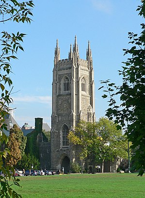
Soldier's Tower Address: Hart House Circle street in Toronto
Attractions near Soldier's Tower
Robinhood Tower,Tower Road Parking Lot,Hart House Music Room,CIUT 89.5 FM,Hart House Gym,Justina M. Barnicke Gallery,University College Art Centre,Hart House Library,Hart House Gym,University Of Toronto Art Centre,TD Green Machine Robarts Library,Taste of Ramen,Tower Road,Dig In! Utsu Equity Garden Plot,UTAC Art Lounge,University of Toronto Students' Union,Nike+ Annex Run Club,Arbor Room,Crux Discount Theological Books,Hart House QuadHow to get to popular attractions in Toronto with public transit
Ancaster, Ontario, Hamilton,Lawrence Subway Station, Toronto,City of Hamilton, Hamilton,Toronto Zoo, Toronto,Brampton ON, Brampton,University Of Toronto Mississauga Campus, Mississauga,Outlet Collection at Niagara, Niagara-On-The-Lake,Earls Kitchen & Bar, Toronto,Landmark Cinemas, Waterloo,Starbucks, Waterloo,Durham College (Oshawa Campus), Oshawa,Starbucks, Toronto,Oshawa, Ontario, Oshawa,Starbucks, Toronto,City of Burlington, Burlington,Burlington GO Station, Burlington,City of Welland, Welland,Destiny 緣續園, Richmond Hill,TTC 505 Dundas Streetcar, Toronto,Rogers Centre, TorontoGet around Toronto by public transit!
Traveling around Toronto has never been so easy. See step by step directions as you travel to any attraction, street or major public transit station. View bus and train schedules, arrival times, service alerts and detailed routes on a map, so you know exactly how to get to anywhere in Toronto.
When traveling to any destination around Toronto use Moovit's Live Directions with Get Off Notifications to know exactly where and how far to walk, how long to wait for your line, and how many stops are left. Moovit will alert you when it's time to get off — no need to constantly re-check whether yours is the next stop.
Wondering how to use public transit in Toronto or how to pay for public transit in Toronto? Moovit public transit app can help you navigate your way with public transit easily, and at minimum cost. It includes public transit fees, ticket prices, and costs. Looking for a map of Toronto public transit lines? Moovit public transit app shows all public transit maps in Toronto with all bus, subway or train routes and stops on an interactive map.
Toronto has 3 transit type(s), including: bus, subway or train, operated by several transit agencies, including TTC, TTC Streetcar, Toronto Subway, GO Transit Bus, GO Transit, Amtrak, York Region Transit, Grand River Transit, Guelph Transit, grt, Hamilton Street Railway, MiWay, Brampton Transit, Burlington Transit and Oakville Transit