Directions to Soleil Concepts (Watertown Town) with public transportation
The following transit lines have routes that pass near Soleil Concepts
 Bus: 504, 57, 70, 71, 59.
- Train: FITCHBURG, FRAMINGHAM/WORCESTER.
- Subway: GREEN LINE D, GREEN LINE B.
How to get to Soleil Concepts by bus?
Click on the bus route to see step by step directions with maps, line arrival times and updated time schedules.
From 221 Longwood, Boston
45 minFrom Acorn Street, Boston
42 minFrom The Middle East Restaurant, Cambridge
38 minFrom The Swan Boats, Boston
35 minFrom Beth Israel Deaconess Medical Center West Campus, Boston
45 minFrom Boston Ballet, Boston
37 minFrom Park Plaza Castle, Boston
32 minFrom davio's, Boston
30 minFrom Massachusetts General Hospital/Harvard Medical School, Boston
49 minFrom Dana-Farber Cancer Institute, Boston
44 min
How to get to Soleil Concepts by train?
Click on the train route to see step by step directions with maps, line arrival times and updated time schedules.
From 221 Longwood, Boston
59 minFrom Acorn Street, Boston
82 minFrom The Swan Boats, Boston
59 minFrom Beth Israel Deaconess Medical Center West Campus, Boston
58 minFrom Boston Ballet, Boston
51 minFrom Park Plaza Castle, Boston
51 minFrom davio's, Boston
52 minFrom Massachusetts General Hospital/Harvard Medical School, Boston
74 minFrom Dana-Farber Cancer Institute, Boston
57 min
Bus stops near Soleil Concepts in Watertown Town
Train stations near Soleil Concepts in Watertown Town
Subway stations near Soleil Concepts in Watertown Town
Bus lines to Soleil Concepts in Watertown Town
What are the closest stations to Soleil Concepts?
The closest stations to Soleil Concepts are:
- Watertown St @ Pond St is 312 yards away, 4 min walk.
- Newtonville is 376 yards away, 5 min walk.
- Main St @ Cross St is 519 yards away, 7 min walk.
- Technology Way @ Watertown Yard is 561 yards away, 7 min walk.
- Watertown Square is 715 yards away, 9 min walk.
- Newton Centre is 3788 yards away, 45 min walk.
- Boston College is 5238 yards away, 62 min walk.
- Waverley is 5265 yards away, 62 min walk.
Which bus lines stop near Soleil Concepts?
These bus lines stop near Soleil Concepts: 504, 57, 70, 71.
Which train lines stop near Soleil Concepts?
These train lines stop near Soleil Concepts: FITCHBURG, FRAMINGHAM/WORCESTER.
What’s the nearest train station to Soleil Concepts in Watertown Town?
The nearest train station to Soleil Concepts in Watertown Town is Newtonville. It’s a 5 min walk away.
What’s the nearest bus station to Soleil Concepts in Watertown Town?
The nearest bus station to Soleil Concepts in Watertown Town is Watertown St @ Pond St. It’s a 4 min walk away.
What time is the first subway to Soleil Concepts in Watertown Town?
The GREEN LINE D is the first subway that goes to Soleil Concepts in Watertown Town. It stops nearby at 4:54 AM.
What time is the last subway to Soleil Concepts in Watertown Town?
The GREEN LINE B is the last subway that goes to Soleil Concepts in Watertown Town. It stops nearby at 2:39 AM.
What time is the first train to Soleil Concepts in Watertown Town?
The FRAMINGHAM/WORCESTER is the first train that goes to Soleil Concepts in Watertown Town. It stops nearby at 5:22 AM.
What time is the last train to Soleil Concepts in Watertown Town?
The FRAMINGHAM/WORCESTER is the last train that goes to Soleil Concepts in Watertown Town. It stops nearby at 12:20 AM.
What time is the first bus to Soleil Concepts in Watertown Town?
The 57 is the first bus that goes to Soleil Concepts in Watertown Town. It stops nearby at 4:30 AM.
What time is the last bus to Soleil Concepts in Watertown Town?
The 57 is the last bus that goes to Soleil Concepts in Watertown Town. It stops nearby at 2:34 AM.
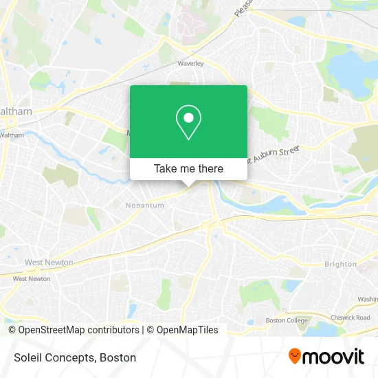
See Soleil Concepts, Watertown Town, on the map
Public Transit to Soleil Concepts in Watertown Town
Wondering how to get to Soleil Concepts in Watertown Town? Moovit helps you find the best way to get to Soleil Concepts with step-by-step directions from the nearest public transit station.
Moovit provides free maps and live directions to help you navigate through your city. View schedules, routes, timetables, and find out how long does it take to get to Soleil Concepts in real time.
Looking for the nearest stop or station to Soleil Concepts? Check out this list of stops closest to your destination: Watertown St @ Pond St; Newtonville; Main St @ Cross St; Technology Way @ Watertown Yard; Watertown Square; Newton Centre; Boston College; Waverley.
Bus: 504, 57, 70, 71, 59.Train: FITCHBURG, FRAMINGHAM/WORCESTER.Subway: GREEN LINE D, GREEN LINE B.
Want to see if there’s another route that gets you there at an earlier time? Moovit helps you find alternative routes or times. Get directions from and directions to Soleil Concepts easily from the Moovit App or Website.
We make riding to Soleil Concepts easy, which is why over 1.7 million users, including users in Watertown Town, trust Moovit as the best app for public transit. You don’t need to download an individual bus app or train app, Moovit is your all-in-one transit app that helps you find the best bus time or train time available.
For information on prices of bus, train and subway, costs and ride fares to Soleil Concepts, please check the Moovit app.
Use the app to navigate to popular places including to the airport, hospital, stadium, grocery store, mall, coffee shop, school, college, and university.
Soleil Concepts Address: 124 Watertown St street in Watertown Town
- Alpha Omega Autobody of Watertown,
- Watertown Dealtry Pool,
- The Pappas Company,
- Applied Image of Watertown,
- Brewbound Experience,
- Fablevision Studios,
- Modera Newton,
- MBTA Watertown Yard,
- Nanotemper Technologies,
- Reit Management,
- RMR,
- SHC Steward Health,
- FedEx,
- Amethyst Chiropractic,
- Goddard School,
- The Watertown Catholic Collaborative of Sacred Heart and Saint Patrick,
- 63 pleasant st, watertown, ma,
- Bluemetal,
- Innovative Promotional CNCPTS,
- Turtle Studios Newton
Places Near Soleil Concepts (Watertown Town)
- Prudential Center, Boston,
- Cheers, Boston,
- Boston Convention & Exhibition Center, Boston,
- Td Garden, Boston,
- Castle Island, Boston,
- Wang Theater, Boston,
- Boston Children's Hospital, Boston,
- Leader Bank Pavilion (Leader Bank Pavillion), Boston,
- Massachusetts General Hospital, Boston,
- Boston Medical Center, Boston,
- Seaport District, Boston,
- Faneuil Hall, Boston,
- House Of Blues, Boston,
- Museum Of Science, Boston,
- Quincy Market, Boston,
- Boston Common, Boston,
- Wilbur Theatre, Boston,
- Mgm Music Hall, Boston,
- Isabella Stewart Gardner Museum, Boston,
- North End, Boston
How to get to popular places in Boston with public transit
Get around Watertown Town by public transit!
Traveling around Watertown Town has never been so easy. See step by step directions as you travel to any attraction, street or major public transit station. View bus and train schedules, arrival times, service alerts and detailed routes on a map, so you know exactly how to get to anywhere in Watertown Town.
When traveling to any destination around Watertown Town use Moovit's Live Directions with Get Off Notifications to know exactly where and how far to walk, how long to wait for your line, and how many stops are left. Moovit will alert you when it's time to get off — no need to constantly re-check whether yours is the next stop.
Wondering how to use public transit in Watertown Town or how to pay for public transit in Watertown Town? Moovit public transit app can help you navigate your way with public transit easily, and at minimum cost. It includes public transit fees, ticket prices, and costs. Looking for a map of Watertown Town public transit lines? Moovit public transit app shows all public transit maps in Watertown Town with all Bus, Train, Subway and Ferry routes and stops on an interactive map.
Boston has 4 transit type(s), including: Bus, Train, Subway and Ferry, operated by several transit agencies, including MBTA, Southeastern Regional Transit Authority, MetroWest Regional Transit Authority, Rhode Island Public Transit Authority, WRTA, Lowell Regional Transit Authority, Merrimack Valley Transit, Montachusett Regional Transit Authority, Cape Cod Regional Transit Authority, Brockton Area Transit Authority, Martha's Vineyard Transit Authority, the WAVE - Nantucket Regional Transit Authority, GATRA, Cape Ann Transportation Authority and Massport