How to get to Solid Color Inc by bus?
Click on the bus route to see step by step directions with maps, line arrival times and updated time schedules.
How to get to Solid Color Inc by train?
Click on the train route to see step by step directions with maps, line arrival times and updated time schedules.
How to get to Solid Color Inc by subway?
Click on the subway route to see step by step directions with maps, line arrival times and updated time schedules.
Bus stops near Solid Color Inc in Manhattan
Subway stations near Solid Color Inc in Manhattan
Bus lines to Solid Color Inc in Manhattan
- SHORTLINE HUDSON, Nanuet,VIEW
- SHORTLINE HUDSON, Circleville,VIEW
- M21, Soho Washington St Crosstown,VIEW
- M55, 44 St 6 Av,VIEW
- X27, Bay Ridge - Manhattan Express,VIEW
- X28, Sea Gate / Bensonhurst - Manhattan Express,VIEW
- SIM1C, Eltingville - Manhattan Express,VIEW
- SIM3C, Pt. Richmond - Manhattan Express,VIEW
- SIM4C, Huguenot - Manhattan Express,VIEW
- SIM7, Eltingville - Greenwich Village Express,VIEW
- SIM9, Eltingville - Greenwich Village Express,VIEW
- SIM33, Mariners Harbor - Manhattan Express,VIEW
- SIM33C, Mariners Harbor - Greenwich Village Express,VIEW
- M20, Lincoln Center 66 St Via 8 Av,VIEW
What are the closest stations to Solid Color Inc?
The closest stations to Solid Color Inc are:
- 6th Ave & Spring St is 65 yards away, 1 min walk.
- Spring St is 68 yards away, 1 min walk.
- 6 Av/Spring St is 103 yards away, 2 min walk.
- 6 Av/Prince St is 276 yards away, 4 min walk.
- Hudson St/Charlton St is 295 yards away, 4 min walk.
- Canal St is 468 yards away, 6 min walk.
- Prince St is 682 yards away, 9 min walk.
Which bus lines stop near Solid Color Inc?
These bus lines stop near Solid Color Inc: M1, M20, M55, X27.
Which train lines stop near Solid Color Inc?
These train lines stop near Solid Color Inc: BLU, YEL.
Which subway lines stop near Solid Color Inc?
These subway lines stop near Solid Color Inc: 1, C, E.
What’s the nearest subway station to Solid Color Inc in Manhattan?
The nearest subway station to Solid Color Inc in Manhattan is Spring St. It’s a 1 min walk away.
What’s the nearest bus station to Solid Color Inc in Manhattan?
The nearest bus station to Solid Color Inc in Manhattan is 6th Ave & Spring St. It’s a 1 min walk away.
What time is the first subway to Solid Color Inc in Manhattan?
The N is the first subway that goes to Solid Color Inc in Manhattan. It stops nearby at 3:00 AM.
What time is the last subway to Solid Color Inc in Manhattan?
The 2 is the last subway that goes to Solid Color Inc in Manhattan. It stops nearby at 4:05 AM.
What time is the first bus to Solid Color Inc in Manhattan?
The SIM1C is the first bus that goes to Solid Color Inc in Manhattan. It stops nearby at 3:53 AM.
What time is the last bus to Solid Color Inc in Manhattan?
The SIM1C is the last bus that goes to Solid Color Inc in Manhattan. It stops nearby at 2:53 AM.
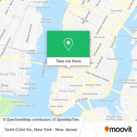
See Solid Color Inc, Manhattan, on the map
Public Transit to Solid Color Inc in Manhattan
Wondering how to get to Solid Color Inc in Manhattan? Moovit helps you find the best way to get to Solid Color Inc with step-by-step directions from the nearest public transit station.
Moovit provides free maps and live directions to help you navigate through your city. View schedules, routes, timetables, and find out how long does it take to get to Solid Color Inc in real time.
Looking for the nearest stop or station to Solid Color Inc? Check out this list of stops closest to your destination: 6th Ave & Spring St; Spring St; 6 Av/Spring St; 6 Av/Prince St; Hudson St/Charlton St; Canal St; Prince St.
Bus: M1, M20, M55, X27, SHORTLINE HUDSON, SHORTLINE HUDSON, M21, X28.Train: BLU, YEL.Subway: 1, C, E, A, 2, N, Q, R, W.
Want to see if there’s another route that gets you there at an earlier time? Moovit helps you find alternative routes or times. Get directions from and directions to Solid Color Inc easily from the Moovit App or Website.
We make riding to Solid Color Inc easy, which is why over 1.7 million users, including users in Manhattan, trust Moovit as the best app for public transit. You don’t need to download an individual bus app or train app, Moovit is your all-in-one transit app that helps you find the best bus time or train time available.
For information on prices of subway, bus and train, costs and ride fares to Solid Color Inc, please check the Moovit app.
Use the app to navigate to popular places including to the airport, hospital, stadium, grocery store, mall, coffee shop, school, college, and university.
Solid Color Inc Address: 155 Avenue of the Americas street in Manhattan
- Ducati Nyc,
- Trader Joe's,
- Affirm,
- Juicewell,
- Springer Clinical Medicine,
- Aveda Institute New York,
- Flatiron Health,
- Shecky's Media, Inc.,
- Minute Media,
- The Players' Tribune,
- Jerusalén Mariachi Cristiano De Coatepeque,
- MXM - Part of Accenture Interactive,
- Songtrust,
- Recruitment Center,
- Accenture New York Innovation Hub,
- Babor Signature Spa at the Dominick,
- El Ta'Koy,
- Color Factory,
- Watershed Technology Nyc,
- The Library
Places Near Solid Color Inc (Manhattan)
- Rockefeller Center, Manhattan,
- Hudson Yards, Manhattan,
- 111 Centre New York City Supreme Court, Manhattan,
- Katz's Deli, Manhattan,
- SoHo, Manhattan,
- 376 Hudson Street, Manhattan,
- Mountainside Hospital, Glen Ridge,
- 66 John Street, Manhattan,
- qqqq, Manhattan,
- 26 Federal Plaza, Manhattan,
- Wall Street, Manhattan,
- 1 Police Plaza, Manhattan,
- Pier 83, Manhattan,
- 911 Memorial, Manhattan,
- Queens Center Mall, Queens,
- Times Square, Manhattan,
- Chinatown, Manhattan,
- San Gennaro Feast, Manhattan,
- 3 Stone St, Manhattan,
- Bellevue Hospital, Manhattan
How to get to popular places in New York - New Jersey with public transit
Get around Manhattan by public transit!
Traveling around Manhattan has never been so easy. See step by step directions as you travel to any attraction, street or major public transit station. View bus and train schedules, arrival times, service alerts and detailed routes on a map, so you know exactly how to get to anywhere in Manhattan.
When traveling to any destination around Manhattan use Moovit's Live Directions with Get Off Notifications to know exactly where and how far to walk, how long to wait for your line, and how many stops are left. Moovit will alert you when it's time to get off — no need to constantly re-check whether yours is the next stop.
Wondering how to use public transit in Manhattan or how to pay for public transit in Manhattan? Moovit public transit app can help you navigate your way with public transit easily, and at minimum cost. It includes public transit fees, ticket prices, and costs. Looking for a map of Manhattan public transit lines? Moovit public transit app shows all public transit maps in Manhattan with all Bus, Train, Subway, Light Rail, Ferry and Cable Car routes and stops on an interactive map.
New York - New Jersey has 6 transit type(s), including: Bus, Train, Subway, Light Rail, Ferry and Cable Car, operated by several transit agencies, including MTA Subway, Metro-North Railroad, LIRR, PATH, MTA New York City Transit - Express routes, MTA Bus, NJ Transit, NYC Ferry, NICE bus, Bee-Line Bus, NJ Transit Rail, Norwalk Transit District, Hartford Line, River Valley Transit and HART