How to get to Solutions Wireless 3 by bus?
Click on the bus route to see step by step directions with maps, line arrival times and updated time schedules.
How to get to Solutions Wireless 3 by train?
Click on the train route to see step by step directions with maps, line arrival times and updated time schedules.
Bus stops near Solutions Wireless 3 in Lawrence
Train station near Solutions Wireless 3 in Lawrence
- Lawrence, 35 min walk,VIEW
Bus lines to Solutions Wireless 3 in Lawrence
What are the closest stations to Solutions Wireless 3?
The closest stations to Solutions Wireless 3 are:
- Jackson Street & Kendrick Street is 148 yards away, 2 min walk.
- Ferry Street & Home Street is 515 yards away, 6 min walk.
- Lawrence is 2974 yards away, 35 min walk.
Which bus line stops near Solutions Wireless 3?
1 (Washington Square Transit Center)
Which train line stops near Solutions Wireless 3?
HAVERHILL (#232 | North Station)
What’s the nearest bus station to Solutions Wireless 3 in Lawrence?
The nearest bus station to Solutions Wireless 3 in Lawrence is Jackson Street & Kendrick Street. It’s a 2 min walk away.
What time is the first train to Solutions Wireless 3 in Lawrence?
The HAVERHILL is the first train that goes to Solutions Wireless 3 in Lawrence. It stops nearby at 4:51 AM.
What time is the last train to Solutions Wireless 3 in Lawrence?
The HAVERHILL is the last train that goes to Solutions Wireless 3 in Lawrence. It stops nearby at 12:38 AM.
What time is the first bus to Solutions Wireless 3 in Lawrence?
The 1 is the first bus that goes to Solutions Wireless 3 in Lawrence. It stops nearby at 5:13 AM.
What time is the last bus to Solutions Wireless 3 in Lawrence?
The 4 is the last bus that goes to Solutions Wireless 3 in Lawrence. It stops nearby at 9:47 PM.
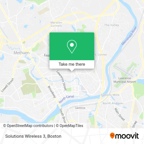
See Solutions Wireless 3, Lawrence, on the map
Public Transit to Solutions Wireless 3 in Lawrence
Wondering how to get to Solutions Wireless 3 in Lawrence? Moovit helps you find the best way to get to Solutions Wireless 3 with step-by-step directions from the nearest public transit station.
Moovit provides free maps and live directions to help you navigate through your city. View schedules, routes, timetables, and find out how long does it take to get to Solutions Wireless 3 in real time.
Looking for the nearest stop or station to Solutions Wireless 3? Check out this list of stops closest to your destination: Jackson Street & Kendrick Street; Ferry Street & Home Street; Lawrence.
Bus: 1, 4.Train: HAVERHILL.
Want to see if there’s another route that gets you there at an earlier time? Moovit helps you find alternative routes or times. Get directions from and directions to Solutions Wireless 3 easily from the Moovit App or Website.
We make riding to Solutions Wireless 3 easy, which is why over 1.7 million users, including users in Lawrence, trust Moovit as the best app for public transit. You don’t need to download an individual bus app or train app, Moovit is your all-in-one transit app that helps you find the best bus time or train time available.
For information on prices of bus and train, costs and ride fares to Solutions Wireless 3, please check the Moovit app.
Use the app to navigate to popular places including to the airport, hospital, stadium, grocery store, mall, coffee shop, school, college, and university.
Solutions Wireless 3 Address: 269 Jackson St street in Lawrence
- Botanica Anaisa,
- Berkeley Boutique,
- Los Originales Plasticover,
- Hook King and Queen SH,
- 4 Ace's Communications,
- Tabernaculo Deadoracion Y Musica,
- Jackson Training School,
- McAuliffe Funeral Service,
- Twomey & Legare Contracting,
- Damphousse Roofing,
- German American Bank Itm,
- AAA the Barbershop,
- VIP Painters,
- Marte,
- Kailey Convenience Store,
- Community Baptist Church Lawrence,
- Weecare,
- Yanilda's Family Weecare,
- Iglesia Universal,
- Dimar and Management Group
Places Near Solutions Wireless 3 (Lawrence)
- Boston Medical Center, Boston,
- Museum Of Science, Boston,
- Massachusetts General Hospital, Boston,
- Prudential Center, Boston,
- Boston Children's Hospital, Boston,
- Wilbur Theatre, Boston,
- House Of Blues, Boston,
- Boston Convention & Exhibition Center, Boston,
- Seaport District, Boston,
- Wang Theater, Boston,
- Isabella Stewart Gardner Museum, Boston,
- Cheers, Boston,
- Mgm Music Hall, Boston,
- Castle Island, Boston,
- Td Garden, Boston,
- North End, Boston,
- Boston Common, Boston,
- Leader Bank Pavilion (Leader Bank Pavillion), Boston,
- Quincy Market, Boston,
- Faneuil Hall, Boston
How to get to popular places in Boston with public transit
Get around Lawrence by public transit!
Traveling around Lawrence has never been so easy. See step by step directions as you travel to any attraction, street or major public transit station. View bus and train schedules, arrival times, service alerts and detailed routes on a map, so you know exactly how to get to anywhere in Lawrence.
When traveling to any destination around Lawrence use Moovit's Live Directions with Get Off Notifications to know exactly where and how far to walk, how long to wait for your line, and how many stops are left. Moovit will alert you when it's time to get off — no need to constantly re-check whether yours is the next stop.
Wondering how to use public transit in Lawrence or how to pay for public transit in Lawrence? Moovit public transit app can help you navigate your way with public transit easily, and at minimum cost. It includes public transit fees, ticket prices, and costs. Looking for a map of Lawrence public transit lines? Moovit public transit app shows all public transit maps in Lawrence with all Bus, Train, Subway and Ferry routes and stops on an interactive map.
Boston has 4 transit type(s), including: Bus, Train, Subway and Ferry, operated by several transit agencies, including MBTA, Southeastern Regional Transit Authority, MetroWest Regional Transit Authority, Rhode Island Public Transit Authority, WRTA, Lowell Regional Transit Authority, Merrimack Valley Transit, Montachusett Regional Transit Authority, Cape Cod Regional Transit Authority, Brockton Area Transit Authority, Martha's Vineyard Transit Authority, the WAVE - Nantucket Regional Transit Authority, GATRA, Cape Ann Transportation Authority and Massport