How to get to Sonia Adams, Md by bus?
Click on the bus route to see step by step directions with maps, line arrival times and updated time schedules.
How to get to Sonia Adams, Md by train?
Click on the train route to see step by step directions with maps, line arrival times and updated time schedules.
Bus stops near Sonia Adams, Md in Methuen Town
Train station near Sonia Adams, Md in Methuen Town
- Lawrence, 28 min walk,VIEW
Bus lines to Sonia Adams, Md in Methuen Town
What are the closest stations to Sonia Adams, Md?
The closest stations to Sonia Adams, Md are:
- Jackson And Swan Street is 110 yards away, 2 min walk.
- East Street & Pinewood Road is 151 yards away, 2 min walk.
- Lawrence is 2344 yards away, 28 min walk.
Which bus lines stop near Sonia Adams, Md?
These bus lines stop near Sonia Adams, Md: 1, 6.
Which train line stops near Sonia Adams, Md?
HAVERHILL (#232 | North Station)
What’s the nearest train station to Sonia Adams, Md in Methuen Town?
The nearest train station to Sonia Adams, Md in Methuen Town is Lawrence. It’s a 28 min walk away.
What’s the nearest bus station to Sonia Adams, Md in Methuen Town?
The nearest bus stations to Sonia Adams, Md in Methuen Town are Jackson And Swan Street and East Street & Pinewood Road. The closest one is a 2 min walk away.
What time is the first train to Sonia Adams, Md in Methuen Town?
The HAVERHILL is the first train that goes to Sonia Adams, Md in Methuen Town. It stops nearby at 4:51 AM.
What time is the last train to Sonia Adams, Md in Methuen Town?
The HAVERHILL is the last train that goes to Sonia Adams, Md in Methuen Town. It stops nearby at 12:38 AM.
What time is the first bus to Sonia Adams, Md in Methuen Town?
The 6 is the first bus that goes to Sonia Adams, Md in Methuen Town. It stops nearby at 5:14 AM.
What time is the last bus to Sonia Adams, Md in Methuen Town?
The 1 is the last bus that goes to Sonia Adams, Md in Methuen Town. It stops nearby at 9:30 PM.
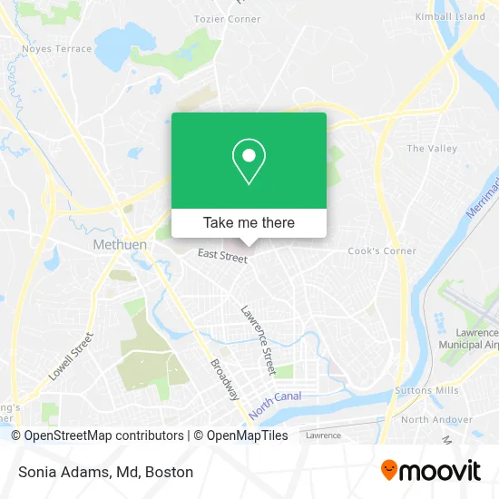
See Sonia Adams, Md, Methuen Town, on the map
Public Transit to Sonia Adams, Md in Methuen Town
Wondering how to get to Sonia Adams, Md in Methuen Town? Moovit helps you find the best way to get to Sonia Adams, Md with step-by-step directions from the nearest public transit station.
Moovit provides free maps and live directions to help you navigate through your city. View schedules, routes, timetables, and find out how long does it take to get to Sonia Adams, Md in real time.
Looking for the nearest stop or station to Sonia Adams, Md? Check out this list of stops closest to your destination: Jackson And Swan Street; East Street & Pinewood Road; Lawrence.
Bus: 1, 6.Train: HAVERHILL.
Want to see if there’s another route that gets you there at an earlier time? Moovit helps you find alternative routes or times. Get directions from and directions to Sonia Adams, Md easily from the Moovit App or Website.
We make riding to Sonia Adams, Md easy, which is why over 1.7 million users, including users in Methuen Town, trust Moovit as the best app for public transit. You don’t need to download an individual bus app or train app, Moovit is your all-in-one transit app that helps you find the best bus time or train time available.
For information on prices of bus and train, costs and ride fares to Sonia Adams, Md, please check the Moovit app.
Use the app to navigate to popular places including to the airport, hospital, stadium, grocery store, mall, coffee shop, school, college, and university.
Sonia Adams, Md Address: 60 East St 3rd Floor street in Methuen Town
- Dipakkumar M Patel MD,
- Stone Scapes,
- Ahmed Gayed MD,
- Simonne Stahl MD,
- Greater Lawrence Family Health Center,
- Deo Mulindwa MD,
- Ig Construction,
- Lawrence Country Club,
- Halcyon House Nursing Home,
- Plonowski Funeral Home,
- City Haul Trucking,
- AmpUp,
- Mls Property Information Network,
- Lawrence Central Little League,
- Keller Williams Realty,
- Nanny Hopn's,
- Fidelity House,
- Ice Rink,
- Methuen Rangers,
- Larry Klimas Memorial Field House
Places Near Sonia Adams, Md (Methuen Town)
- Prudential Center, Boston,
- Seaport District, Boston,
- Mgm Music Hall, Boston,
- Td Garden, Boston,
- Boston Common, Boston,
- Wilbur Theatre, Boston,
- Boston Medical Center, Boston,
- Quincy Market, Boston,
- North End, Boston,
- Museum Of Science, Boston,
- Massachusetts General Hospital, Boston,
- Castle Island, Boston,
- Leader Bank Pavilion (Leader Bank Pavillion), Boston,
- Boston Convention & Exhibition Center, Boston,
- Isabella Stewart Gardner Museum, Boston,
- Boston Children's Hospital, Boston,
- House Of Blues, Boston,
- Wang Theater, Boston,
- Faneuil Hall, Boston,
- Cheers, Boston
How to get to popular places in Boston with public transit
Get around Methuen Town by public transit!
Traveling around Methuen Town has never been so easy. See step by step directions as you travel to any attraction, street or major public transit station. View bus and train schedules, arrival times, service alerts and detailed routes on a map, so you know exactly how to get to anywhere in Methuen Town.
When traveling to any destination around Methuen Town use Moovit's Live Directions with Get Off Notifications to know exactly where and how far to walk, how long to wait for your line, and how many stops are left. Moovit will alert you when it's time to get off — no need to constantly re-check whether yours is the next stop.
Wondering how to use public transit in Methuen Town or how to pay for public transit in Methuen Town? Moovit public transit app can help you navigate your way with public transit easily, and at minimum cost. It includes public transit fees, ticket prices, and costs. Looking for a map of Methuen Town public transit lines? Moovit public transit app shows all public transit maps in Methuen Town with all Bus, Train, Subway and Ferry routes and stops on an interactive map.
Boston has 4 transit type(s), including: Bus, Train, Subway and Ferry, operated by several transit agencies, including MBTA, Southeastern Regional Transit Authority, MetroWest Regional Transit Authority, Rhode Island Public Transit Authority, WRTA, Lowell Regional Transit Authority, Merrimack Valley Transit, Montachusett Regional Transit Authority, Cape Cod Regional Transit Authority, Brockton Area Transit Authority, Martha's Vineyard Transit Authority, the WAVE - Nantucket Regional Transit Authority, GATRA, Cape Ann Transportation Authority and Massport