How to get to Sonny's Place by bus?
Click on the bus route to see step by step directions with maps, line arrival times and updated time schedules.
From Palladium, Worcester
129 minFrom Registry Of Motor Vehicles (Rmv) Branch Office, Worcester
128 minFrom Walmart Supercenter, Worcester
183 minFrom Dcu Center, Worcester
126 minFrom South High Community School, Worcester
221 minFrom Polar Park, Worcester
126 minFrom Worcester, MA, Worcester
124 minFrom Foxwoods, Worcester
154 min
Bus lines to Sonny's Place in Boston
What are the closest stations to Sonny's Place?
The closest stations to Sonny's Place are:
- Main / Rogers is 135 yards away, 2 min walk.
- East / Hubbard is 174 yards away, 3 min walk.
Which bus line stops near Sonny's Place?
B6 (Ludlow Big Y Via Bay/Berkshire/Pasco)
What’s the nearest bus station to Sonny's Place in Boston?
The nearest bus station to Sonny's Place in Boston is Main / Rogers. It’s a 2 min walk away.
What time is the first bus to Sonny's Place in Boston?
The B6 is the first bus that goes to Sonny's Place in Boston. It stops nearby at 5:36 AM.
What time is the last bus to Sonny's Place in Boston?
The B6 is the last bus that goes to Sonny's Place in Boston. It stops nearby at 10:13 PM.
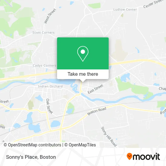
See Sonny's Place, Boston, on the map
Public Transit to Sonny's Place in Boston
Wondering how to get to Sonny's Place in Boston? Moovit helps you find the best way to get to Sonny's Place with step-by-step directions from the nearest public transit station.
Moovit provides free maps and live directions to help you navigate through your city. View schedules, routes, timetables, and find out how long does it take to get to Sonny's Place in real time.
Looking for the nearest stop or station to Sonny's Place? Check out this list of stops closest to your destination: Main / Rogers; East / Hubbard.
Bus: B6, X94.
Want to see if there’s another route that gets you there at an earlier time? Moovit helps you find alternative routes or times. Get directions from and directions to Sonny's Place easily from the Moovit App or Website.
We make riding to Sonny's Place easy, which is why over 1.7 million users, including users in Boston, trust Moovit as the best app for public transit. You don’t need to download an individual bus app or train app, Moovit is your all-in-one transit app that helps you find the best bus time or train time available.
For information on prices of bus, costs and ride fares to Sonny's Place, please check the Moovit app.
Use the app to navigate to popular places including to the airport, hospital, stadium, grocery store, mall, coffee shop, school, college, and university.
Location: Boston
- Junior's Barbershop,
- I. B. Wholesale,
- Ludlow Ideal Weight Loss,
- Amodio Moving of Mass,
- Armentano Susan & Associates,
- Elements Hair Salon,
- United Church Of Christ,
- AAA Security,
- Rental Housing Association of Greater Springfield,
- En Vogue Hair Design,
- WM A Axton Podiatrst,
- Paul Blomerth DC,
- Chestnut Office Park,
- Marta Law Offices,
- FedEx Drop Box,
- 83 Winsor St Parking,
- Ludlow Us Post Office,
- Ludlow Floor Sanding,
- Michael's Overhead Door Company,
- Ludlow Ecc
Places Near Sonny's Place (Boston)
- Museum Of Science, Boston,
- Quincy Market, Boston,
- House Of Blues, Boston,
- Cheers, Boston,
- Mgm Music Hall, Boston,
- Isabella Stewart Gardner Museum, Boston,
- Boston Children's Hospital, Boston,
- Td Garden, Boston,
- Castle Island, Boston,
- Prudential Center, Boston,
- Faneuil Hall, Boston,
- Boston Convention & Exhibition Center, Boston,
- North End, Boston,
- Massachusetts General Hospital, Boston,
- Wilbur Theatre, Boston,
- Seaport District, Boston,
- Leader Bank Pavilion (Leader Bank Pavillion), Boston,
- Wang Theater, Boston,
- Boston Medical Center, Boston,
- Boston Common, Boston
How to get to popular places in Boston with public transit
Get around Boston by public transit!
Traveling around Boston has never been so easy. See step by step directions as you travel to any attraction, street or major public transit station. View bus and train schedules, arrival times, service alerts and detailed routes on a map, so you know exactly how to get to anywhere in Boston.
When traveling to any destination around Boston use Moovit's Live Directions with Get Off Notifications to know exactly where and how far to walk, how long to wait for your line, and how many stops are left. Moovit will alert you when it's time to get off — no need to constantly re-check whether yours is the next stop.
Wondering how to use public transit in Boston or how to pay for public transit in Boston? Moovit public transit app can help you navigate your way with public transit easily, and at minimum cost. It includes public transit fees, ticket prices, and costs. Looking for a map of Boston public transit lines? Moovit public transit app shows all public transit maps in Boston with all Bus, Train, Subway and Ferry routes and stops on an interactive map.
Boston has 4 transit type(s), including: Bus, Train, Subway and Ferry, operated by several transit agencies, including MBTA, Southeastern Regional Transit Authority, MetroWest Regional Transit Authority, Rhode Island Public Transit Authority, WRTA, Lowell Regional Transit Authority, Merrimack Valley Transit, Montachusett Regional Transit Authority, Cape Cod Regional Transit Authority, Brockton Area Transit Authority, Martha's Vineyard Transit Authority, the WAVE - Nantucket Regional Transit Authority, GATRA, Cape Ann Transportation Authority and Massport