Directions to South Shore Sleep Diagnostics (Monument Beach) with public transportation
The following transit lines have routes that pass near South Shore Sleep Diagnostics
 Bus: BOURNE RUN, PETER PAN, SANDWICH LINE, CAPEFLYER CONNECTION.
- Train: CAPEFLYER.
How to get to South Shore Sleep Diagnostics by bus?
Click on the bus route to see step by step directions with maps, line arrival times and updated time schedules.
Bus stops near South Shore Sleep Diagnostics in Monument Beach
Train station near South Shore Sleep Diagnostics in Monument Beach
- Buzzards Bay, 33 min walk,VIEW
Bus lines to South Shore Sleep Diagnostics in Monument Beach
What are the closest stations to South Shore Sleep Diagnostics?
The closest stations to South Shore Sleep Diagnostics are:
- Keystone Place is 401 yards away, 5 min walk.
- Cape Side Convenience Bourne is 575 yards away, 7 min walk.
- Cape Side Convenience, Bourne is 606 yards away, 8 min walk.
- Buzzards Bay is 2803 yards away, 33 min walk.
Which bus lines stop near South Shore Sleep Diagnostics?
These bus lines stop near South Shore Sleep Diagnostics: BOURNE RUN, PETER PAN.
What’s the nearest bus station to South Shore Sleep Diagnostics in Monument Beach?
The nearest bus station to South Shore Sleep Diagnostics in Monument Beach is Keystone Place. It’s a 5 min walk away.
What time is the first bus to South Shore Sleep Diagnostics in Monument Beach?
The PETER PAN is the first bus that goes to South Shore Sleep Diagnostics in Monument Beach. It stops nearby at 6:20 AM.
What time is the last bus to South Shore Sleep Diagnostics in Monument Beach?
The PETER PAN is the last bus that goes to South Shore Sleep Diagnostics in Monument Beach. It stops nearby at 8:20 PM.
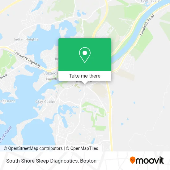
See South Shore Sleep Diagnostics, Monument Beach, on the map
Public Transit to South Shore Sleep Diagnostics in Monument Beach
Wondering how to get to South Shore Sleep Diagnostics in Monument Beach? Moovit helps you find the best way to get to South Shore Sleep Diagnostics with step-by-step directions from the nearest public transit station.
Moovit provides free maps and live directions to help you navigate through your city. View schedules, routes, timetables, and find out how long does it take to get to South Shore Sleep Diagnostics in real time.
Looking for the nearest stop or station to South Shore Sleep Diagnostics? Check out this list of stops closest to your destination: Keystone Place; Cape Side Convenience Bourne; Cape Side Convenience; Buzzards Bay.
Bus: BOURNE RUN, PETER PAN, SANDWICH LINE, CAPEFLYER CONNECTION.Train: CAPEFLYER.
Want to see if there’s another route that gets you there at an earlier time? Moovit helps you find alternative routes or times. Get directions from and directions to South Shore Sleep Diagnostics easily from the Moovit App or Website.
We make riding to South Shore Sleep Diagnostics easy, which is why over 1.7 million users, including users in Monument Beach, trust Moovit as the best app for public transit. You don’t need to download an individual bus app or train app, Moovit is your all-in-one transit app that helps you find the best bus time or train time available.
For information on prices of bus, train and ferry, costs and ride fares to South Shore Sleep Diagnostics, please check the Moovit app.
Use the app to navigate to popular places including to the airport, hospital, stadium, grocery store, mall, coffee shop, school, college, and university.
South Shore Sleep Diagnostics Address: 1 County Rd street in Monument Beach
- بورن، ماساچوست,
- Bourne Station,
- Worcester Surf Casting Club,
- Bourne, Massachusetts,
- Connect 55 +,
- Xfinity,
- Cape Cod Charter Guys,
- Ses Marine,
- Quantam Sales,
- Massachusetts Maritime Academy,
- Nicole's Lash Bar and Spa,
- Rogersgray,
- ATM,
- USPS Collection Box - Blue Box,
- Dewitt Clinton Lodge,
- Masonic Lodges,
- Fast Lane Transportation,
- Massachusetts Maritime Academy Alumni Association,
- Old Country Store and Emporium,
- Symmetry Insurance Services
Places Near South Shore Sleep Diagnostics (Monument Beach)
- Boston Medical Center, Boston,
- North End, Boston,
- Prudential Center, Boston,
- Castle Island, Boston,
- Boston Children's Hospital, Boston,
- Td Garden, Boston,
- Museum Of Science, Boston,
- Wilbur Theatre, Boston,
- Quincy Market, Boston,
- Boston Convention & Exhibition Center, Boston,
- Isabella Stewart Gardner Museum, Boston,
- House Of Blues, Boston,
- Wang Theater, Boston,
- Cheers, Boston,
- Massachusetts General Hospital, Boston,
- Mgm Music Hall, Boston,
- Leader Bank Pavilion (Leader Bank Pavillion), Boston,
- Faneuil Hall, Boston,
- Boston Common, Boston,
- Seaport District, Boston
How to get to popular places in Boston with public transit
Get around Monument Beach by public transit!
Traveling around Monument Beach has never been so easy. See step by step directions as you travel to any attraction, street or major public transit station. View bus and train schedules, arrival times, service alerts and detailed routes on a map, so you know exactly how to get to anywhere in Monument Beach.
When traveling to any destination around Monument Beach use Moovit's Live Directions with Get Off Notifications to know exactly where and how far to walk, how long to wait for your line, and how many stops are left. Moovit will alert you when it's time to get off — no need to constantly re-check whether yours is the next stop.
Wondering how to use public transit in Monument Beach or how to pay for public transit in Monument Beach? Moovit public transit app can help you navigate your way with public transit easily, and at minimum cost. It includes public transit fees, ticket prices, and costs. Looking for a map of Monument Beach public transit lines? Moovit public transit app shows all public transit maps in Monument Beach with all Bus, Train, Subway and Ferry routes and stops on an interactive map.
Boston has 4 transit type(s), including: Bus, Train, Subway and Ferry, operated by several transit agencies, including MBTA, Southeastern Regional Transit Authority, MetroWest Regional Transit Authority, Rhode Island Public Transit Authority, WRTA, Lowell Regional Transit Authority, Merrimack Valley Transit, Montachusett Regional Transit Authority, Cape Cod Regional Transit Authority, Brockton Area Transit Authority, Martha's Vineyard Transit Authority, the WAVE - Nantucket Regional Transit Authority, GATRA, Cape Ann Transportation Authority and Massport