Directions to Southcoast Diabetes Management Program (Smith Mills) with public transportation
The following transit lines have routes that pass near Southcoast Diabetes Management Program
 Bus: 210, 9, 206.
- Train: FALL RIVER/NEW BEDFORD.
- Ferry: SEASTREAK, SEASTREAK, CUTTYHUNK FERRY.
How to get to Southcoast Diabetes Management Program by bus?
Click on the bus route to see step by step directions with maps, line arrival times and updated time schedules.
From Lizzy Borden House, Fall River
48 minFrom B.M.C. Durfee High School, Fall River
89 minFrom Walmart Fall River Supercenter, Fall River
50 minFrom Bristol Community College, Fall River
61 minFrom Amazon Fulfillment Bos7, Fall River
91 minFrom RMV New Bedford, New Bedford
69 minFrom Charlton Memorial Hospital, Fall River
79 minFrom Bedford Industrial Park, New Bedford
72 min
Bus stops near Southcoast Diabetes Management Program in Smith Mills
Train station near Southcoast Diabetes Management Program in Smith Mills
- New Bedford, 50 min walk,VIEW
Ferry stations near Southcoast Diabetes Management Program in Smith Mills
Bus lines to Southcoast Diabetes Management Program in Smith Mills
What are the closest stations to Southcoast Diabetes Management Program?
The closest stations to Southcoast Diabetes Management Program are:
- State Rd And Macomber Ave is 71 yards away, 1 min walk.
- W Hill Rd And Bryant Ln is 1486 yards away, 18 min walk.
- New Bedford is 4207 yards away, 50 min walk.
- New Bedford, MA is 4475 yards away, 53 min walk.
- Cuttyhunk Ferry Pier, New Bedford, MA is 4668 yards away, 55 min walk.
Which bus lines stop near Southcoast Diabetes Management Program?
These bus lines stop near Southcoast Diabetes Management Program: 210, 9.
Which train line stops near Southcoast Diabetes Management Program?
FALL RIVER/NEW BEDFORD (#2011 | New Bedford)
What’s the nearest bus station to Southcoast Diabetes Management Program in Smith Mills?
The nearest bus station to Southcoast Diabetes Management Program in Smith Mills is State Rd And Macomber Ave. It’s a 1 min walk away.
What time is the first train to Southcoast Diabetes Management Program in Smith Mills?
The FALL RIVER/NEW BEDFORD is the first train that goes to Southcoast Diabetes Management Program in Smith Mills. It stops nearby at 4:16 AM.
What time is the last train to Southcoast Diabetes Management Program in Smith Mills?
The FALL RIVER/NEW BEDFORD is the last train that goes to Southcoast Diabetes Management Program in Smith Mills. It stops nearby at 1:38 AM.
What time is the first bus to Southcoast Diabetes Management Program in Smith Mills?
The 210 is the first bus that goes to Southcoast Diabetes Management Program in Smith Mills. It stops nearby at 5:53 AM.
What time is the last bus to Southcoast Diabetes Management Program in Smith Mills?
The 9 is the last bus that goes to Southcoast Diabetes Management Program in Smith Mills. It stops nearby at 9:50 PM.
What time is the first ferry to Southcoast Diabetes Management Program in Smith Mills?
The SEASTREAK is the first ferry that goes to Southcoast Diabetes Management Program in Smith Mills. It stops nearby at 8:20 AM.
What time is the last ferry to Southcoast Diabetes Management Program in Smith Mills?
The SEASTREAK is the last ferry that goes to Southcoast Diabetes Management Program in Smith Mills. It stops nearby at 8:40 PM.
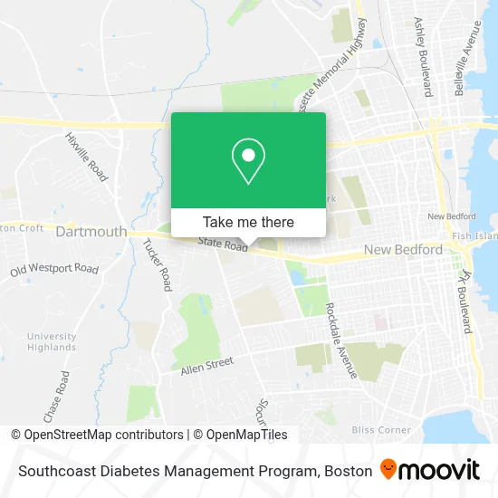
See Southcoast Diabetes Management Program, Smith Mills, on the map
Public Transit to Southcoast Diabetes Management Program in Smith Mills
Wondering how to get to Southcoast Diabetes Management Program in Smith Mills? Moovit helps you find the best way to get to Southcoast Diabetes Management Program with step-by-step directions from the nearest public transit station.
Moovit provides free maps and live directions to help you navigate through your city. View schedules, routes, timetables, and find out how long does it take to get to Southcoast Diabetes Management Program in real time.
Looking for the nearest stop or station to Southcoast Diabetes Management Program? Check out this list of stops closest to your destination: State Rd And Macomber Ave; W Hill Rd And Bryant Ln; New Bedford; New Bedford; Cuttyhunk Ferry Pier.
Bus: 210, 9, 206.Train: FALL RIVER/NEW BEDFORD.Ferry: SEASTREAK, SEASTREAK, CUTTYHUNK FERRY.
Want to see if there’s another route that gets you there at an earlier time? Moovit helps you find alternative routes or times. Get directions from and directions to Southcoast Diabetes Management Program easily from the Moovit App or Website.
We make riding to Southcoast Diabetes Management Program easy, which is why over 1.7 million users, including users in Smith Mills, trust Moovit as the best app for public transit. You don’t need to download an individual bus app or train app, Moovit is your all-in-one transit app that helps you find the best bus time or train time available.
For information on prices of bus and train, costs and ride fares to Southcoast Diabetes Management Program, please check the Moovit app.
Use the app to navigate to popular places including to the airport, hospital, stadium, grocery store, mall, coffee shop, school, college, and university.
Southcoast Diabetes Management Program Address: 49 State Rd street in Smith Mills
- The Ultimate Touch Nail Salon,
- Pink Door Pediatric Dentistry,
- Community Nurse Home Care,
- Sullivans Auctioneers,
- Ventura Mark A MD,
- Dr. Candace Criscione,
- Gillian Simmons MD,
- Dartmouth Office,
- Dr. Stephanie Leung DMD,
- Coinstar - Bitcoin ATM,
- German American Bank Itm,
- Southcoast Primary Care,
- Conway Jack Realtor,
- Sara Smith, Realtor,
- Lynn Ellis, Realtor,
- Lindsey Rebelo, Realtor,
- Anytime Fitness,
- A1 Landscaping & Tree Service,
- Lionsgatepath,
- Bishop Stang High School
Places Near Southcoast Diabetes Management Program (Smith Mills)
- Quincy Market, Boston,
- Boston Convention & Exhibition Center, Boston,
- Faneuil Hall, Boston,
- Castle Island, Boston,
- Wilbur Theatre, Boston,
- Boston Medical Center, Boston,
- Seaport District, Boston,
- Wang Theater, Boston,
- Massachusetts General Hospital, Boston,
- Prudential Center, Boston,
- Boston Common, Boston,
- Museum Of Science, Boston,
- Cheers, Boston,
- Td Garden, Boston,
- Isabella Stewart Gardner Museum, Boston,
- Mgm Music Hall, Boston,
- Leader Bank Pavilion (Leader Bank Pavillion), Boston,
- North End, Boston,
- House Of Blues, Boston,
- Boston Children's Hospital, Boston
How to get to popular places in Boston with public transit
Get around Smith Mills by public transit!
Traveling around Smith Mills has never been so easy. See step by step directions as you travel to any attraction, street or major public transit station. View bus and train schedules, arrival times, service alerts and detailed routes on a map, so you know exactly how to get to anywhere in Smith Mills.
When traveling to any destination around Smith Mills use Moovit's Live Directions with Get Off Notifications to know exactly where and how far to walk, how long to wait for your line, and how many stops are left. Moovit will alert you when it's time to get off — no need to constantly re-check whether yours is the next stop.
Wondering how to use public transit in Smith Mills or how to pay for public transit in Smith Mills? Moovit public transit app can help you navigate your way with public transit easily, and at minimum cost. It includes public transit fees, ticket prices, and costs. Looking for a map of Smith Mills public transit lines? Moovit public transit app shows all public transit maps in Smith Mills with all Bus, Train, Subway and Ferry routes and stops on an interactive map.
Boston has 4 transit type(s), including: Bus, Train, Subway and Ferry, operated by several transit agencies, including MBTA, Southeastern Regional Transit Authority, MetroWest Regional Transit Authority, Rhode Island Public Transit Authority, WRTA, Lowell Regional Transit Authority, Merrimack Valley Transit, Montachusett Regional Transit Authority, Cape Cod Regional Transit Authority, Brockton Area Transit Authority, Martha's Vineyard Transit Authority, the WAVE - Nantucket Regional Transit Authority, GATRA, Cape Ann Transportation Authority and Massport