Southlake Regional Health Centre stop - Saturday schedule
| Line | Direction | Time |
|---|---|---|
| YELLOW | Newmarket Terminal - Wb | 5:40 AM |
| YELLOW | Newmarket Terminal - Wb | 5:58 AM |
| YELLOW | Newmarket Terminal - Wb | 6:16 AM |
| YELLOW | Newmarket Terminal - Wb | 6:35 AM |
| YELLOW | Newmarket Terminal - Wb | 6:53 AM |
| YELLOW | Newmarket Terminal - Wb | 7:11 AM |
| YELLOW | Newmarket Terminal - Wb | 7:29 AM |
| YELLOW | Newmarket Terminal - Wb | 7:47 AM |
| YELLOW | Newmarket Terminal - Wb | 8:05 AM |
| YELLOW | Newmarket Terminal - Wb | 8:23 AM |
| YELLOW | Newmarket Terminal - Wb | 8:41 AM |
| YELLOW | Newmarket Terminal - Wb | 8:59 AM |
| YELLOW | Newmarket Terminal - Wb | 9:17 AM |
| YELLOW | Newmarket Terminal - Wb | 9:35 AM |
| YELLOW | Newmarket Terminal - Wb | 9:57 AM |
| YELLOW | Newmarket Terminal - Wb | 10:17 AM |
| YELLOW | Newmarket Terminal - Wb | 10:37 AM |
| YELLOW | Newmarket Terminal - Wb | 10:57 AM |
| YELLOW | Newmarket Terminal - Wb | 11:17 AM |
| YELLOW | Newmarket Terminal - Wb | 11:37 AM |
| YELLOW | Newmarket Terminal - Wb | 11:57 AM |
| YELLOW | Newmarket Terminal - Wb | 12:17 PM |
| YELLOW | Newmarket Terminal - Wb | 12:37 PM |
| YELLOW | Newmarket Terminal - Wb | 12:57 PM |
| YELLOW | Newmarket Terminal - Wb | 1:17 PM |
Directions to Southlake Regional Health Centre stop (Newmarket) with public transit
The following transit lines have routes that pass near Southlake Regional Health Centre
How to get to Southlake Regional Health Centre stop by bus?
Click on the bus route to see step by step directions with maps, line arrival times and updated time schedules.
How to get to Southlake Regional Health Centre stop by train?
Click on the train route to see step by step directions with maps, line arrival times and updated time schedules.
Bus stops near Southlake Regional Health Centre stop in Newmarket
- Davis Dr / Bolton Av, 1 min walk,
- Southlake Regional Health Centre, 2 min walk,
- Davis Dr. @ Prospect St., 3 min walk,
- Newmarket Go, 8 min walk,
Bus lines to Southlake Regional Health Centre stop in Newmarket
- 50, Newmarket Terminal - Sb,
- 55, Newmarket Terminal - Wb,
- 425, Huron Heights School Special - Af,
- YELLOW, Highway 404 Park And Ride - Eb,
- 65, 65e - East Gwillimbury Go,
- 68, 68e - East Gwillimbury Go,
- BR, # | Bradford Go,
What are the closest stations to Southlake Regional Health Centre?
The closest stations to Southlake Regional Health Centre are:
- Davis Dr / Bolton Av is 26 meters away, 1 min walk.
- Southlake Regional Health Centre is 142 meters away, 2 min walk.
- Davis Dr. @ Prospect St. is 212 meters away, 3 min walk.
- Newmarket Go is 559 meters away, 8 min walk.
Which bus lines stop near Southlake Regional Health Centre?
These bus lines stop near Southlake Regional Health Centre: 50, 55, YELLOW.
Which train line stops near Southlake Regional Health Centre?
BR
What’s the nearest bus station to Southlake Regional Health Centre in Newmarket?
The nearest bus station to Southlake Regional Health Centre in Newmarket is Davis Dr / Bolton Av. It’s a 1 min walk away.
What time is the first train to Southlake Regional Health Centre in Newmarket?
The BR is the first train that goes to Southlake Regional Health Centre in Newmarket. It stops nearby at 5:29 AM.
What time is the last train to Southlake Regional Health Centre in Newmarket?
The BR is the last train that goes to Southlake Regional Health Centre in Newmarket. It stops nearby at 11:59 PM.
What time is the first bus to Southlake Regional Health Centre in Newmarket?
The 65 is the first bus that goes to Southlake Regional Health Centre in Newmarket. It stops nearby at 3:33 AM.
What time is the last bus to Southlake Regional Health Centre in Newmarket?
The 65 is the last bus that goes to Southlake Regional Health Centre in Newmarket. It stops nearby at 3:31 AM.
How much is the bus fare to Southlake Regional Health Centre?
The bus fare to Southlake Regional Health Centre costs about $3.70 - $14.54.
See Southlake Regional Health Centre stop, Newmarket, on the map
Public transit to Southlake Regional Health Centre stop (ID: 9848) in Newmarket
Looking for directions to Southlake Regional Health Centre in Newmarket, Canada?
Download the Moovit App to find the current schedule and step-by-step directions for Bus or Train routes that pass through Southlake Regional Health Centre.
Looking for the nearest stops closest to Southlake Regional Health Centre ? Check out this list of closest stops to your destination: Davis Dr / Bolton Av; Southlake Regional Health Centre; Davis Dr. @ Prospect St.; Newmarket Go.
Bus: 50, 55, YELLOW, 425, 65, 68, BR.Train: BR.
We make riding on public transit to Southlake Regional Health Centre easy, which is why over 1.5 million users, including users in Newmarket trust Moovit as the best app for public transit.
Use the app to navigate to popular places including to the airport, hospital, stadium, grocery store, mall, coffee shop, school, college, and university.
Southlake Regional Health Centre stop’s code is 9848
The first line to this stop is YELLOW, at 5:40 AM, and the last line is YELLOW at 11:21 PM.
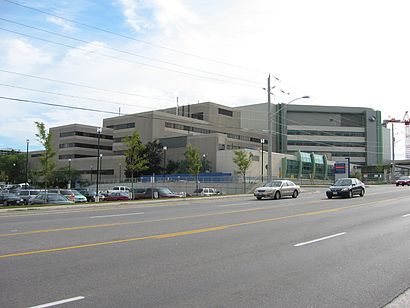
625 Davis Drive, Newmarket, ON, Canada
This stop serves York Region Transit’s lines
Bus stops near Southlake Regional Health Centre stop
Popular public transit stations in Newmarket
Get around Newmarket by public transit!
Traveling around Newmarket has never been so easy. See step by step directions as you travel to any attraction, street or major public transit station. View bus and train schedules, arrival times, service alerts and detailed routes on a map, so you know exactly how to get to anywhere in Newmarket.
When traveling to any destination around Newmarket use Moovit's Live Directions with Get Off Notifications to know exactly where and how far to walk, how long to wait for your line, and how many stops are left. Moovit will alert you when it's time to get off — no need to constantly re-check whether yours is the next stop.
Wondering how to use public transit in Newmarket or how to pay for public transit in Newmarket? Moovit public transit app can help you navigate your way with public transit easily, and at minimum cost. It includes public transit fees, ticket prices, and costs. Looking for a map of Newmarket public transit lines? Moovit public transit app shows all public transit maps in Newmarket with all Bus, Train, Subway, Streetcar and Ferry routes and stops on an interactive map.
Toronto has 5 transit type(s), including: Bus, Train, Subway, Streetcar and Ferry, operated by several transit agencies, including TTC, TTC Streetcar, Toronto Subway, Brampton Transit, MiWay, York Region Transit, GO Transit Bus, GO Transit, Durham Region Transit, UP Express, Grand River Transit, Guelph Transit, Hamilton Street Railway, Burlington Transit and Oakville Transit