Directions to Space Entertainment (Boston) with public transportation
The following transit lines have routes that pass near Space Entertainment
 Bus: 43, 501, 504, SL4, 39.
- Train: FRAMINGHAM/WORCESTER.
- Subway: GREEN LINE B, GREEN LINE D, ORANGE LINE, RED LINE, GREEN LINE C.
How to get to Space Entertainment by bus?
Click on the bus route to see step by step directions with maps, line arrival times and updated time schedules.
From Newton, MA, Newton
42 minFrom Arlington, MA, Arlington
82 minFrom Heartbreak Hill, Newton
42 minFrom Milton Academy, Milton
91 minFrom Warren St, Boston
44 minFrom Christian A Herter Park, Boston
61 minFrom Hampton Inn Boston Logan Airport, Revere
46 minFrom Arsenal Yards, Watertown Town
58 minFrom Newton, MA, Newton
54 minFrom Ramada Boston, Boston
62 min
How to get to Space Entertainment by train?
Click on the train route to see step by step directions with maps, line arrival times and updated time schedules.
How to get to Space Entertainment by subway?
Click on the subway route to see step by step directions with maps, line arrival times and updated time schedules.
Bus stops near Space Entertainment in Boston
Subway stations near Space Entertainment in Boston
Bus lines to Space Entertainment in Boston
- 39, Forest Hills,VIEW
- 57, Watertown Via Kenmore,VIEW
- 501, Downtown Via Cambridge St And Copley (Express),VIEW
- 504, Downtown Via Copley (Express),VIEW
- 43, Park St & Tremont St,VIEW
- 9, City Point,VIEW
- 10, Arlington via South Bay Center - City Point via South Bay Center,VIEW
- 55, Arlington - West Fenway,VIEW
- GREEN LINE E SHUTTLE, Heath Street - Park Street,VIEW
- GREEN LINE SHUTTLE, Boston University East - Park Street,VIEW
- SL5, Downtown,VIEW
- 11, Chauncy & Summer,VIEW
- 15, Mattapan Via Nubian & Fields Corner,VIEW
- SL4, South Station,VIEW
What are the closest stations to Space Entertainment?
The closest stations to Space Entertainment are:
- Stuart St @ Charles St S is 122 yards away, 2 min walk.
- Charles St S @ Park Plaza is 164 yards away, 3 min walk.
- Arlington St @ Saint James Ave is 322 yards away, 5 min walk.
- Saint James Ave @ Arlington St is 366 yards away, 5 min walk.
- Arlington is 395 yards away, 6 min walk.
- Chinatown is 500 yards away, 7 min walk.
- Washington St @ Essex St is 502 yards away, 7 min walk.
- Park Street is 631 yards away, 8 min walk.
Which bus lines stop near Space Entertainment?
These bus lines stop near Space Entertainment: 43, 501, 504, SL4.
Which train line stops near Space Entertainment?
FRAMINGHAM/WORCESTER (#518 | South Station)
Which subway lines stop near Space Entertainment?
These subway lines stop near Space Entertainment: GREEN LINE B, GREEN LINE D, ORANGE LINE, RED LINE.
What’s the nearest subway station to Space Entertainment in Boston?
The nearest subway station to Space Entertainment in Boston is Arlington. It’s a 6 min walk away.
What’s the nearest bus station to Space Entertainment in Boston?
The nearest bus station to Space Entertainment in Boston is Stuart St @ Charles St S. It’s a 2 min walk away.
What time is the first subway to Space Entertainment in Boston?
The GREEN LINE E is the first subway that goes to Space Entertainment in Boston. It stops nearby at 5:07 AM.
What time is the last subway to Space Entertainment in Boston?
The GREEN LINE E is the last subway that goes to Space Entertainment in Boston. It stops nearby at 2:18 AM.
What time is the first bus to Space Entertainment in Boston?
The 43 is the first bus that goes to Space Entertainment in Boston. It stops nearby at 5:06 AM.
What time is the last bus to Space Entertainment in Boston?
The 10 is the last bus that goes to Space Entertainment in Boston. It stops nearby at 1:19 AM.
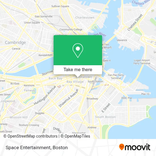
See Space Entertainment, Boston, on the map
Public Transit to Space Entertainment in Boston
Wondering how to get to Space Entertainment in Boston? Moovit helps you find the best way to get to Space Entertainment with step-by-step directions from the nearest public transit station.
Moovit provides free maps and live directions to help you navigate through your city. View schedules, routes, timetables, and find out how long does it take to get to Space Entertainment in real time.
Looking for the nearest stop or station to Space Entertainment? Check out this list of stops closest to your destination: Stuart St @ Charles St S; Charles St S @ Park Plaza; Arlington St @ Saint James Ave; Saint James Ave @ Arlington St; Arlington; Chinatown; Washington St @ Essex St; Park Street.
Bus: 43, 501, 504, SL4, 39, 57, 9.Train: FRAMINGHAM/WORCESTER.Subway: GREEN LINE B, GREEN LINE D, ORANGE LINE, RED LINE, GREEN LINE C, GREEN LINE E.
Want to see if there’s another route that gets you there at an earlier time? Moovit helps you find alternative routes or times. Get directions from and directions to Space Entertainment easily from the Moovit App or Website.
We make riding to Space Entertainment easy, which is why over 1.7 million users, including users in Boston, trust Moovit as the best app for public transit. You don’t need to download an individual bus app or train app, Moovit is your all-in-one transit app that helps you find the best bus time or train time available.
For information on prices of bus, subway and train, costs and ride fares to Space Entertainment, please check the Moovit app.
Use the app to navigate to popular places including to the airport, hospital, stadium, grocery store, mall, coffee shop, school, college, and university.
Space Entertainment Address: 100 Warrenton St street in Boston
- Nick's Comedy Stop,
- Venu,
- Nick's Comedy Stop (Nick From Nick's),
- Blacklist Boston,
- Icon Nightclub,
- New England Law | Boston,
- Moot Court Room,
- New England Law l Boston Library,
- W Boston Fit,
- W HOTELS,
- W Boston,
- MBTA Clinic,
- Bliss Spa at W Boston,
- Shubert Theater (Citi Performing Arts Center Shubert Theatre),
- Rock Bottom Restaurant and Brewery,
- The W Hotel Boston,
- Legacy,
- Shubert Theatre MA USA,
- Shubert Theatre,
- Revere Hotel Boston Common
Places Near Space Entertainment (Boston)
- Prudential Center, Boston,
- Quincy Market, Boston,
- Castle Island, Boston,
- Boston Convention & Exhibition Center, Boston,
- Mgm Music Hall, Boston,
- Massachusetts General Hospital, Boston,
- Td Garden, Boston,
- Faneuil Hall, Boston,
- Boston Medical Center, Boston,
- Wang Theater, Boston,
- Seaport District, Boston,
- House Of Blues, Boston,
- Boston Common, Boston,
- Leader Bank Pavilion (Leader Bank Pavillion), Boston,
- Wilbur Theatre, Boston,
- Cheers, Boston,
- North End, Boston,
- Isabella Stewart Gardner Museum, Boston,
- Boston Children's Hospital, Boston,
- Museum Of Science, Boston
How to get to popular places in Boston with public transit
Get around Boston by public transit!
Traveling around Boston has never been so easy. See step by step directions as you travel to any attraction, street or major public transit station. View bus and train schedules, arrival times, service alerts and detailed routes on a map, so you know exactly how to get to anywhere in Boston.
When traveling to any destination around Boston use Moovit's Live Directions with Get Off Notifications to know exactly where and how far to walk, how long to wait for your line, and how many stops are left. Moovit will alert you when it's time to get off — no need to constantly re-check whether yours is the next stop.
Wondering how to use public transit in Boston or how to pay for public transit in Boston? Moovit public transit app can help you navigate your way with public transit easily, and at minimum cost. It includes public transit fees, ticket prices, and costs. Looking for a map of Boston public transit lines? Moovit public transit app shows all public transit maps in Boston with all Bus, Train, Subway and Ferry routes and stops on an interactive map.
Boston has 4 transit type(s), including: Bus, Train, Subway and Ferry, operated by several transit agencies, including MBTA, Southeastern Regional Transit Authority, MetroWest Regional Transit Authority, Rhode Island Public Transit Authority, WRTA, Lowell Regional Transit Authority, Merrimack Valley Transit, Montachusett Regional Transit Authority, Cape Cod Regional Transit Authority, Brockton Area Transit Authority, Martha's Vineyard Transit Authority, the WAVE - Nantucket Regional Transit Authority, GATRA, Cape Ann Transportation Authority and Massport