Directions to Sparkling Image Car Wash (Malden) with public transportation
The following transit lines have routes that pass near Sparkling Image Car Wash
 Bus: 104, 105, 411, 430, 106.
- Train: HAVERHILL, NEWBURYPORT/ROCKPORT, ORANGE LINE.
- Subway: ORANGE LINE.
How to get to Sparkling Image Car Wash by bus?
Click on the bus route to see step by step directions with maps, line arrival times and updated time schedules.
From Old South Church, Boston
88 minFrom Belmont, MA, Belmont
84 minFrom JFK Federal Building, Boston
46 minFrom Paradise Rock Club, Boston
61 minFrom YMCA of Greater Boston, Boston
98 minFrom New England Conservatory of Music, Boston
97 minFrom Copley Place, Boston
64 minFrom Sweet Cheeks Q, Boston
62 minFrom Vertex Pharmaceuticals (Fan Pier), Boston
60 minFrom Landmark Center, Boston
59 min
How to get to Sparkling Image Car Wash by train?
Click on the train route to see step by step directions with maps, line arrival times and updated time schedules.
How to get to Sparkling Image Car Wash by subway?
Click on the subway route to see step by step directions with maps, line arrival times and updated time schedules.
From Old South Church, Boston
49 minFrom JFK Federal Building, Boston
40 minFrom Paradise Rock Club, Boston
74 minFrom YMCA of Greater Boston, Boston
50 minFrom New England Conservatory of Music, Boston
49 minFrom Copley Place, Boston
44 minFrom Sweet Cheeks Q, Boston
69 minFrom Vertex Pharmaceuticals (Fan Pier), Boston
52 minFrom Landmark Center, Boston
65 min
Bus stops near Sparkling Image Car Wash in Malden
Train stations near Sparkling Image Car Wash in Malden
Bus lines to Sparkling Image Car Wash in Malden
What are the closest stations to Sparkling Image Car Wash?
The closest stations to Sparkling Image Car Wash are:
- Bryant St @ Willow St is 175 yards away, 3 min walk.
- Salem St @ Richardson St is 302 yards away, 4 min walk.
- Chelsea is 2828 yards away, 37 min walk.
- Oak Grove is 3225 yards away, 39 min walk.
Which bus lines stop near Sparkling Image Car Wash?
These bus lines stop near Sparkling Image Car Wash: 104, 105, 411, 430.
Which train line stops near Sparkling Image Car Wash?
HAVERHILL (#229 | Haverhill)
Which subway line stops near Sparkling Image Car Wash?
ORANGE LINE (Oak Grove)
What’s the nearest bus station to Sparkling Image Car Wash in Malden?
The nearest bus station to Sparkling Image Car Wash in Malden is Bryant St @ Willow St. It’s a 3 min walk away.
What time is the first subway to Sparkling Image Car Wash in Malden?
The ORANGE LINE is the first subway that goes to Sparkling Image Car Wash in Malden. It stops nearby at 5:15 AM.
What time is the last subway to Sparkling Image Car Wash in Malden?
The ORANGE LINE is the last subway that goes to Sparkling Image Car Wash in Malden. It stops nearby at 1:59 AM.
What time is the first train to Sparkling Image Car Wash in Malden?
The HAVERHILL is the first train that goes to Sparkling Image Car Wash in Malden. It stops nearby at 5:35 AM.
What time is the last train to Sparkling Image Car Wash in Malden?
The NEWBURYPORT/ROCKPORT is the last train that goes to Sparkling Image Car Wash in Malden. It stops nearby at 12:06 AM.
What time is the first bus to Sparkling Image Car Wash in Malden?
The 105 is the first bus that goes to Sparkling Image Car Wash in Malden. It stops nearby at 5:03 AM.
What time is the last bus to Sparkling Image Car Wash in Malden?
The 108 is the last bus that goes to Sparkling Image Car Wash in Malden. It stops nearby at 1:39 AM.
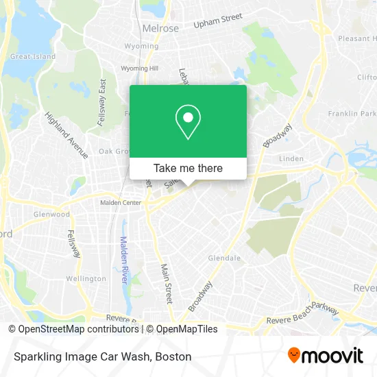
See Sparkling Image Car Wash, Malden, on the map
Public Transit to Sparkling Image Car Wash in Malden
Wondering how to get to Sparkling Image Car Wash in Malden? Moovit helps you find the best way to get to Sparkling Image Car Wash with step-by-step directions from the nearest public transit station.
Moovit provides free maps and live directions to help you navigate through your city. View schedules, routes, timetables, and find out how long does it take to get to Sparkling Image Car Wash in real time.
Looking for the nearest stop or station to Sparkling Image Car Wash? Check out this list of stops closest to your destination: Bryant St @ Willow St; Salem St @ Richardson St; Chelsea; Oak Grove.
Bus: 104, 105, 411, 430, 106, 108.Train: HAVERHILL, NEWBURYPORT/ROCKPORT, ORANGE LINE.Subway: ORANGE LINE.
Want to see if there’s another route that gets you there at an earlier time? Moovit helps you find alternative routes or times. Get directions from and directions to Sparkling Image Car Wash easily from the Moovit App or Website.
We make riding to Sparkling Image Car Wash easy, which is why over 1.7 million users, including users in Malden, trust Moovit as the best app for public transit. You don’t need to download an individual bus app or train app, Moovit is your all-in-one transit app that helps you find the best bus time or train time available.
For information on prices of bus, subway and train, costs and ride fares to Sparkling Image Car Wash, please check the Moovit app.
Use the app to navigate to popular places including to the airport, hospital, stadium, grocery store, mall, coffee shop, school, college, and university.
Sparkling Image Car Wash Address: 435 Eastern Ave street in Malden
- Alvim Team - Personal Training Studio,
- Mystic Valley Charter School (Mystic Valley Regional Charter School Turf Field),
- USPS Collection Box - Blue Box,
- ATM,
- Radio Heritage Celeste,
- Azaka Mede,
- Mystic Valley Regional Charter School-K,
- Friendly Fuel (Pro Tech Fuel),
- Natila,
- Imani Temple Cogic,
- Big Mike's Smoke & Vape,
- Dogs for Days,
- Joseph & Jules Design,
- Radiant Beauty Salon,
- Robt W McElhinney Jr CPA,
- Ie Commercial Floor Cleaning,
- Bcless,
- City of Malden,
- Witchcraft Zone,
- Southern Baptist Convention
Places Near Sparkling Image Car Wash (Malden)
- Faneuil Hall, Boston,
- Mgm Music Hall, Boston,
- Boston Children's Hospital, Boston,
- Td Garden, Boston,
- House Of Blues, Boston,
- North End, Boston,
- Museum Of Science, Boston,
- Seaport District, Boston,
- Boston Common, Boston,
- Wilbur Theatre, Boston,
- Cheers, Boston,
- Leader Bank Pavilion (Leader Bank Pavillion), Boston,
- Boston Medical Center, Boston,
- Boston Convention & Exhibition Center, Boston,
- Prudential Center, Boston,
- Massachusetts General Hospital, Boston,
- Wang Theater, Boston,
- Castle Island, Boston,
- Isabella Stewart Gardner Museum, Boston,
- Quincy Market, Boston
How to get to popular places in Boston with public transit
Get around Malden by public transit!
Traveling around Malden has never been so easy. See step by step directions as you travel to any attraction, street or major public transit station. View bus and train schedules, arrival times, service alerts and detailed routes on a map, so you know exactly how to get to anywhere in Malden.
When traveling to any destination around Malden use Moovit's Live Directions with Get Off Notifications to know exactly where and how far to walk, how long to wait for your line, and how many stops are left. Moovit will alert you when it's time to get off — no need to constantly re-check whether yours is the next stop.
Wondering how to use public transit in Malden or how to pay for public transit in Malden? Moovit public transit app can help you navigate your way with public transit easily, and at minimum cost. It includes public transit fees, ticket prices, and costs. Looking for a map of Malden public transit lines? Moovit public transit app shows all public transit maps in Malden with all Bus, Train, Subway and Ferry routes and stops on an interactive map.
Boston has 4 transit type(s), including: Bus, Train, Subway and Ferry, operated by several transit agencies, including MBTA, Southeastern Regional Transit Authority, MetroWest Regional Transit Authority, Rhode Island Public Transit Authority, WRTA, Lowell Regional Transit Authority, Merrimack Valley Transit, Montachusett Regional Transit Authority, Cape Cod Regional Transit Authority, Brockton Area Transit Authority, Martha's Vineyard Transit Authority, the WAVE - Nantucket Regional Transit Authority, GATRA, Cape Ann Transportation Authority and Massport