Directions to Spatially (Somerville) with public transportation
The following transit lines have routes that pass near Spatially
 Bus: 88, 89, 96, 87, 90.
- Train: FITCHBURG, RED LINE.
- Subway: RED LINE, GREEN LINE B, GREEN LINE C, GREEN LINE E.
How to get to Spatially by bus?
Click on the bus route to see step by step directions with maps, line arrival times and updated time schedules.
From Comfort Inn & Suites Logan International Airport, Revere
77 minFrom Uscis Biometrics Office, Revere
75 minFrom Verb Hotel, Boston
49 minFrom 7F Everett Street, Revere
74 minFrom Faneuil Hall Marketplace, Boston
48 minFrom The Banshee Bar, Boston
77 minFrom New England Law | Boston, Boston
54 minFrom Copley Square, Boston
52 minFrom Massachusetts College of Art and Design, Boston
62 minFrom Uphams Corner, Boston
78 min
How to get to Spatially by train?
Click on the train route to see step by step directions with maps, line arrival times and updated time schedules.
How to get to Spatially by subway?
Click on the subway route to see step by step directions with maps, line arrival times and updated time schedules.
From Comfort Inn & Suites Logan International Airport, Revere
62 minFrom Uscis Biometrics Office, Revere
60 minFrom Verb Hotel, Boston
49 minFrom 7F Everett Street, Revere
59 minFrom Faneuil Hall Marketplace, Boston
30 minFrom The Banshee Bar, Boston
38 minFrom New England Law | Boston, Boston
30 minFrom Copley Square, Boston
33 minFrom Massachusetts College of Art and Design, Boston
47 minFrom Uphams Corner, Boston
44 min
Bus stops near Spatially in Somerville
Train station near Spatially in Somerville
- Porter, 26 min walk,VIEW
Subway station near Spatially in Somerville
- Medford/Tufts Station, 32 min walk,VIEW
Bus lines to Spatially in Somerville
- 87, Arlington Center,VIEW
- 88, Lechmere,VIEW
- 89, Sullivan,VIEW
- 90, Assembly,VIEW
- 94, Davis,VIEW
- 96, Medford Square,VIEW
- RED LINE SHUTTLE, Alewife - Park Street,VIEW
- RED LINE SHUTTLE, Alewife - Harvard via Brattle Street,VIEW
- RED LINE SHUTTLE, Alewife - Davis,VIEW
- RED LINE SHUTTLE, Alewife - Harvard via Holyoke Street,VIEW
- RED LINE SHUTTLE, Alewife - Kendall/MIT,VIEW
- 77, Arlington Heights,VIEW
What are the closest stations to Spatially?
The closest stations to Spatially are:
- Holland St @ Simpson Ave is 226 yards away, 3 min walk.
- Grove St @ Highland Ave is 316 yards away, 5 min walk.
- Holland St @ Dover St is 384 yards away, 5 min walk.
- Massachusetts Ave Opp Rindge Ave is 394 yards away, 6 min walk.
- Porter is 2166 yards away, 26 min walk.
- Medford/Tufts Station is 2651 yards away, 32 min walk.
Which bus lines stop near Spatially?
These bus lines stop near Spatially: 88, 89, 96.
Which train line stops near Spatially?
FITCHBURG (#409 | Wachusett)
Which subway line stops near Spatially?
RED LINE (Alewife)
What’s the nearest train station to Spatially in Somerville?
The nearest train station to Spatially in Somerville is Porter. It’s a 26 min walk away.
What’s the nearest bus station to Spatially in Somerville?
The nearest bus station to Spatially in Somerville is Holland St @ Simpson Ave. It’s a 3 min walk away.
What time is the first subway to Spatially in Somerville?
The GREEN LINE E is the first subway that goes to Spatially in Somerville. It stops nearby at 4:53 AM.
What time is the last subway to Spatially in Somerville?
The GREEN LINE E is the last subway that goes to Spatially in Somerville. It stops nearby at 2:41 AM.
What time is the first train to Spatially in Somerville?
The FITCHBURG is the first train that goes to Spatially in Somerville. It stops nearby at 5:47 AM.
What time is the last train to Spatially in Somerville?
The FITCHBURG is the last train that goes to Spatially in Somerville. It stops nearby at 12:17 AM.
What time is the first bus to Spatially in Somerville?
The 89 is the first bus that goes to Spatially in Somerville. It stops nearby at 5:06 AM.
What time is the last bus to Spatially in Somerville?
The 89 is the last bus that goes to Spatially in Somerville. It stops nearby at 1:39 AM.
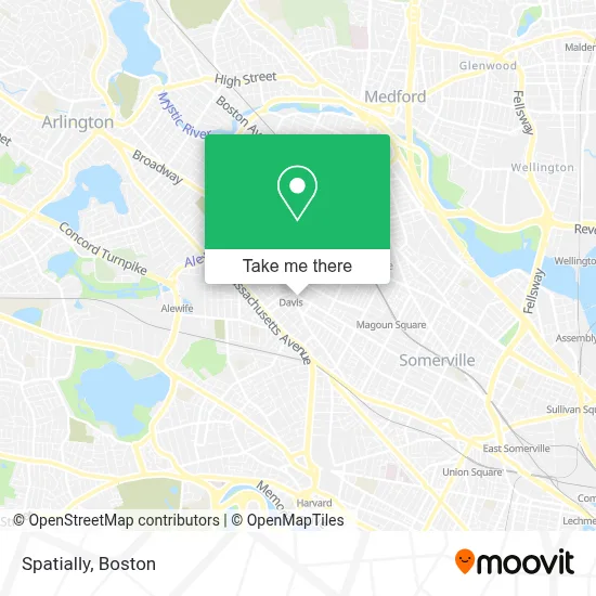
See Spatially, Somerville, on the map
Public Transit to Spatially in Somerville
Wondering how to get to Spatially in Somerville? Moovit helps you find the best way to get to Spatially with step-by-step directions from the nearest public transit station.
Moovit provides free maps and live directions to help you navigate through your city. View schedules, routes, timetables, and find out how long does it take to get to Spatially in real time.
Looking for the nearest stop or station to Spatially? Check out this list of stops closest to your destination: Holland St @ Simpson Ave; Grove St @ Highland Ave; Holland St @ Dover St; Massachusetts Ave Opp Rindge Ave; Porter; Medford/Tufts Station.
Bus: 88, 89, 96, 87, 90, 94, RED LINE SHUTTLE, RED LINE SHUTTLE, RED LINE SHUTTLE, RED LINE SHUTTLE, RED LINE SHUTTLE, 77.Train: FITCHBURG, RED LINE.Subway: RED LINE, GREEN LINE B, GREEN LINE C, GREEN LINE E.
Want to see if there’s another route that gets you there at an earlier time? Moovit helps you find alternative routes or times. Get directions from and directions to Spatially easily from the Moovit App or Website.
We make riding to Spatially easy, which is why over 1.7 million users, including users in Somerville, trust Moovit as the best app for public transit. You don’t need to download an individual bus app or train app, Moovit is your all-in-one transit app that helps you find the best bus time or train time available.
For information on prices of subway, bus and train, costs and ride fares to Spatially, please check the Moovit app.
Use the app to navigate to popular places including to the airport, hospital, stadium, grocery store, mall, coffee shop, school, college, and university.
Spatially Address: 418 Highland Ave street in Somerville
- Magpie,
- Gong Cha,
- Davis Sq. Nails & Spa,
- DJ Micaiah Professional Djing Service,
- Koa,
- Prager Judith Body-Mind Inst,
- Ras na hEireann U.S.A. 5K Race,
- Comicazi,
- Skin and Body Works I,
- Bricklogix,
- Somerville Community Chorus,
- Muckrock Foundation,
- Cornerstone Reputation,
- Ammon Embry-Pelrine, LMT,
- Massage Therapy Works of Davis Square,
- Diesel Café,
- Burren,
- Davis Sq,
- The Rockwell,
- Angela Vang Psychotherapy
Places Near Spatially (Somerville)
- Boston Children's Hospital, Boston,
- North End, Boston,
- Cheers, Boston,
- Wang Theater, Boston,
- Boston Convention & Exhibition Center, Boston,
- Museum Of Science, Boston,
- Mgm Music Hall, Boston,
- House Of Blues, Boston,
- Boston Medical Center, Boston,
- Wilbur Theatre, Boston,
- Boston Common, Boston,
- Leader Bank Pavilion (Leader Bank Pavillion), Boston,
- Massachusetts General Hospital, Boston,
- Prudential Center, Boston,
- Castle Island, Boston,
- Td Garden, Boston,
- Faneuil Hall, Boston,
- Isabella Stewart Gardner Museum, Boston,
- Seaport District, Boston,
- Quincy Market, Boston
How to get to popular places in Boston with public transit
Get around Somerville by public transit!
Traveling around Somerville has never been so easy. See step by step directions as you travel to any attraction, street or major public transit station. View bus and train schedules, arrival times, service alerts and detailed routes on a map, so you know exactly how to get to anywhere in Somerville.
When traveling to any destination around Somerville use Moovit's Live Directions with Get Off Notifications to know exactly where and how far to walk, how long to wait for your line, and how many stops are left. Moovit will alert you when it's time to get off — no need to constantly re-check whether yours is the next stop.
Wondering how to use public transit in Somerville or how to pay for public transit in Somerville? Moovit public transit app can help you navigate your way with public transit easily, and at minimum cost. It includes public transit fees, ticket prices, and costs. Looking for a map of Somerville public transit lines? Moovit public transit app shows all public transit maps in Somerville with all Bus, Train, Subway and Ferry routes and stops on an interactive map.
Boston has 4 transit type(s), including: Bus, Train, Subway and Ferry, operated by several transit agencies, including MBTA, Southeastern Regional Transit Authority, MetroWest Regional Transit Authority, Rhode Island Public Transit Authority, WRTA, Lowell Regional Transit Authority, Merrimack Valley Transit, Montachusett Regional Transit Authority, Cape Cod Regional Transit Authority, Brockton Area Transit Authority, Martha's Vineyard Transit Authority, the WAVE - Nantucket Regional Transit Authority, GATRA, Cape Ann Transportation Authority and Massport