Directions to Speak For the Trees Boston with public transportation
The following transit lines have routes that pass near Speak For the Trees Boston
 Bus: 15, 19, RED LINE SHUTTLE, RED LINE SHUTTLE, 18.
- Train: FAIRMOUNT, FRANKLIN/FOXBORO, PROVIDENCE/STOUGHTON.
- Subway: RED LINE.
How to get to Speak For the Trees Boston by bus?
Click on the bus route to see step by step directions with maps, line arrival times and updated time schedules.
How to get to Speak For the Trees Boston by train?
Click on the train route to see step by step directions with maps, line arrival times and updated time schedules.
How to get to Speak For the Trees Boston by subway?
Click on the subway route to see step by step directions with maps, line arrival times and updated time schedules.
Bus stops near Speak For the Trees Boston
Subway station near Speak For the Trees Boston
- Shawmut, 14 min walk,VIEW
Train station near Speak For the Trees Boston
- Four Corners/Geneva, 20 min walk,VIEW
Bus lines to Speak For the Trees Boston
What are the closest stations to Speak For the Trees Boston?
The closest stations to Speak For the Trees Boston are:
- Dorchester Ave @ Lincoln St - Fields Corner Sta is 21 yards away, 1 min walk.
- Dorchester Ave @ Fields Corner Station is 97 yards away, 2 min walk.
- Dorchester Ave Opp Charles St is 148 yards away, 2 min walk.
- Fields Corner is 266 yards away, 4 min walk.
- Shawmut is 1163 yards away, 14 min walk.
- Four Corners/Geneva is 1635 yards away, 20 min walk.
Which bus lines stop near Speak For the Trees Boston?
These bus lines stop near Speak For the Trees Boston: 15, 19.
Which train line stops near Speak For the Trees Boston?
FAIRMOUNT (#1619 | Fairmount)
Which subway line stops near Speak For the Trees Boston?
RED LINE (Ashmont/Braintree)
What’s the nearest subway station to Speak For the Trees Boston?
The nearest subway station to Speak For the Trees Boston is Shawmut. It’s a 14 min walk away.
What’s the nearest train station to Speak For the Trees Boston?
The nearest train station to Speak For the Trees Boston is Four Corners/Geneva. It’s a 20 min walk away.
What’s the nearest bus station to Speak For the Trees Boston?
The nearest bus station to Speak For the Trees Boston is Dorchester Ave @ Lincoln St - Fields Corner Sta. It’s a 1 min walk away.
What time is the first subway to Speak For the Trees Boston?
The RED LINE is the first subway that goes to Speak For the Trees Boston. It stops nearby at 5:16 AM.
What time is the last subway to Speak For the Trees Boston?
The RED LINE is the last subway that goes to Speak For the Trees Boston. It stops nearby at 2:03 AM.
What time is the first train to Speak For the Trees Boston?
The FAIRMOUNT is the first train that goes to Speak For the Trees Boston. It stops nearby at 6:30 AM.
What time is the last train to Speak For the Trees Boston?
The FAIRMOUNT is the last train that goes to Speak For the Trees Boston. It stops nearby at 12:00 AM.
What time is the first bus to Speak For the Trees Boston?
The 15 is the first bus that goes to Speak For the Trees Boston. It stops nearby at 3:30 AM.
What time is the last bus to Speak For the Trees Boston?
The 15 is the last bus that goes to Speak For the Trees Boston. It stops nearby at 1:26 AM.
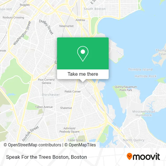
See Speak For the Trees Boston on the map
Public Transportation to Speak For the Trees Boston
Wondering how to get to Speak For the Trees Boston? Moovit helps you find the best way to get to Speak For the Trees Boston with step-by-step directions from the nearest public transit station.
Moovit provides free maps and live directions to help you navigate through your city. View schedules, routes, timetables, and find out how long does it take to get to Speak For the Trees Boston in real time.
Looking for the nearest stop or station to Speak For the Trees Boston? Check out this list of stops closest to your destination: Dorchester Ave @ Lincoln St - Fields Corner Sta; Dorchester Ave @ Fields Corner Station; Dorchester Ave Opp Charles St; Fields Corner; Shawmut; Four Corners/Geneva.
Bus: 15, 19, RED LINE SHUTTLE, RED LINE SHUTTLE, 18, 17, 201, 202.Train: FAIRMOUNT, FRANKLIN/FOXBORO, PROVIDENCE/STOUGHTON.Subway: RED LINE.
Want to see if there’s another route that gets you there at an earlier time? Moovit helps you find alternative routes or times. Get directions from and directions to Speak For the Trees Boston easily from the Moovit App or Website.
We make riding to Speak For the Trees Boston easy, which is why over 1.7 million users, including users in Boston, trust Moovit as the best app for public transit. You don’t need to download an individual bus app or train app, Moovit is your all-in-one transit app that helps you find the best bus time or train time available.
For information on prices of subway, bus and train, costs and ride fares to Speak For the Trees Boston, please check the Moovit app.
Use the app to navigate to popular places including to the airport, hospital, stadium, grocery store, mall, coffee shop, school, college, and university.
Speak For the Trees Boston Address: 60 Clayton St street in Boston
- Feeney Brothers Utility Services,
- Everett St & Park St,
- Ronan Park Dog Recreation Space,
- Cộng Đoàn Mẹ La Vang, Dorchester,
- Boston Duck Tours Garage Facility,
- IBEW Local 103 Freeport Hall,
- Santander,
- Santander Bank,
- Social Security Office,
- Adams St (adams street dorchester),
- Everett St (elm street everett),
- D'Benny Sub Shop (D Bennys Subs and More),
- Grand Line Development,
- SK Dugbazah Enterprise,
- Mujeres Unidas en Accion,
- Blasis Kitchen & Bar,
- Serene Cleaning,
- Kelly House,
- VI Multi Service and Gift Shop,
- MBTA-Fields Corner (Fields Corner Station - MBTA - Red Line)
Places Near Speak For the Trees Boston
- Boston Medical Center, Boston,
- Leader Bank Pavilion (Leader Bank Pavillion), Boston,
- House Of Blues, Boston,
- Mgm Music Hall, Boston,
- Museum Of Science, Boston,
- Castle Island, Boston,
- Boston Convention & Exhibition Center, Boston,
- Isabella Stewart Gardner Museum, Boston,
- Td Garden, Boston,
- Wang Theater, Boston,
- Massachusetts General Hospital, Boston,
- Quincy Market, Boston,
- Boston Common, Boston,
- North End, Boston,
- Wilbur Theatre, Boston,
- Seaport District, Boston,
- Cheers, Boston,
- Faneuil Hall, Boston,
- Boston Children's Hospital, Boston,
- Prudential Center, Boston
How to get to popular places in Boston with public transit
Get around Boston by public transit!
Traveling around Boston has never been so easy. See step by step directions as you travel to any attraction, street or major public transit station. View bus and train schedules, arrival times, service alerts and detailed routes on a map, so you know exactly how to get to anywhere in Boston.
When traveling to any destination around Boston use Moovit's Live Directions with Get Off Notifications to know exactly where and how far to walk, how long to wait for your line, and how many stops are left. Moovit will alert you when it's time to get off — no need to constantly re-check whether yours is the next stop.
Wondering how to use public transit in Boston or how to pay for public transit in Boston? Moovit public transit app can help you navigate your way with public transit easily, and at minimum cost. It includes public transit fees, ticket prices, and costs. Looking for a map of Boston public transit lines? Moovit public transit app shows all public transit maps in Boston with all Bus, Train, Subway and Ferry routes and stops on an interactive map.
Boston has 4 transit type(s), including: Bus, Train, Subway and Ferry, operated by several transit agencies, including MBTA, Southeastern Regional Transit Authority, MetroWest Regional Transit Authority, Rhode Island Public Transit Authority, WRTA, Lowell Regional Transit Authority, Merrimack Valley Transit, Montachusett Regional Transit Authority, Cape Cod Regional Transit Authority, Brockton Area Transit Authority, Martha's Vineyard Transit Authority, the WAVE - Nantucket Regional Transit Authority, GATRA, Cape Ann Transportation Authority and Massport