Directions to Spectrum Store (Kansas City) with public transportation
The following transit lines have routes that pass near Spectrum Store
 Bus: 101.
How to get to Spectrum Store by bus?
Click on the bus route to see step by step directions with maps, line arrival times and updated time schedules.
From Tornado Bus Company, kansas City, Kansas City
53 minFrom Park & Recreation Department, Kansas City
36 minFrom Villa Bella Townhomes, Kansas City
38 minFrom KCKCC Jewell Building, Kansas City
32 minFrom KCKCC Baseball Field, Kansas City
34 minFrom Kansas City Kansas Community College (KCKCC), Kansas City
22 min
Bus stop near Spectrum Store in Kansas City
- On Village Pkwy at Prairie Crossing Wb, 6 min walk,VIEW
Bus lines to Spectrum Store in Kansas City
- 101, 101-State Ave / To Village West,VIEW
What are the closest stations to Spectrum Store?
The closest stations to Spectrum Store are:
- On Village Pkwy at Prairie Crossing Wb is 470 yards away, 6 min walk.
Which bus line stops near Spectrum Store?
101 (101-State Ave / To Village West)
What’s the nearest bus station to Spectrum Store in Kansas City?
The nearest bus station to Spectrum Store in Kansas City is On Village Pkwy at Prairie Crossing Wb. It’s a 6 min walk away.
What time is the first bus to Spectrum Store in Kansas City?
The 101 is the first bus that goes to Spectrum Store in Kansas City. It stops nearby at 5:45 AM.
What time is the last bus to Spectrum Store in Kansas City?
The 101 is the last bus that goes to Spectrum Store in Kansas City. It stops nearby at 11:17 PM.
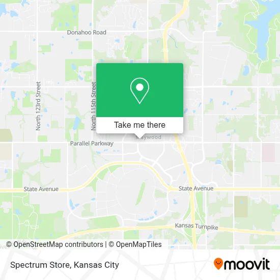
See Spectrum Store, Kansas City, on the map
Public Transit to Spectrum Store in Kansas City
Wondering how to get to Spectrum Store in Kansas City? Moovit helps you find the best way to get to Spectrum Store with step-by-step directions from the nearest public transit station.
Moovit provides free maps and live directions to help you navigate through your city. View schedules, routes, timetables, and find out how long does it take to get to Spectrum Store in real time.
Looking for the nearest stop or station to Spectrum Store? Check out this list of stops closest to your destination: On Village Pkwy at Prairie Crossing Wb.
Bus: 101.
Want to see if there’s another route that gets you there at an earlier time? Moovit helps you find alternative routes or times. Get directions from and directions to Spectrum Store easily from the Moovit App or Website.
We make riding to Spectrum Store easy, which is why over 1.5 million users, including users in Kansas City, trust Moovit as the best app for public transit. You don’t need to download an individual bus app or train app, Moovit is your all-in-one transit app that helps you find the best bus time or train time available.
For information on prices of bus, costs and ride fares to Spectrum Store, please check the Moovit app.
Use the app to navigate to popular places including to the airport, hospital, stadium, grocery store, mall, coffee shop, school, college, and university.
Spectrum Store Address: 10810 Parallel Pkwy street in Kansas City
- Legends,
- BCBGMAXAZRIA,
- AMC Legends 14,
- Legends Outlets Kansas City,
- Legends Field,
- Kansas City Monarchs Baseball,
- Children's Mercy Park,
- Nebraska Furniture Mart,
- Entrance I-435 S,
- Elements Spa Salon at Great Wolf Lodge,
- Great Wolf Lodge,
- Switch Apartments,
- Patricks Church (St Patrick Catholic Church & School),
- ChargePoint,
- Wyandotte,
- Bp,
- Quick Shop,
- Nolan Local Locksmith (The Locksmith Company),
- Car Lockout Service,
- QUALITY INN
Places Near Spectrum Store (Kansas City)
- Arrowhead Stadium,
- Kauffman Stadium,
- Amazon Fulfilment Center-MKC6, Kansas City,
- Kansas City International Airport (MCI) (Kansas City International Airport),
- GEHA Field at Arrowhead Stadium,
- Truman Medical Center,
- Kansas City Zoo,
- Ku Medical Center, Kansas City,
- The Glory Hole,
- T-Mobile Center,
- Walmart, Kansas City,
- Grandview, MO, Grandview,
- St. Luke's Hospital - Medical Plaza I,
- Legends Outlets Kansas City, Kansas City,
- Worlds of Fun,
- Liberty, MO, Liberty,
- Stans Glory Hole,
- Walmart Supercenter,
- Harrah's Casino, North Kansas City,
- Country Club Plaza
How to get to popular places in Kansas City with public transit
Get around Kansas City by public transit!
Traveling around Kansas City has never been so easy. See step by step directions as you travel to any attraction, street or major public transit station. View bus and train schedules, arrival times, service alerts and detailed routes on a map, so you know exactly how to get to anywhere in Kansas City.
When traveling to any destination around Kansas City use Moovit's Live Directions with Get Off Notifications to know exactly where and how far to walk, how long to wait for your line, and how many stops are left. Moovit will alert you when it's time to get off — no need to constantly re-check whether yours is the next stop.
Wondering how to use public transit in Kansas City or how to pay for public transit in Kansas City? Moovit public transit app can help you navigate your way with public transit easily, and at minimum cost. It includes public transit fees, ticket prices, and costs. Looking for a map of Kansas City public transit lines? Moovit public transit app shows all public transit maps in Kansas City with all Bus, Train and Light Rail routes and stops on an interactive map.
Kansas City has 3 transit type(s), including: Bus, Train and Light Rail, operated by several transit agencies, including Kansas City Area Transportation Authority, Lawrence Transit, Topeka Metro, RideKC Johnson County, Amtrak, Greyhound-us and FlixBus-us