Directions to Speed Gym (Brookline) with public transportation
The following transit lines have routes that pass near Speed Gym
 Bus: 19, 51, 65, GREEN LINE C SHUTTLE, GREEN LINE C SHUTTLE.
- Train: FRAMINGHAM/WORCESTER.
- Subway: GREEN LINE C, GREEN LINE D.
How to get to Speed Gym by bus?
Click on the bus route to see step by step directions with maps, line arrival times and updated time schedules.
From Marina Bay, Quincy
159 minFrom Black Falcon Cruise Terminal, Boston
81 minFrom Mass Eye And Ear, Boston
64 minFrom The Lawn on D, Boston
54 minFrom Georgetown, Massachusetts, Boston
77 minFrom Castle Island, Boston
95 minFrom Franklin Park Zoo, Boston
50 minFrom Medford, MA, Medford
81 minFrom Silver Line Stop Terminal B, Boston
48 minFrom Terminal B- Logan International Airport, Boston
48 min
How to get to Speed Gym by train?
Click on the train route to see step by step directions with maps, line arrival times and updated time schedules.
How to get to Speed Gym by subway?
Click on the subway route to see step by step directions with maps, line arrival times and updated time schedules.
Bus stops near Speed Gym in Brookline
Bus lines to Speed Gym in Brookline
What are the closest stations to Speed Gym?
The closest stations to Speed Gym are:
- Washington St @ Winthrop Path is 258 yards away, 3 min walk.
- Dean Road is 518 yards away, 7 min walk.
- Beaconsfield is 1434 yards away, 17 min walk.
Which bus lines stop near Speed Gym?
These bus lines stop near Speed Gym: 19, 51, 65.
Which train line stops near Speed Gym?
FRAMINGHAM/WORCESTER (#525 | Worcester)
Which subway line stops near Speed Gym?
GREEN LINE C (Cleveland Circle)
What’s the nearest subway station to Speed Gym in Brookline?
The nearest subway station to Speed Gym in Brookline is Dean Road. It’s a 7 min walk away.
What’s the nearest bus station to Speed Gym in Brookline?
The nearest bus station to Speed Gym in Brookline is Washington St @ Winthrop Path. It’s a 3 min walk away.
What time is the first subway to Speed Gym in Brookline?
The GREEN LINE D is the first subway that goes to Speed Gym in Brookline. It stops nearby at 4:48 AM.
What time is the last subway to Speed Gym in Brookline?
The GREEN LINE D is the last subway that goes to Speed Gym in Brookline. It stops nearby at 2:29 AM.
What time is the first bus to Speed Gym in Brookline?
The 65 is the first bus that goes to Speed Gym in Brookline. It stops nearby at 6:01 AM.
What time is the last bus to Speed Gym in Brookline?
The 65 is the last bus that goes to Speed Gym in Brookline. It stops nearby at 8:53 PM.
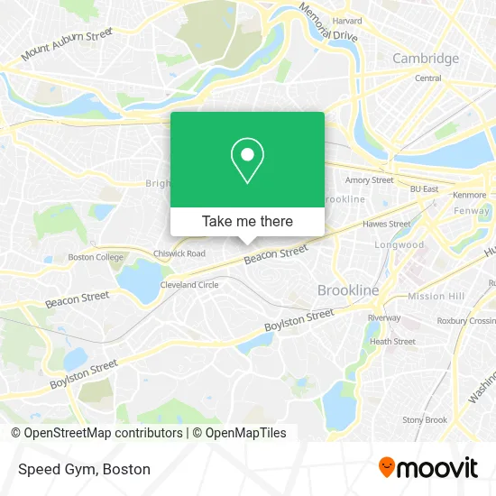
See Speed Gym, Brookline, on the map
Public Transit to Speed Gym in Brookline
Wondering how to get to Speed Gym in Brookline? Moovit helps you find the best way to get to Speed Gym with step-by-step directions from the nearest public transit station.
Moovit provides free maps and live directions to help you navigate through your city. View schedules, routes, timetables, and find out how long does it take to get to Speed Gym in real time.
Looking for the nearest stop or station to Speed Gym? Check out this list of stops closest to your destination: Washington St @ Winthrop Path; Dean Road; Beaconsfield.
Bus: 19, 51, 65, GREEN LINE C SHUTTLE, GREEN LINE C SHUTTLE, SHUTTLE.Train: FRAMINGHAM/WORCESTER.Subway: GREEN LINE C, GREEN LINE D.
Want to see if there’s another route that gets you there at an earlier time? Moovit helps you find alternative routes or times. Get directions from and directions to Speed Gym easily from the Moovit App or Website.
We make riding to Speed Gym easy, which is why over 1.7 million users, including users in Brookline, trust Moovit as the best app for public transit. You don’t need to download an individual bus app or train app, Moovit is your all-in-one transit app that helps you find the best bus time or train time available.
For information on prices of bus, subway, train and ferry, costs and ride fares to Speed Gym, please check the Moovit app.
Use the app to navigate to popular places including to the airport, hospital, stadium, grocery store, mall, coffee shop, school, college, and university.
Speed Gym Address: 21 Salisbury Rd street in Brookline
- Sirona Health Advocates,
- International Paper Museum (Research Institute Paper Histr),
- Kirzner/Fuchs+Hill,
- Ferullo Michael,
- 1842 Medical Building,
- Dumitriu, Delia DMD,
- Locks and Lockout Service,
- The Publick House,
- Beacon Dry Cleaners,
- Nuevo Locksmith & Key,
- Bartaco,
- Barcelona Wine Bar,
- Alvin's Lock Safe Services LLC,
- Abbey,
- Driscoll Elementary School,
- Driscoll Pto,
- Beacon Kosher,
- Golden Temple,
- Travel by Arleen,
- Vca
Places Near Speed Gym (Brookline)
- Seaport District, Boston,
- Museum Of Science, Boston,
- Boston Children's Hospital, Boston,
- Faneuil Hall, Boston,
- Leader Bank Pavilion (Leader Bank Pavillion), Boston,
- Wilbur Theatre, Boston,
- House Of Blues, Boston,
- North End, Boston,
- Boston Medical Center, Boston,
- Castle Island, Boston,
- Boston Convention & Exhibition Center, Boston,
- Quincy Market, Boston,
- Boston Common, Boston,
- Td Garden, Boston,
- Wang Theater, Boston,
- Massachusetts General Hospital, Boston,
- Cheers, Boston,
- Mgm Music Hall, Boston,
- Prudential Center, Boston,
- Isabella Stewart Gardner Museum, Boston
How to get to popular places in Boston with public transit
Get around Brookline by public transit!
Traveling around Brookline has never been so easy. See step by step directions as you travel to any attraction, street or major public transit station. View bus and train schedules, arrival times, service alerts and detailed routes on a map, so you know exactly how to get to anywhere in Brookline.
When traveling to any destination around Brookline use Moovit's Live Directions with Get Off Notifications to know exactly where and how far to walk, how long to wait for your line, and how many stops are left. Moovit will alert you when it's time to get off — no need to constantly re-check whether yours is the next stop.
Wondering how to use public transit in Brookline or how to pay for public transit in Brookline? Moovit public transit app can help you navigate your way with public transit easily, and at minimum cost. It includes public transit fees, ticket prices, and costs. Looking for a map of Brookline public transit lines? Moovit public transit app shows all public transit maps in Brookline with all Bus, Train, Subway and Ferry routes and stops on an interactive map.
Boston has 4 transit type(s), including: Bus, Train, Subway and Ferry, operated by several transit agencies, including MBTA, Southeastern Regional Transit Authority, MetroWest Regional Transit Authority, Rhode Island Public Transit Authority, WRTA, Lowell Regional Transit Authority, Merrimack Valley Transit, Montachusett Regional Transit Authority, Cape Cod Regional Transit Authority, Brockton Area Transit Authority, Martha's Vineyard Transit Authority, the WAVE - Nantucket Regional Transit Authority, GATRA, Cape Ann Transportation Authority and Massport