Directions to Speedy Locksmith (Stoneham) with public transportation
The following transit lines have routes that pass near Speedy Locksmith
 Bus: 132, 354.
- Train: HAVERHILL, ORANGE LINE, LOWELL.
How to get to Speedy Locksmith by bus?
Click on the bus route to see step by step directions with maps, line arrival times and updated time schedules.
From Target, Everett
53 minFrom Spaulding Hospital, Cambridge
110 minFrom Comfort Inn & Suites Logan International Airport, Revere
81 minFrom Downeast Cider House, Boston
94 minFrom Costco Wholesale, Everett
54 minFrom Burlington Mall, Burlington
83 minFrom Middlesex Superior Court, Woburn
73 minFrom La Quinta, Somerville
45 minFrom Cambridge Hospital, Cambridge
109 minFrom Bunker Hill, Boston
100 min
Bus stop near Speedy Locksmith in Stoneham
- Main St @ Summer St, 1 min walk,VIEW
Train stations near Speedy Locksmith in Stoneham
Bus lines to Speedy Locksmith in Stoneham
- 132, Malden,VIEW
What are the closest stations to Speedy Locksmith?
The closest stations to Speedy Locksmith are:
- Main St @ Summer St is 38 yards away, 1 min walk.
- Oak Grove is 2639 yards away, 31 min walk.
- Winchester Center is 4974 yards away, 58 min walk.
Which bus lines stop near Speedy Locksmith?
These bus lines stop near Speedy Locksmith: 132, 354.
What’s the nearest bus station to Speedy Locksmith in Stoneham?
The nearest bus station to Speedy Locksmith in Stoneham is Main St @ Summer St. It’s a 1 min walk away.
What time is the first subway to Speedy Locksmith in Stoneham?
The ORANGE LINE is the first subway that goes to Speedy Locksmith in Stoneham. It stops nearby at 5:15 AM.
What time is the last subway to Speedy Locksmith in Stoneham?
The ORANGE LINE is the last subway that goes to Speedy Locksmith in Stoneham. It stops nearby at 1:59 AM.
What time is the first train to Speedy Locksmith in Stoneham?
The LOWELL is the first train that goes to Speedy Locksmith in Stoneham. It stops nearby at 5:27 AM.
What time is the last train to Speedy Locksmith in Stoneham?
The LOWELL is the last train that goes to Speedy Locksmith in Stoneham. It stops nearby at 12:15 AM.
What time is the first bus to Speedy Locksmith in Stoneham?
The 132 is the first bus that goes to Speedy Locksmith in Stoneham. It stops nearby at 5:38 AM.
What time is the last bus to Speedy Locksmith in Stoneham?
The 132 is the last bus that goes to Speedy Locksmith in Stoneham. It stops nearby at 11:33 PM.
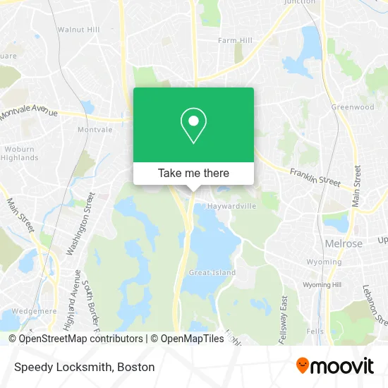
See Speedy Locksmith, Stoneham, on the map
Public Transit to Speedy Locksmith in Stoneham
Wondering how to get to Speedy Locksmith in Stoneham? Moovit helps you find the best way to get to Speedy Locksmith with step-by-step directions from the nearest public transit station.
Moovit provides free maps and live directions to help you navigate through your city. View schedules, routes, timetables, and find out how long does it take to get to Speedy Locksmith in real time.
Looking for the nearest stop or station to Speedy Locksmith? Check out this list of stops closest to your destination: Main St @ Summer St; Oak Grove; Winchester Center.
Bus: 132, 354.Train: HAVERHILL, ORANGE LINE, LOWELL.
Want to see if there’s another route that gets you there at an earlier time? Moovit helps you find alternative routes or times. Get directions from and directions to Speedy Locksmith easily from the Moovit App or Website.
We make riding to Speedy Locksmith easy, which is why over 1.7 million users, including users in Stoneham, trust Moovit as the best app for public transit. You don’t need to download an individual bus app or train app, Moovit is your all-in-one transit app that helps you find the best bus time or train time available.
For information on prices of bus and subway, costs and ride fares to Speedy Locksmith, please check the Moovit app.
Use the app to navigate to popular places including to the airport, hospital, stadium, grocery store, mall, coffee shop, school, college, and university.
Speedy Locksmith Address: 610 Main St street in Stoneham
- Rug Cleaning Near Me,
- Stoneham Pool,
- Straw Point,
- Find A Plumbers,
- JMS Masonry & Restoration,
- Charron & Flaws,
- Mexican Gray Wolf,
- Snow Leopards,
- White Cheeked Gibbon,
- Foundation Building Materials,
- Ram Electrical Consululting,
- Appian Club,
- World Glass Window Cleaning,
- Stone Zoo,
- The Mave,
- Prorestoration,
- ATM,
- Johnny Boy,
- Nutnapat Aroy Thai,
- Park Place Pantry
Places Near Speedy Locksmith (Stoneham)
- House Of Blues, Boston,
- Faneuil Hall, Boston,
- Quincy Market, Boston,
- Museum Of Science, Boston,
- Boston Children's Hospital, Boston,
- Wang Theater, Boston,
- Isabella Stewart Gardner Museum, Boston,
- Boston Common, Boston,
- Leader Bank Pavilion (Leader Bank Pavillion), Boston,
- Cheers, Boston,
- Prudential Center, Boston,
- Td Garden, Boston,
- Massachusetts General Hospital, Boston,
- Seaport District, Boston,
- Boston Medical Center, Boston,
- Castle Island, Boston,
- Boston Convention & Exhibition Center, Boston,
- Mgm Music Hall, Boston,
- North End, Boston,
- Wilbur Theatre, Boston
How to get to popular places in Boston with public transit
Get around Stoneham by public transit!
Traveling around Stoneham has never been so easy. See step by step directions as you travel to any attraction, street or major public transit station. View bus and train schedules, arrival times, service alerts and detailed routes on a map, so you know exactly how to get to anywhere in Stoneham.
When traveling to any destination around Stoneham use Moovit's Live Directions with Get Off Notifications to know exactly where and how far to walk, how long to wait for your line, and how many stops are left. Moovit will alert you when it's time to get off — no need to constantly re-check whether yours is the next stop.
Wondering how to use public transit in Stoneham or how to pay for public transit in Stoneham? Moovit public transit app can help you navigate your way with public transit easily, and at minimum cost. It includes public transit fees, ticket prices, and costs. Looking for a map of Stoneham public transit lines? Moovit public transit app shows all public transit maps in Stoneham with all Bus, Train, Subway and Ferry routes and stops on an interactive map.
Boston has 4 transit type(s), including: Bus, Train, Subway and Ferry, operated by several transit agencies, including MBTA, Southeastern Regional Transit Authority, MetroWest Regional Transit Authority, Rhode Island Public Transit Authority, WRTA, Lowell Regional Transit Authority, Merrimack Valley Transit, Montachusett Regional Transit Authority, Cape Cod Regional Transit Authority, Brockton Area Transit Authority, Martha's Vineyard Transit Authority, the WAVE - Nantucket Regional Transit Authority, GATRA, Cape Ann Transportation Authority and Massport