See Sperling-Burnaby Lake Station on the map
Directions to Sperling-Burnaby Lake Station with public transportation
The following transit lines have routes that pass near Sperling-Burnaby Lake Station
 Bus:
Bus: - SkyTrain:
How to get to Sperling-Burnaby Lake Station by bus?
Click on the bus route to see step by step directions with maps, line arrival times and updated time schedules.
How to get to Sperling-Burnaby Lake Station by SkyTrain?
Click on the SkyTrain route to see step by step directions with maps, line arrival times and updated time schedules.
Bus stations near Sperling-Burnaby Lake Station
- Sperling Station @ Bay 4,1 min walk,
- Sperling Station @ Bay 2,1 min walk,
- Westbound Lougheed Hwy @ Sperling Ave,4 min walk,
- Northbound Kensington Ave @ Joe Sakic Way,12 min walk,
Skytrain stations near Sperling-Burnaby Lake Station
- Lake City Way Station,19 min walk,
- Production Way-University Station,47 min walk,
Bus lines to Sperling-Burnaby Lake Station
- 134,Lake City Station,
- 144,SFU,
- N9,Downtown,
- 110,Lougheed Station,
What are the closest stations to Sperling-Burnaby Lake Station?
The closest stations to Sperling-Burnaby Lake Station are:
- Sperling Station @ Bay 4 is 12 meters away, 1 min walk.
- Sperling Station @ Bay 2 is 20 meters away, 1 min walk.
- Westbound Lougheed Hwy @ Sperling Ave is 260 meters away, 4 min walk.
- Northbound Kensington Ave @ Joe Sakic Way is 876 meters away, 12 min walk.
- Lake City Way Station is 1463 meters away, 19 min walk.
- Production Way-University Station is 3658 meters away, 47 min walk.
Which bus lines stop near Sperling-Burnaby Lake Station?
These bus lines stop near Sperling-Burnaby Lake Station: 110, 134, 144.
Which SkyTrain line stops near Sperling-Burnaby Lake Station?
MILLENNIUM LINE
What’s the nearest SkyTrain station to Sperling-Burnaby Lake Station?
The nearest SkyTrain station to Sperling-Burnaby Lake Station is Lake City Way Station. It’s a 19 min walk away.
What’s the nearest bus stop to Sperling-Burnaby Lake Station?
The nearest bus stops to Sperling-Burnaby Lake Station are Sperling Station @ Bay 4 and Sperling Station @ Bay 2. The closest one is a 1 min walk away.
What time is the first SkyTrain to Sperling-Burnaby Lake Station?
The EXPO LINE is the first SkyTrain that goes to Sperling-Burnaby Lake Station. It stops nearby at 5:08 AM.
What time is the last SkyTrain to Sperling-Burnaby Lake Station?
The MILLENNIUM LINE is the last SkyTrain that goes to Sperling-Burnaby Lake Station. It stops nearby at 1:47 AM.
What time is the first bus to Sperling-Burnaby Lake Station?
The N9 is the first bus that goes to Sperling-Burnaby Lake Station. It stops nearby at 3:30 AM.
What time is the last bus to Sperling-Burnaby Lake Station?
The N9 is the last bus that goes to Sperling-Burnaby Lake Station. It stops nearby at 2:56 AM.
How much is the bus fare to Sperling-Burnaby Lake Station?
The bus fare to Sperling-Burnaby Lake Station costs about $2.60.
How much is the SkyTrain fare to Sperling-Burnaby Lake Station?
The SkyTrain fare to Sperling-Burnaby Lake Station costs about $2.60 - $3.85.
See Sperling-Burnaby Lake Station on the map
Public Transportation to Sperling-Burnaby Lake Station
Wondering how to get to Sperling-Burnaby Lake Station, Canada? Moovit helps you find the best way to get to Sperling-Burnaby Lake Station with step-by-step directions from the nearest public transit station.
Moovit provides free maps and live directions to help you navigate through your city. View schedules, routes, timetables, and find out how long does it take to get to Sperling-Burnaby Lake Station in real time.
Looking for the nearest stop or station to Sperling-Burnaby Lake Station? Check out this list of stops closest to your destination: Sperling Station @ Bay 4; Sperling Station @ Bay 2; Westbound Lougheed Hwy @ Sperling Ave; Northbound Kensington Ave @ Joe Sakic Way; Lake City Way Station; Production Way-University Station.
Bus:SkyTrain:
Want to see if there’s another route that gets you there at an earlier time? Moovit helps you find alternative routes or times. Get directions from and directions to Sperling-Burnaby Lake Station easily from the Moovit App or Website.
We make riding to Sperling-Burnaby Lake Station easy, which is why over 1.5 million users, including users in Burnaby, trust Moovit as the best app for public transit. You don’t need to download an individual bus app or train app, Moovit is your all-in-one transit app that helps you find the best bus time or train time available.
For information on prices of SkyTrain and bus, costs and ride fares to Sperling-Burnaby Lake Station, please check the Moovit app.
Use the app to navigate to popular places including to the airport, hospital, stadium, grocery store, mall, coffee shop, school, college, and university.
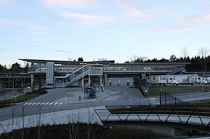
Sperling-Burnaby Lake Station Address: Sperling Bus Loop street in Burnaby
Attractions near Sperling-Burnaby Lake Station
Sperling / Burnaby Lake SkyTrain Station,6751 Lougheed Highway,Kneale Place,Kingsford Place,Spirit of Dance,2430 Sperling Ave,Thomas Sheet Metal,Lougheed Hwy,Direct Liquidation,6924 Hycrest Dr,Bainbridge Liquor Store,Lougheed Hwy / Bainbridge Ave,7075 Greenwood St,Sperling Elementary school,Bainbridge,Paulus Cres,Bill Copeland Sports Centre,6733 Yeovil Pl,Burnaby Lake Sports Complex West,3676 Kensington AveHow to get to popular attractions in Burnaby with public transit
The Sandbar Seafood Restaurant, Vancouver,Costco Wholesale, Abbotsford,Playland, Vancouver,Maple Ridge, British Columbia, Maple Ridge,Children's & Women's Health Centre of British Columbia, Vancouver,Parallel 49 Brewing Co., Vancouver,Walnut Grove Park and Ride, Langley District Municipality,Hawksworth Restaurant, Vancouver,Kwantlen Polytechnic University - Surrey Campus, Surrey,Steve Nash Sports Club, Surrey,Salt Tasting Room, Vancouver,Gastown, Vancouver,Rogers Arena, Vancouver,Save-On-Foods, Surrey,Tap & Barrel, Vancouver,Stanley Park, Vancouver,Queen Elizabeth Park, Vancouver,200 Granville St., Vancouver,Holiday Inn Express Vancouver-Metrotown (Burnaby), Burnaby,Newton Exchange, SurreyGet around Burnaby by public transit!
Traveling around Burnaby has never been so easy. See step by step directions as you travel to any attraction, street or major public transit station. View bus and train schedules, arrival times, service alerts and detailed routes on a map, so you know exactly how to get to anywhere in Burnaby.
When traveling to any destination around Burnaby use Moovit's Live Directions with Get Off Notifications to know exactly where and how far to walk, how long to wait for your line, and how many stops are left. Moovit will alert you when it's time to get off — no need to constantly re-check whether yours is the next stop.
Wondering how to use public transit in Burnaby or how to pay for public transit in Burnaby? Moovit public transit app can help you navigate your way with public transit easily, and at minimum cost. It includes public transit fees, ticket prices, and costs. Looking for a map of Burnaby public transit lines? Moovit public transit app shows all public transit maps in Burnaby with all SkyTrain or bus routes and stops on an interactive map.
Burnaby has 2 transit type(s), including: SkyTrain or bus, operated by several transit agencies, including TransLink, TransLink, TransLink, TransLink, False Creek Ferries, BC Ferries, Aquabus, BC Transit - Central Fraser Valley Transit System, BCTransit, BC Transit - Comox Valley Transit System, BC Transit - Aggasiz-Harrison and Hope Transit System, BC Transit - Chilliwack Transit System, BC Transit - Squamish, BC Transit - Whistler Transit System and BC Transit - Cowichan Valley Regional Transit System