Directions to Spinnaker Analytics (Boston) with public transportation
The following transit lines have routes that pass near Spinnaker Analytics
 Bus: 10, 39, 450, 501, 504.
- Train: ACELA, FRAMINGHAM/WORCESTER, NEEDHAM, FOXBORO EVENT SERVICE, FRANKLIN/FOXBORO.
- Subway: GREEN LINE B, ORANGE LINE, GREEN LINE E, GREEN LINE C, GREEN LINE D.
How to get to Spinnaker Analytics by bus?
Click on the bus route to see step by step directions with maps, line arrival times and updated time schedules.
From FOUR POINTS BY SHERATON Boston Newton, Newton
20 minFrom Four Points by Sheraton Boston Logan Airport, Revere
73 minFrom Qea, Quincy
98 minFrom Arlington, MA, Arlington
93 minFrom Arsenal Mall, Watertown Town
55 minFrom Market Basket, Revere
65 minFrom Wegmans, Medford
86 minFrom Milton Academy, Milton
98 minFrom Sonia, Boston
55 minFrom Dorchester, Boston
58 min
How to get to Spinnaker Analytics by train?
Click on the train route to see step by step directions with maps, line arrival times and updated time schedules.
How to get to Spinnaker Analytics by subway?
Click on the subway route to see step by step directions with maps, line arrival times and updated time schedules.
Bus stops near Spinnaker Analytics in Boston
- Boylston St @ Dartmouth St, 2 min walk,VIEW
- Copley - Boylston St @ Dartmouth St, 3 min walk,VIEW
- Copley - Opp 575 Boylston St, 4 min walk,VIEW
- Saint James Ave @ Dartmouth St, 4 min walk,VIEW
- Back Bay Station (Dartmouth Street), 4 min walk,VIEW
- Boston, MA - Copley Square (Corner Of Clarendon St. & St. James Ave. In Front Of Trinity Church), 5 min walk,VIEW
- Stuart St @ Dartmouth St, 6 min walk,VIEW
Train station near Spinnaker Analytics in Boston
- Back Bay - South End, 7 min walk,VIEW
Subway stations near Spinnaker Analytics in Boston
Bus lines to Spinnaker Analytics in Boston
- 9, Copley - City Point,VIEW
- 10, Arlington via South Bay Center - City Point via South Bay Center,VIEW
- 39, Back Bay - Forest Hills,VIEW
- 55, Arlington - West Fenway,VIEW
- 57, Kenmore - Watertown Yard,VIEW
- GREEN LINE B SHUTTLE, Boston University East - Back Bay,VIEW
- GREEN LINE C SHUTTLE, Saint Mary's Street - Back Bay,VIEW
- GREEN LINE E SHUTTLE, Heath Street - Park Street,VIEW
- GREEN LINE SHUTTLE, Boston University East - Park Street,VIEW
- ORANGE LINE SHUTTLE, Ruggles - Copley,VIEW
- GREEN LINE D SHUTTLE, Riverside (Shuttle),VIEW
- ORANGE LINE SHUTTLE, Copley (Shuttle),VIEW
- ORANGE LINE SHUTTLE, Forest Hills (Shuttle),VIEW
- 501, Downtown Via Cambridge St And Copley (Express),VIEW
- 504, Downtown Via Copley (Express),VIEW
- GREEN LINE B SHUTTLE, Babcock Street (Shuttle),VIEW
- GREEN LINE D SHUTTLE, Riverside (Express Shuttle),VIEW
- GREEN LINE D SHUTTLE, Riverside Via Woodland (Express Shuttle),VIEW
- GREEN LINE D SHUTTLE, Woodland Via Riverside (Express Shuttle),VIEW
- ORANGE LINE SHUTTLE, Ruggles - Back Bay,VIEW
What are the closest stations to Spinnaker Analytics?
The closest stations to Spinnaker Analytics are:
- Boylston St @ Dartmouth St is 142 yards away, 2 min walk.
- Copley - Boylston St @ Dartmouth St is 179 yards away, 3 min walk.
- Copley - Opp 575 Boylston St is 248 yards away, 4 min walk.
- Saint James Ave @ Dartmouth St is 250 yards away, 4 min walk.
- Back Bay Station (Dartmouth Street) is 267 yards away, 4 min walk.
- Boston, MA - Copley Square (Corner Of Clarendon St. & St. James Ave. In Front Of Trinity Church) is 396 yards away, 5 min walk.
- Stuart St @ Dartmouth St is 422 yards away, 6 min walk.
- Back Bay - South End is 502 yards away, 7 min walk.
- Prudential is 633 yards away, 8 min walk.
- Arlington is 715 yards away, 9 min walk.
Which bus lines stop near Spinnaker Analytics?
These bus lines stop near Spinnaker Analytics: 10, 39, 450, 501, 504, 9.
Which train lines stop near Spinnaker Analytics?
These train lines stop near Spinnaker Analytics: ACELA, FRAMINGHAM/WORCESTER, NEEDHAM.
Which subway lines stop near Spinnaker Analytics?
These subway lines stop near Spinnaker Analytics: GREEN LINE B, ORANGE LINE.
What’s the nearest subway station to Spinnaker Analytics in Boston?
The nearest subway station to Spinnaker Analytics in Boston is Prudential. It’s a 8 min walk away.
What’s the nearest train station to Spinnaker Analytics in Boston?
The nearest train station to Spinnaker Analytics in Boston is Back Bay - South End. It’s a 7 min walk away.
What’s the nearest bus station to Spinnaker Analytics in Boston?
The nearest bus station to Spinnaker Analytics in Boston is Boylston St @ Dartmouth St. It’s a 2 min walk away.
What time is the first subway to Spinnaker Analytics in Boston?
The GREEN LINE D is the first subway that goes to Spinnaker Analytics in Boston. It stops nearby at 5:05 AM.
What time is the last subway to Spinnaker Analytics in Boston?
The GREEN LINE E is the last subway that goes to Spinnaker Analytics in Boston. It stops nearby at 2:14 AM.
What time is the first train to Spinnaker Analytics in Boston?
The PROVIDENCE/STOUGHTON is the first train that goes to Spinnaker Analytics in Boston. It stops nearby at 4:25 AM.
What time is the last train to Spinnaker Analytics in Boston?
The LAKE SHORE LIMITED is the last train that goes to Spinnaker Analytics in Boston. It stops nearby at 8:26 PM.
What time is the first bus to Spinnaker Analytics in Boston?
The 57 is the first bus that goes to Spinnaker Analytics in Boston. It stops nearby at 4:53 AM.
What time is the last bus to Spinnaker Analytics in Boston?
The 10 is the last bus that goes to Spinnaker Analytics in Boston. It stops nearby at 1:18 AM.
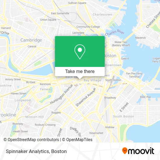
See Spinnaker Analytics, Boston, on the map
Public Transit to Spinnaker Analytics in Boston
Wondering how to get to Spinnaker Analytics in Boston? Moovit helps you find the best way to get to Spinnaker Analytics with step-by-step directions from the nearest public transit station.
Moovit provides free maps and live directions to help you navigate through your city. View schedules, routes, timetables, and find out how long does it take to get to Spinnaker Analytics in real time.
Looking for the nearest stop or station to Spinnaker Analytics? Check out this list of stops closest to your destination: Boylston St @ Dartmouth St; Copley - Boylston St @ Dartmouth St; Copley - Opp 575 Boylston St; Saint James Ave @ Dartmouth St; Back Bay Station (Dartmouth Street); Boston, MA - Copley Square (Corner Of Clarendon St. & St. James Ave. In Front Of Trinity Church); Stuart St @ Dartmouth St; Back Bay - South End; Prudential; Arlington.
Bus: 10, 39, 450, 501, 504, 9, 55, 57, GREEN LINE D SHUTTLE, ORANGE LINE SHUTTLE, ORANGE LINE SHUTTLE.Train: ACELA, FRAMINGHAM/WORCESTER, NEEDHAM, FOXBORO EVENT SERVICE, FRANKLIN/FOXBORO, ORANGE LINE.Subway: GREEN LINE B, ORANGE LINE, GREEN LINE E, GREEN LINE C, GREEN LINE D.
Want to see if there’s another route that gets you there at an earlier time? Moovit helps you find alternative routes or times. Get directions from and directions to Spinnaker Analytics easily from the Moovit App or Website.
We make riding to Spinnaker Analytics easy, which is why over 1.7 million users, including users in Boston, trust Moovit as the best app for public transit. You don’t need to download an individual bus app or train app, Moovit is your all-in-one transit app that helps you find the best bus time or train time available.
For information on prices of bus, subway and train, costs and ride fares to Spinnaker Analytics, please check the Moovit app.
Use the app to navigate to popular places including to the airport, hospital, stadium, grocery store, mall, coffee shop, school, college, and university.
Spinnaker Analytics Address: 200 Clarendon St street in Boston
- Nera,
- Metlife,
- Arrowstreet Capital (F.A.M. Capital ATM),
- John Hancock Tower MA USA,
- John Hancock Tower,
- Ernst & Young,
- John Hancock Tower (200 Clarendon),
- John Hancock,
- Lyric Stage,
- The Fairmont Copley Plaza Hotel,
- Raffles Boston Back Bay Hotel & Residences,
- Trinity Church,
- Trinity Church Boston,
- Fairmont Copley Plaza Boston,
- Lyric Stage Company,
- Post 390 (Banks Fish House),
- The Banks Fish House,
- SoulCycle Back Bay,
- Bain Capital - Fitness Center,
- Flour Bakery
Places Near Spinnaker Analytics (Boston)
- Boston Convention & Exhibition Center, Boston,
- Faneuil Hall, Boston,
- Museum Of Science, Boston,
- Wilbur Theatre, Boston,
- Td Garden, Boston,
- Quincy Market, Boston,
- Mgm Music Hall, Boston,
- Massachusetts General Hospital, Boston,
- Wang Theater, Boston,
- House Of Blues, Boston,
- Prudential Center, Boston,
- Castle Island, Boston,
- Boston Children's Hospital, Boston,
- Isabella Stewart Gardner Museum, Boston,
- Seaport District, Boston,
- Boston Medical Center, Boston,
- Cheers, Boston,
- Boston Common, Boston,
- North End, Boston,
- Leader Bank Pavilion (Leader Bank Pavillion), Boston
How to get to popular places in Boston with public transit
Get around Boston by public transit!
Traveling around Boston has never been so easy. See step by step directions as you travel to any attraction, street or major public transit station. View bus and train schedules, arrival times, service alerts and detailed routes on a map, so you know exactly how to get to anywhere in Boston.
When traveling to any destination around Boston use Moovit's Live Directions with Get Off Notifications to know exactly where and how far to walk, how long to wait for your line, and how many stops are left. Moovit will alert you when it's time to get off — no need to constantly re-check whether yours is the next stop.
Wondering how to use public transit in Boston or how to pay for public transit in Boston? Moovit public transit app can help you navigate your way with public transit easily, and at minimum cost. It includes public transit fees, ticket prices, and costs. Looking for a map of Boston public transit lines? Moovit public transit app shows all public transit maps in Boston with all Bus, Train, Subway and Ferry routes and stops on an interactive map.
Boston has 4 transit type(s), including: Bus, Train, Subway and Ferry, operated by several transit agencies, including MBTA, Southeastern Regional Transit Authority, MetroWest Regional Transit Authority, Rhode Island Public Transit Authority, WRTA, Lowell Regional Transit Authority, Merrimack Valley Transit, Montachusett Regional Transit Authority, Cape Cod Regional Transit Authority, Brockton Area Transit Authority, Martha's Vineyard Transit Authority, the WAVE - Nantucket Regional Transit Authority, GATRA, Cape Ann Transportation Authority and Massport