Directions to Spire of Lloyd (Kells) with public transportation
The following transit lines have routes that pass near Spire of Lloyd
How to get to Spire of Lloyd by bus?
Click on the bus route to see step by step directions with maps, line arrival times and updated time schedules.
Bus stations near Spire of Lloyd in Kells
- Kells Ind Estate Stop 101721, 13 min walk,
Bus lines to Spire of Lloyd in Kells
- 109, Virginia,
- 109A, Dublin Airport,
- 109X, U C D Belfield,
- 187, Oldcastle,
What are the closest stations to Spire of Lloyd?
The closest stations to Spire of Lloyd are:
- Kells Ind Estate Stop 101721 is 918 meters away, 13 min walk.
Which bus lines stop near Spire of Lloyd?
These bus lines stop near Spire of Lloyd: 109, 109X.
What’s the nearest bus stop to Spire of Lloyd in Kells?
The nearest bus stop to Spire of Lloyd in Kells is Kells Ind Estate Stop 101721. It’s a 13 min walk away.
What time is the first bus to Spire of Lloyd in Kells?
The 109A is the first bus that goes to Spire of Lloyd in Kells. It stops nearby at 3:05 AM.
What time is the last bus to Spire of Lloyd in Kells?
The 109A is the last bus that goes to Spire of Lloyd in Kells. It stops nearby at 4:05 AM.
How much is the bus fare to Spire of Lloyd?
The bus fare to Spire of Lloyd costs about €1.30 - €2.00.
How much is the train fare to Spire of Lloyd?
The train fare to Spire of Lloyd costs about €1.30 - €2.00.
See Spire of Lloyd, Kells, on the map
Public Transit to Spire of Lloyd in Kells
Wondering how to get to Spire of Lloyd in Kells, Ireland? Moovit helps you find the best way to get to Spire of Lloyd with step-by-step directions from the nearest public transit station.
Moovit provides free maps and live directions to help you navigate through your city. View schedules, routes, timetables, and find out how long does it take to get to Spire of Lloyd in real time.
Looking for the nearest stop or station to Spire of Lloyd? Check out this list of stops closest to your destination: Kells Ind Estate Stop 101721.
Bus: 109, 109X, 109A, 187.
Want to see if there’s another route that gets you there at an earlier time? Moovit helps you find alternative routes or times. Get directions from and directions to Spire of Lloyd easily from the Moovit App or Website.
We make riding to Spire of Lloyd easy, which is why over 1.5 million users, including users in Kells, trust Moovit as the best app for public transit. You don’t need to download an individual bus app or train app, Moovit is your all-in-one transit app that helps you find the best bus time or train time available.
For information on prices of bus and train, costs and ride fares to Spire of Lloyd, please check the Moovit app.
Use the app to navigate to popular places including to the airport, hospital, stadium, grocery store, mall, coffee shop, school, college, and university.
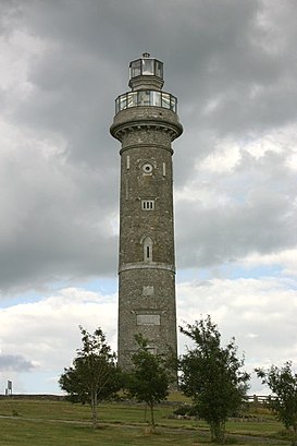
Spire of Lloyd Address: Spire of Lloyd, R163, Kells, County Meath street in Kells
Attractions near Spire of Lloyd
Goldstar Transport,Newrath Big (Kells),Newrath Big,PJ Malone,Tower of Lloyd,Business Park,St Colmcille's,Kells Car Wash & Valeting Services,Ida Industrial Estate,Eclips Hair Salon,Kells Business Park 38kv Substation,Kells Car Wash,Nct Test Centre,Kells Business Park,Newrath View,Kells Cold Store,D&K Shoes,The Cloisters,Aldi,ALDIHow to get to popular attractions in Kells with public transit
Stillorgan Luas, Dundrum,St Stephen's Green Luas, Dublin,Navan / an Uaimh, Navan,Maynooth / Maigh Nuad,The Franciscan Well Brewery & Brewpub, Cork,Dundrum Town Centre, Dundrum,St. James's Hospital, Dublin,Spire Of Dublin, Dublin,Bray, Bray,InterContinental Dublin, Dublin,U.S. Customs and Border Protection (CBP) Preclearance, Airport,Salthill Promenade, Salthill,Dublin City University Glasnevin Campus, Dublin,Phoenix Park Visitors' Centre, Dublin,University College Cork (UCC),Aer Lingus Lounge, Airport,Children's Health Ireland at Crumlin, Dublin,Vodafone Ireland, Glencullen,Dún Laoghaire Mallin Railway Station, Dún Laoghaire,Dundrum Luas, DundrumGet around Ireland by public transit!
Traveling around Ireland has never been so easy. See step by step directions as you travel to any attraction, street or major public transit station. View bus and train schedules, arrival times, service alerts and detailed routes on a map, so you know exactly how to get to anywhere in Ireland.
When traveling to any destination around Ireland use Moovit's Live Directions with Get Off Notifications to know exactly where and how far to walk, how long to wait for your line, and how many stops are left. Moovit will alert you when it's time to get off — no need to constantly re-check whether yours is the next stop.
Wondering how to use public transit in Ireland or how to pay for public transit in Ireland? Moovit public transit app can help you navigate your way with public transit easily, and at minimum cost. It includes public transit fees, ticket prices, and costs. Looking for a map of Ireland public transit lines? Moovit public transit app shows all public transit maps in Ireland with all Bus, Train and Light Rail routes and stops on an interactive map.
Ireland has 3 transit type(s), including: Bus, Train and Light Rail, operated by several transit agencies, including Luas, Bus Átha Cliath – Dublin Bus, Bus Éireann, Go-Ahead Ireland, Nitelink, Dublin Bus, Citylink, Kenneally's Bus Service, Aircoach, TFI Local Link Mayo, Irish Rail, Express Bus, JJ/Bernard Kavanagh, Dublin Coach, Kearns Transport, Matthews Coach Hire