How to get to Spirit Halloween by bus?
Click on the bus route to see step by step directions with maps, line arrival times and updated time schedules.
From Studio Allston, Boston
78 minFrom Canopy by Hilton Boston Downtown, Boston
34 minFrom Brigham & Women's Hospital, Boston
83 minFrom Ac Hotel Cambridge, Cambridge
99 minFrom The Strand Theater, Boston
84 minFrom Yotel, Boston
40 minFrom 110 Francis Street Garage, Boston
96 minFrom Whole Foods, Boston
61 minFrom Lolita Cocina & Tequila Bar, Boston
62 minFrom Mr Dooley's Boston Tavern, Boston
37 min
How to get to Spirit Halloween by train?
Click on the train route to see step by step directions with maps, line arrival times and updated time schedules.
How to get to Spirit Halloween by subway?
Click on the subway route to see step by step directions with maps, line arrival times and updated time schedules.
From Canopy by Hilton Boston Downtown, Boston
53 minFrom Brigham & Women's Hospital, Boston
77 minFrom Ac Hotel Cambridge, Cambridge
87 minFrom The Strand Theater, Boston
88 minFrom Yotel, Boston
59 minFrom 110 Francis Street Garage, Boston
84 minFrom Whole Foods, Boston
61 minFrom Lolita Cocina & Tequila Bar, Boston
60 minFrom Mr Dooley's Boston Tavern, Boston
51 min
Bus stops near Spirit Halloween in Chelsea
Subway station near Spirit Halloween in Chelsea
- Orient Heights, 8 min walk,VIEW
Train station near Spirit Halloween in Chelsea
- Chelsea, 26 min walk,VIEW
Bus lines to Spirit Halloween in Chelsea
What are the closest stations to Spirit Halloween?
The closest stations to Spirit Halloween are:
- Broadway @ Stockton St is 400 yards away, 6 min walk.
- Hillside Ave @ Crest Ave is 526 yards away, 7 min walk.
- Orient Heights is 630 yards away, 8 min walk.
- Sagamore Ave @ Garfield Ave is 784 yards away, 10 min walk.
- Chelsea is 2151 yards away, 26 min walk.
Which bus lines stop near Spirit Halloween?
These bus lines stop near Spirit Halloween: 111, 112, 116, SL3.
Which train line stops near Spirit Halloween?
NEWBURYPORT/ROCKPORT (#125 | Newburyport)
Which subway line stops near Spirit Halloween?
BLUE LINE (Wonderland)
What’s the nearest subway station to Spirit Halloween in Chelsea?
The nearest subway station to Spirit Halloween in Chelsea is Orient Heights. It’s a 8 min walk away.
What’s the nearest train station to Spirit Halloween in Chelsea?
The nearest train station to Spirit Halloween in Chelsea is Chelsea. It’s a 26 min walk away.
What’s the nearest bus station to Spirit Halloween in Chelsea?
The nearest bus station to Spirit Halloween in Chelsea is Broadway @ Stockton St. It’s a 6 min walk away.
What time is the first subway to Spirit Halloween in Chelsea?
The BLUE LINE is the first subway that goes to Spirit Halloween in Chelsea. It stops nearby at 5:08 AM.
What time is the last subway to Spirit Halloween in Chelsea?
The BLUE LINE is the last subway that goes to Spirit Halloween in Chelsea. It stops nearby at 2:04 AM.
What time is the first train to Spirit Halloween in Chelsea?
The NEWBURYPORT/ROCKPORT is the first train that goes to Spirit Halloween in Chelsea. It stops nearby at 5:40 AM.
What time is the last train to Spirit Halloween in Chelsea?
The NEWBURYPORT/ROCKPORT is the last train that goes to Spirit Halloween in Chelsea. It stops nearby at 12:06 AM.
What time is the first bus to Spirit Halloween in Chelsea?
The 116 is the first bus that goes to Spirit Halloween in Chelsea. It stops nearby at 4:31 AM.
What time is the last bus to Spirit Halloween in Chelsea?
The 111 is the last bus that goes to Spirit Halloween in Chelsea. It stops nearby at 2:34 AM.
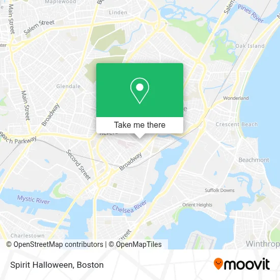
See Spirit Halloween, Chelsea, on the map
Public Transit to Spirit Halloween in Chelsea
Wondering how to get to Spirit Halloween in Chelsea? Moovit helps you find the best way to get to Spirit Halloween with step-by-step directions from the nearest public transit station.
Moovit provides free maps and live directions to help you navigate through your city. View schedules, routes, timetables, and find out how long does it take to get to Spirit Halloween in real time.
Looking for the nearest stop or station to Spirit Halloween? Check out this list of stops closest to your destination: Broadway @ Stockton St; Hillside Ave @ Crest Ave; Orient Heights; Sagamore Ave @ Garfield Ave; Chelsea.
Bus: 111, 112, 116, SL3.Train: NEWBURYPORT/ROCKPORT.Subway: BLUE LINE.
Want to see if there’s another route that gets you there at an earlier time? Moovit helps you find alternative routes or times. Get directions from and directions to Spirit Halloween easily from the Moovit App or Website.
We make riding to Spirit Halloween easy, which is why over 1.7 million users, including users in Chelsea, trust Moovit as the best app for public transit. You don’t need to download an individual bus app or train app, Moovit is your all-in-one transit app that helps you find the best bus time or train time available.
For information on prices of bus, subway and train, costs and ride fares to Spirit Halloween, please check the Moovit app.
Use the app to navigate to popular places including to the airport, hospital, stadium, grocery store, mall, coffee shop, school, college, and university.
Spirit Halloween Address: 121 Webster Ave # 121 street in Chelsea
- Ecoatm,
- Space Adventure,
- Boston Playground,
- Boston Paintball Chelsea Pro Shop And Playing Field,
- Planet Fitness - Chelsea, MA,
- Ups Access Point Location,
- Family Dollar,
- Starbucks,
- Cvs Store #00109,
- Revive Community Church,
- Subway,
- Ikigai Ikiru - Natural & Organic,
- Una Nueva Vida En Cristo,
- The Home Depot,
- 932 Broadway Luxury Condominiums,
- Atm 7eleven, Inc.,
- Keyme Locksmiths,
- Bispo Paulo Tenorio Ap Boston,
- Sully's Variety Store,
- Cvs
Places Near Spirit Halloween (Chelsea)
- Boston Children's Hospital, Boston,
- Faneuil Hall, Boston,
- Leader Bank Pavilion (Leader Bank Pavillion), Boston,
- Wilbur Theatre, Boston,
- House Of Blues, Boston,
- Td Garden, Boston,
- Seaport District, Boston,
- Isabella Stewart Gardner Museum, Boston,
- North End, Boston,
- Massachusetts General Hospital, Boston,
- Museum Of Science, Boston,
- Mgm Music Hall, Boston,
- Castle Island, Boston,
- Boston Common, Boston,
- Prudential Center, Boston,
- Quincy Market, Boston,
- Boston Medical Center, Boston,
- Boston Convention & Exhibition Center, Boston,
- Cheers, Boston,
- Wang Theater, Boston
How to get to popular places in Boston with public transit
Get around Chelsea by public transit!
Traveling around Chelsea has never been so easy. See step by step directions as you travel to any attraction, street or major public transit station. View bus and train schedules, arrival times, service alerts and detailed routes on a map, so you know exactly how to get to anywhere in Chelsea.
When traveling to any destination around Chelsea use Moovit's Live Directions with Get Off Notifications to know exactly where and how far to walk, how long to wait for your line, and how many stops are left. Moovit will alert you when it's time to get off — no need to constantly re-check whether yours is the next stop.
Wondering how to use public transit in Chelsea or how to pay for public transit in Chelsea? Moovit public transit app can help you navigate your way with public transit easily, and at minimum cost. It includes public transit fees, ticket prices, and costs. Looking for a map of Chelsea public transit lines? Moovit public transit app shows all public transit maps in Chelsea with all Bus, Train, Subway and Ferry routes and stops on an interactive map.
Boston has 4 transit type(s), including: Bus, Train, Subway and Ferry, operated by several transit agencies, including MBTA, Southeastern Regional Transit Authority, MetroWest Regional Transit Authority, Rhode Island Public Transit Authority, WRTA, Lowell Regional Transit Authority, Merrimack Valley Transit, Montachusett Regional Transit Authority, Cape Cod Regional Transit Authority, Brockton Area Transit Authority, Martha's Vineyard Transit Authority, the WAVE - Nantucket Regional Transit Authority, GATRA, Cape Ann Transportation Authority and Massport