Directions to Spring Step (Dover) with public transportation
The following transit lines have routes that pass near Spring Step
 Bus: 2, 33, 101, 1.
- Train: DOWNEASTER.
How to get to Spring Step by bus?
Click on the bus route to see step by step directions with maps, line arrival times and updated time schedules.
From Gavin Webb, MD, Somersworth
23 minFrom Gaire Susan R MD Facog, Rochester
28 minFrom New England Sunlight, Somersworth
45 minFrom Bill Somerset, Seacoast New Hampshire and Maine Realtor, Rochester
29 minFrom Cutter Family Properties, Somersworth
36 minFrom George Argilla, MD, Rochester
29 minFrom Organic Goods Dispensary, Kittery
85 minFrom Stafford Wellness Massage (Heart Stone Haven Massage Therapy), Rochester
29 minFrom Falls River Wellness Center, LLC, Rollinsford
93 minFrom Hyder House Hospice House (Hyder Family Hospice House an Amedisys Company), Dover
34 min
Bus stops near Spring Step in Dover
Train station near Spring Step in Dover
- Dover, 17 min walk,VIEW
What are the closest stations to Spring Step?
The closest stations to Spring Step are:
- Central Ave. / Oak St. (Rite-Aid) is 132 yards away, 3 min walk.
- Central Ave. / Ash St. is 163 yards away, 3 min walk.
- Main / School Sts. is 600 yards away, 8 min walk.
- Dover Transportation Center is 770 yards away, 10 min walk.
- Dover is 1354 yards away, 17 min walk.
Which bus lines stop near Spring Step?
These bus lines stop near Spring Step: 2, 33.
What’s the nearest train station to Spring Step in Dover?
The nearest train station to Spring Step in Dover is Dover. It’s a 17 min walk away.
What’s the nearest bus station to Spring Step in Dover?
The nearest bus stations to Spring Step in Dover are Central Ave. / Oak St. (Rite-Aid) and Central Ave. / Ash St.. The closest one is a 3 min walk away.
What time is the first train to Spring Step in Dover?
The DOWNEASTER is the first train that goes to Spring Step in Dover. It stops nearby at 6:17 AM.
What time is the last train to Spring Step in Dover?
The DOWNEASTER is the last train that goes to Spring Step in Dover. It stops nearby at 11:59 PM.
What time is the first bus to Spring Step in Dover?
The 1 is the first bus that goes to Spring Step in Dover. It stops nearby at 5:30 AM.
What time is the last bus to Spring Step in Dover?
The 2 is the last bus that goes to Spring Step in Dover. It stops nearby at 9:31 PM.
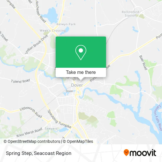
See Spring Step, Dover, on the map
Public Transit to Spring Step in Dover
Wondering how to get to Spring Step in Dover? Moovit helps you find the best way to get to Spring Step with step-by-step directions from the nearest public transit station.
Moovit provides free maps and live directions to help you navigate through your city. View schedules, routes, timetables, and find out how long does it take to get to Spring Step in real time.
Looking for the nearest stop or station to Spring Step? Check out this list of stops closest to your destination: Central Ave. / Oak St. (Rite-Aid); Central Ave. / Ash St.; Main / School Sts.; Dover Transportation Center; Dover.
Bus: 2, 33, 101, 1.Train: DOWNEASTER.
Want to see if there’s another route that gets you there at an earlier time? Moovit helps you find alternative routes or times. Get directions from and directions to Spring Step easily from the Moovit App or Website.
We make riding to Spring Step easy, which is why over 1.5 million users, including users in Dover, trust Moovit as the best app for public transit. You don’t need to download an individual bus app or train app, Moovit is your all-in-one transit app that helps you find the best bus time or train time available.
For information on prices of bus, costs and ride fares to Spring Step, please check the Moovit app.
Use the app to navigate to popular places including to the airport, hospital, stadium, grocery store, mall, coffee shop, school, college, and university.
Spring Step Address: 35 Broadway Dover, NH 03820 street in Dover
- Red Wing Shoe,
- Deep Rooted Healing LLC,
- The Noise Floor,
- Landtech Landscaping,
- Vanity Hair Studio,
- William Walter Building & Design,
- Ocean Spray Cleaning Service,
- The Luna Center for Natural Health,
- Aardvark Management,
- Moe's Italian Sandwiches,
- 6broadway,
- Iron Will Capital,
- Mikes Commercial Cleaning,
- Get A Pair,
- Direct SAT TV,
- J & E Specialty,
- York Harbor Apartments,
- Middleton Apartments,
- Brickyard Estates Apartments,
- Dalton Bayliss Photography
Places Near Spring Step (Dover)
- Kittery Premium Outlets 1, Kittery,
- Portsmouth Regional Hospital, Portsmouth,
- NH DMV Dover, Dover,
- Portsmouth Naval Shipyard, Kittery,
- Tender Crop Farm at the Red Barn (Tendercrop Farm at the Red Barn), Dover,
- Pease Air Force Base, Portsmouth,
- Portsmouth Naval Shipyard Gate 2, Kittery,
- Great Bay Community College, Portsmouth,
- Guy John, Dover,
- Exeter, NH, Exeter,
- C & J Bus Lines, Portsmouth,
- Portsmouth Naval Shipyard Gate 1, Kittery,
- Pease Air National Guard Base, Portsmouth,
- Water Country, Portsmouth,
- Rochester, NH, Rochester,
- Phillips Exeter Academy Library, Exeter,
- Wentworth-Douglass Hospital, Dover,
- Portsmouth Naval Shipyard Parking Garage, Kittery,
- The Foundation For Your Finances, Dover,
- Walmart Supercenter, Rochester
How to get to popular places in Seacoast Region with public transit
Get around Dover by public transit!
Traveling around Dover has never been so easy. See step by step directions as you travel to any attraction, street or major public transit station. View bus and train schedules, arrival times, service alerts and detailed routes on a map, so you know exactly how to get to anywhere in Dover.
When traveling to any destination around Dover use Moovit's Live Directions with Get Off Notifications to know exactly where and how far to walk, how long to wait for your line, and how many stops are left. Moovit will alert you when it's time to get off — no need to constantly re-check whether yours is the next stop.
Wondering how to use public transit in Dover or how to pay for public transit in Dover? Moovit public transit app can help you navigate your way with public transit easily, and at minimum cost. It includes public transit fees, ticket prices, and costs. Looking for a map of Dover public transit lines? Moovit public transit app shows all public transit maps in Dover with all Bus and Train routes and stops on an interactive map.
Seacoast Region has 2 transit type(s), including: Bus and Train, operated by several transit agencies, including Cooperative Alliance for Seacoast Transportation, Amtrak, FlixBus-us and Greyhound-us