Directions to Spring Street Laundry And Dry (Boston) with public transportation
The following transit lines have routes that pass near Spring Street Laundry And Dry
 Bus: 35, 36, 37, 52, NEEDHAM LINE SHUTTLE.
- Train: NEEDHAM, FRANKLIN/FOXBORO, PROVIDENCE/STOUGHTON.
How to get to Spring Street Laundry And Dry by bus?
Click on the bus route to see step by step directions with maps, line arrival times and updated time schedules.
From Prudential Center South Garden, Boston
55 minFrom Christian A Herter Park, Boston
85 minFrom The Colonnade Hotel, Boston
54 minFrom Residence Inn by Marriott Boston Downtown/South End, Boston
49 minFrom Trader Joe's, Boston
60 minFrom SoWa Winter Market, Boston
56 minFrom Dorchester, Boston
56 minFrom Arsenal Mall, Watertown Town
61 minFrom Lasell College, Newton
87 minFrom Four Seasons Hotel One Dalton, Boston
55 min
How to get to Spring Street Laundry And Dry by train?
Click on the train route to see step by step directions with maps, line arrival times and updated time schedules.
From Prudential Center South Garden, Boston
34 minFrom Christian A Herter Park, Boston
80 minFrom The Colonnade Hotel, Boston
34 minFrom Residence Inn by Marriott Boston Downtown/South End, Boston
35 minFrom Trader Joe's, Boston
38 minFrom SoWa Winter Market, Boston
39 minFrom Dorchester, Boston
78 minFrom Lasell College, Newton
81 minFrom Four Seasons Hotel One Dalton, Boston
38 min
Bus stops near Spring Street Laundry And Dry in Boston
Train stations near Spring Street Laundry And Dry in Boston
Bus lines to Spring Street Laundry And Dry in Boston
What are the closest stations to Spring Street Laundry And Dry?
The closest stations to Spring Street Laundry And Dry are:
- Centre St @ Lorette St is 7 yards away, 1 min walk.
- West Roxbury is 536 yards away, 7 min walk.
- Roslindale Village is 3153 yards away, 38 min walk.
- Hyde Park is 4166 yards away, 49 min walk.
Which bus lines stop near Spring Street Laundry And Dry?
These bus lines stop near Spring Street Laundry And Dry: 35, 36, 37, 52.
Which train line stops near Spring Street Laundry And Dry?
NEEDHAM (#625 | Needham Heights)
What’s the nearest bus station to Spring Street Laundry And Dry in Boston?
The nearest bus station to Spring Street Laundry And Dry in Boston is Centre St @ Lorette St. It’s a 1 min walk away.
What time is the first train to Spring Street Laundry And Dry in Boston?
The PROVIDENCE/STOUGHTON is the first train that goes to Spring Street Laundry And Dry in Boston. It stops nearby at 5:08 AM.
What time is the last train to Spring Street Laundry And Dry in Boston?
The PROVIDENCE/STOUGHTON is the last train that goes to Spring Street Laundry And Dry in Boston. It stops nearby at 12:22 AM.
What time is the first bus to Spring Street Laundry And Dry in Boston?
The 36 is the first bus that goes to Spring Street Laundry And Dry in Boston. It stops nearby at 4:42 AM.
What time is the last bus to Spring Street Laundry And Dry in Boston?
The 36 is the last bus that goes to Spring Street Laundry And Dry in Boston. It stops nearby at 1:32 AM.
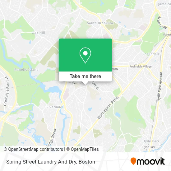
See Spring Street Laundry And Dry, Boston, on the map
Public Transit to Spring Street Laundry And Dry in Boston
Wondering how to get to Spring Street Laundry And Dry in Boston? Moovit helps you find the best way to get to Spring Street Laundry And Dry with step-by-step directions from the nearest public transit station.
Moovit provides free maps and live directions to help you navigate through your city. View schedules, routes, timetables, and find out how long does it take to get to Spring Street Laundry And Dry in real time.
Looking for the nearest stop or station to Spring Street Laundry And Dry? Check out this list of stops closest to your destination: Centre St @ Lorette St; West Roxbury; Roslindale Village; Hyde Park.
Bus: 35, 36, 37, 52, NEEDHAM LINE SHUTTLE, NEEDHAM LINE SHUTTLE.Train: NEEDHAM, FRANKLIN/FOXBORO, PROVIDENCE/STOUGHTON.
Want to see if there’s another route that gets you there at an earlier time? Moovit helps you find alternative routes or times. Get directions from and directions to Spring Street Laundry And Dry easily from the Moovit App or Website.
We make riding to Spring Street Laundry And Dry easy, which is why over 1.7 million users, including users in Boston, trust Moovit as the best app for public transit. You don’t need to download an individual bus app or train app, Moovit is your all-in-one transit app that helps you find the best bus time or train time available.
For information on prices of bus, train and subway, costs and ride fares to Spring Street Laundry And Dry, please check the Moovit app.
Use the app to navigate to popular places including to the airport, hospital, stadium, grocery store, mall, coffee shop, school, college, and university.
Spring Street Laundry And Dry Address: 7 Spring St street in Boston
- St. Theresa-Avila Catholic Church,
- Violet,
- MBTA West Roxbury Station,
- Panera Test Kitchen,
- Dr Green Thumb,
- AB Tel Specialists,
- Catholic Memorial High School ,
- English High School,
- Catholic Memorial School,
- Catholic Memorial,
- City Lock Co.,
- Kenny's Bar,
- Citidental of West Rox,
- Parkway Community Ymca,
- West Roxbury,
- Parkway Mechanical,
- Boston Private School Search,
- Ruttman Lawrence A,
- Hercules Stump Grinding,
- CrossFit Boston Iron & Grit
Places Near Spring Street Laundry And Dry (Boston)
- Museum Of Science, Boston,
- Cheers, Boston,
- Prudential Center, Boston,
- Faneuil Hall, Boston,
- Boston Medical Center, Boston,
- Wilbur Theatre, Boston,
- Boston Convention & Exhibition Center, Boston,
- Massachusetts General Hospital, Boston,
- Boston Common, Boston,
- Wang Theater, Boston,
- Mgm Music Hall, Boston,
- Td Garden, Boston,
- Castle Island, Boston,
- Boston Children's Hospital, Boston,
- Isabella Stewart Gardner Museum, Boston,
- House Of Blues, Boston,
- Quincy Market, Boston,
- Seaport District, Boston,
- North End, Boston,
- Leader Bank Pavilion (Leader Bank Pavillion), Boston
How to get to popular places in Boston with public transit
Get around Boston by public transit!
Traveling around Boston has never been so easy. See step by step directions as you travel to any attraction, street or major public transit station. View bus and train schedules, arrival times, service alerts and detailed routes on a map, so you know exactly how to get to anywhere in Boston.
When traveling to any destination around Boston use Moovit's Live Directions with Get Off Notifications to know exactly where and how far to walk, how long to wait for your line, and how many stops are left. Moovit will alert you when it's time to get off — no need to constantly re-check whether yours is the next stop.
Wondering how to use public transit in Boston or how to pay for public transit in Boston? Moovit public transit app can help you navigate your way with public transit easily, and at minimum cost. It includes public transit fees, ticket prices, and costs. Looking for a map of Boston public transit lines? Moovit public transit app shows all public transit maps in Boston with all Bus, Train, Subway and Ferry routes and stops on an interactive map.
Boston has 4 transit type(s), including: Bus, Train, Subway and Ferry, operated by several transit agencies, including MBTA, Southeastern Regional Transit Authority, MetroWest Regional Transit Authority, Rhode Island Public Transit Authority, WRTA, Lowell Regional Transit Authority, Merrimack Valley Transit, Montachusett Regional Transit Authority, Cape Cod Regional Transit Authority, Brockton Area Transit Authority, Martha's Vineyard Transit Authority, the WAVE - Nantucket Regional Transit Authority, GATRA, Cape Ann Transportation Authority and Massport