Directions to Springfield Jcc Health & Wellness (Boston) with public transportation
The following transit lines have routes that pass near Springfield Jcc Health & Wellness
 Bus: G5.
How to get to Springfield Jcc Health & Wellness by bus?
Click on the bus route to see step by step directions with maps, line arrival times and updated time schedules.
From Worcester, MA, Worcester
139 minFrom Polar Park, Worcester
141 minFrom St Vincent Hospital TH Medical, Worcester
140 minFrom South High Community School, Worcester
236 minFrom Registry Of Motor Vehicles (Rmv) Branch Office, Worcester
143 minFrom Palladium, Worcester
145 minFrom Walmart Supercenter, Worcester
198 minFrom Dcu Center, Worcester
142 min
Bus stop near Springfield Jcc Health & Wellness in Boston
- Converse / Burbank (2), 7 min walk,VIEW
Bus lines to Springfield Jcc Health & Wellness in Boston
- G5, Union Station Via Jewish Home,VIEW
What are the closest stations to Springfield Jcc Health & Wellness?
The closest stations to Springfield Jcc Health & Wellness are:
- Converse / Burbank (2) is 548 yards away, 7 min walk.
Which bus line stops near Springfield Jcc Health & Wellness?
G5 (Jewish Home Via Dickinson)
What’s the nearest bus station to Springfield Jcc Health & Wellness in Boston?
The nearest bus station to Springfield Jcc Health & Wellness in Boston is Converse / Burbank (2). It’s a 7 min walk away.
What time is the first bus to Springfield Jcc Health & Wellness in Boston?
The G5 is the first bus that goes to Springfield Jcc Health & Wellness in Boston. It stops nearby at 6:40 AM.
What time is the last bus to Springfield Jcc Health & Wellness in Boston?
The G5 is the last bus that goes to Springfield Jcc Health & Wellness in Boston. It stops nearby at 7:25 PM.
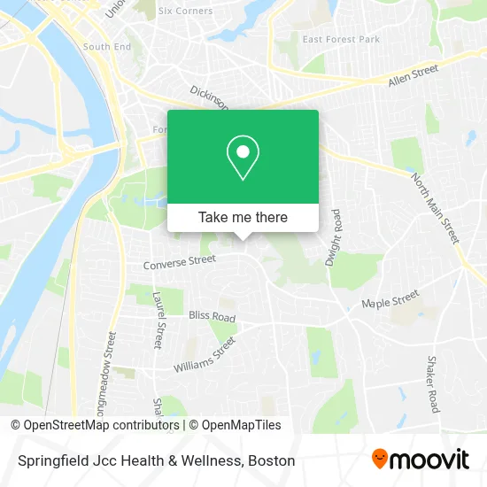
See Springfield Jcc Health & Wellness, Boston, on the map
Public Transit to Springfield Jcc Health & Wellness in Boston
Wondering how to get to Springfield Jcc Health & Wellness in Boston? Moovit helps you find the best way to get to Springfield Jcc Health & Wellness with step-by-step directions from the nearest public transit station.
Moovit provides free maps and live directions to help you navigate through your city. View schedules, routes, timetables, and find out how long does it take to get to Springfield Jcc Health & Wellness in real time.
Looking for the nearest stop or station to Springfield Jcc Health & Wellness? Check out this list of stops closest to your destination: Converse / Burbank (2).
Bus: G5.
Want to see if there’s another route that gets you there at an earlier time? Moovit helps you find alternative routes or times. Get directions from and directions to Springfield Jcc Health & Wellness easily from the Moovit App or Website.
We make riding to Springfield Jcc Health & Wellness easy, which is why over 1.7 million users, including users in Boston, trust Moovit as the best app for public transit. You don’t need to download an individual bus app or train app, Moovit is your all-in-one transit app that helps you find the best bus time or train time available.
For information on prices of bus, costs and ride fares to Springfield Jcc Health & Wellness, please check the Moovit app.
Use the app to navigate to popular places including to the airport, hospital, stadium, grocery store, mall, coffee shop, school, college, and university.
Springfield Jcc Health & Wellness Address: 1160 Dickinson St street in Boston
- Aroma Cafe at Springfield JCC,
- Jewish Community Center,
- Psychic Helena,
- Alliance of Orthodox Congregations,
- First Unitarian Universalist Church,
- Onpoint Property Solutions,
- Yeshiva Academy,
- Arthur J Logan Jr, DMD,
- Sinai Temple Library,
- Curtis Blake Day School,
- Forest Park Extension,
- Linda Cardillo,
- Marie Angelides,
- Lily Good Luxury Imports,
- Porter Lake,
- Blueberry Hill School,
- Paws Calls,
- Alice B. Beal School,
- Lee & Nicole Vardakas,
- Bantam Locksmith & Key
Places Near Springfield Jcc Health & Wellness (Boston)
- Quincy Market, Boston,
- Wilbur Theatre, Boston,
- Castle Island, Boston,
- Faneuil Hall, Boston,
- Wang Theater, Boston,
- Massachusetts General Hospital, Boston,
- Boston Medical Center, Boston,
- Isabella Stewart Gardner Museum, Boston,
- Boston Convention & Exhibition Center, Boston,
- Cheers, Boston,
- Boston Common, Boston,
- Leader Bank Pavilion (Leader Bank Pavillion), Boston,
- Museum Of Science, Boston,
- Prudential Center, Boston,
- Td Garden, Boston,
- Seaport District, Boston,
- House Of Blues, Boston,
- Boston Children's Hospital, Boston,
- Mgm Music Hall, Boston,
- North End, Boston
How to get to popular places in Boston with public transit
Get around Boston by public transit!
Traveling around Boston has never been so easy. See step by step directions as you travel to any attraction, street or major public transit station. View bus and train schedules, arrival times, service alerts and detailed routes on a map, so you know exactly how to get to anywhere in Boston.
When traveling to any destination around Boston use Moovit's Live Directions with Get Off Notifications to know exactly where and how far to walk, how long to wait for your line, and how many stops are left. Moovit will alert you when it's time to get off — no need to constantly re-check whether yours is the next stop.
Wondering how to use public transit in Boston or how to pay for public transit in Boston? Moovit public transit app can help you navigate your way with public transit easily, and at minimum cost. It includes public transit fees, ticket prices, and costs. Looking for a map of Boston public transit lines? Moovit public transit app shows all public transit maps in Boston with all Bus, Train, Subway and Ferry routes and stops on an interactive map.
Boston has 4 transit type(s), including: Bus, Train, Subway and Ferry, operated by several transit agencies, including MBTA, Southeastern Regional Transit Authority, MetroWest Regional Transit Authority, Rhode Island Public Transit Authority, WRTA, Lowell Regional Transit Authority, Merrimack Valley Transit, Montachusett Regional Transit Authority, Cape Cod Regional Transit Authority, Brockton Area Transit Authority, Martha's Vineyard Transit Authority, the WAVE - Nantucket Regional Transit Authority, GATRA, Cape Ann Transportation Authority and Massport