Directions to Springfield Seventh-Day Adventist Church (Boston) with public transportation
The following transit lines have routes that pass near Springfield Seventh-Day Adventist Church
 Bus: G1.
How to get to Springfield Seventh-Day Adventist Church by bus?
Click on the bus route to see step by step directions with maps, line arrival times and updated time schedules.
From Walmart Supercenter, Worcester
166 minFrom Polar Park, Worcester
109 minFrom Worcester, MA, Worcester
108 minFrom Registry Of Motor Vehicles (Rmv) Branch Office, Worcester
112 minFrom Palladium, Worcester
113 minFrom South High Community School, Worcester
204 minFrom Foxwoods, Worcester
137 minFrom Dcu Center, Worcester
110 min
Bus stop near Springfield Seventh-Day Adventist Church in Boston
- Sumner / Perkins, 1 min walk,VIEW
Bus lines to Springfield Seventh-Day Adventist Church in Boston
- G1, Union Station,VIEW
What are the closest stations to Springfield Seventh-Day Adventist Church?
The closest stations to Springfield Seventh-Day Adventist Church are:
- Sumner / Perkins is 48 yards away, 1 min walk.
Which bus line stops near Springfield Seventh-Day Adventist Church?
G1 (Five Town Plaza Via Bicentennial)
What’s the nearest bus station to Springfield Seventh-Day Adventist Church in Boston?
The nearest bus station to Springfield Seventh-Day Adventist Church in Boston is Sumner / Perkins. It’s a 1 min walk away.
What time is the first bus to Springfield Seventh-Day Adventist Church in Boston?
The G1 is the first bus that goes to Springfield Seventh-Day Adventist Church in Boston. It stops nearby at 5:38 AM.
What time is the last bus to Springfield Seventh-Day Adventist Church in Boston?
The G1 is the last bus that goes to Springfield Seventh-Day Adventist Church in Boston. It stops nearby at 9:45 PM.
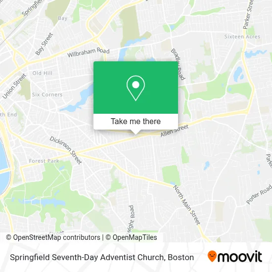
See Springfield Seventh-Day Adventist Church, Boston, on the map
Public Transit to Springfield Seventh-Day Adventist Church in Boston
Wondering how to get to Springfield Seventh-Day Adventist Church in Boston? Moovit helps you find the best way to get to Springfield Seventh-Day Adventist Church with step-by-step directions from the nearest public transit station.
Moovit provides free maps and live directions to help you navigate through your city. View schedules, routes, timetables, and find out how long does it take to get to Springfield Seventh-Day Adventist Church in real time.
Looking for the nearest stop or station to Springfield Seventh-Day Adventist Church? Check out this list of stops closest to your destination: Sumner / Perkins.
Bus: G1.
Want to see if there’s another route that gets you there at an earlier time? Moovit helps you find alternative routes or times. Get directions from and directions to Springfield Seventh-Day Adventist Church easily from the Moovit App or Website.
We make riding to Springfield Seventh-Day Adventist Church easy, which is why over 1.7 million users, including users in Boston, trust Moovit as the best app for public transit. You don’t need to download an individual bus app or train app, Moovit is your all-in-one transit app that helps you find the best bus time or train time available.
For information on prices of bus, costs and ride fares to Springfield Seventh-Day Adventist Church, please check the Moovit app.
Use the app to navigate to popular places including to the airport, hospital, stadium, grocery store, mall, coffee shop, school, college, and university.
Springfield Seventh-Day Adventist Church Address: 1118 Sumner Ave street in Boston
- Grace Presbyterian Church - Pca,
- First Springfield Sda Church,
- Springfield Pioneers Pathfinder Club / Junior Pioneers Adventurer Club,
- Greg's Driveway Automotive Repair,
- Destiny Press,
- Jack Chen II Restaurant,
- East Forest Park Ma Locksmith Store,
- Auto Locksmith 01841,
- Cigna,
- Springfield Fire Department,
- Alicsia O the Salon Inc.,
- Lush Boutique,
- Frederick Harris School,
- Lavallee L,
- GUS & Pauls Bakery,
- Bright Leaves Learning Center,
- Kim Bock's House,
- East Forest Park Civic Association,
- J & A Wholesale,
- Springfield Car Locksmith 19
Places Near Springfield Seventh-Day Adventist Church (Boston)
- Leader Bank Pavilion (Leader Bank Pavillion), Boston,
- Wilbur Theatre, Boston,
- Quincy Market, Boston,
- Faneuil Hall, Boston,
- Seaport District, Boston,
- Boston Common, Boston,
- Isabella Stewart Gardner Museum, Boston,
- House Of Blues, Boston,
- Wang Theater, Boston,
- Boston Medical Center, Boston,
- Prudential Center, Boston,
- Museum Of Science, Boston,
- North End, Boston,
- Mgm Music Hall, Boston,
- Boston Children's Hospital, Boston,
- Cheers, Boston,
- Td Garden, Boston,
- Massachusetts General Hospital, Boston,
- Boston Convention & Exhibition Center, Boston,
- Castle Island, Boston
How to get to popular places in Boston with public transit
Get around Boston by public transit!
Traveling around Boston has never been so easy. See step by step directions as you travel to any attraction, street or major public transit station. View bus and train schedules, arrival times, service alerts and detailed routes on a map, so you know exactly how to get to anywhere in Boston.
When traveling to any destination around Boston use Moovit's Live Directions with Get Off Notifications to know exactly where and how far to walk, how long to wait for your line, and how many stops are left. Moovit will alert you when it's time to get off — no need to constantly re-check whether yours is the next stop.
Wondering how to use public transit in Boston or how to pay for public transit in Boston? Moovit public transit app can help you navigate your way with public transit easily, and at minimum cost. It includes public transit fees, ticket prices, and costs. Looking for a map of Boston public transit lines? Moovit public transit app shows all public transit maps in Boston with all Bus, Train, Subway and Ferry routes and stops on an interactive map.
Boston has 4 transit type(s), including: Bus, Train, Subway and Ferry, operated by several transit agencies, including MBTA, Southeastern Regional Transit Authority, MetroWest Regional Transit Authority, Rhode Island Public Transit Authority, WRTA, Lowell Regional Transit Authority, Merrimack Valley Transit, Montachusett Regional Transit Authority, Cape Cod Regional Transit Authority, Brockton Area Transit Authority, Martha's Vineyard Transit Authority, the WAVE - Nantucket Regional Transit Authority, GATRA, Cape Ann Transportation Authority and Massport