Directions to Sprint Store (Boston) with public transportation
The following transit lines have routes that pass near Sprint Store
 Bus: 1, 21, 35, 54, R.
- Train: PROVIDENCE/STOUGHTON, ACELA, NORTHEAST REGIONAL, PROVIDENCE LINE SHUTTLE, PROVIDENCE LINE SHUTTLE.
How to get to Sprint Store by bus?
Click on the bus route to see step by step directions with maps, line arrival times and updated time schedules.
How to get to Sprint Store by train?
Click on the train route to see step by step directions with maps, line arrival times and updated time schedules.
Bus stops near Sprint Store in Boston
- Rhode Island Convention Center (Sabin), 2 min walk,VIEW
- Francis After Finance, 2 min walk,VIEW
- Fountain Before Union, 5 min walk,VIEW
- Convention Center Providence Ri, 5 min walk,VIEW
- Memorial After Exchange, 5 min walk,VIEW
- Providence Station (Park Row W Before Exchange), 5 min walk,VIEW
- Memorial Before Exchange, 6 min walk,VIEW
- Exchange Terrace (Kennedy Plaza - Stop X), 6 min walk,VIEW
- Kennedy Plaza (Stop Y), 7 min walk,VIEW
Train stations near Sprint Store in Boston
- Providence, 24 min walk,VIEW
Bus lines to Sprint Store in Boston
- 27, Broadway/Manton Ave,VIEW
- 28, Broadway/Hartford Ave,VIEW
- 92, East Side/Federal Hill/RI College,VIEW
- 9X, Pascoag Express,VIEW
- 10X, North Scituate Express,VIEW
- 12X, Arctic/RI-117 Express,VIEW
- 59X, North Smithfield/Lincoln Express,VIEW
- 61X, Tiverton/East Bay Express,VIEW
- 65X, Narragansett/Wakefield Express,VIEW
- 95X, Westerly Express,VIEW
- 50, Bryant University,VIEW
- 55, Kennedy Plaza,VIEW
- 56, Kennedy Plaza Via Chalkstone Ave,VIEW
- 57, Kennedy Plaza Via Smith St,VIEW
- 6, Kennedy Plaza,VIEW
- PETER PAN, CAPE COD - PROVIDENCE - NEW YORK,VIEW
- PETER PAN, PROVIDENCE - NEW YORK Express Service,VIEW
- PETER PAN, PROVIDENCE - BOSTON - BOSTON LOGAN AIRPORT,VIEW
- PETER PAN, BOSTON LOGAN AIRPORT - BOSTON - PROVIDENCE,VIEW
- PETER PAN, NEW YORK - PROVIDENCE Express Service,VIEW
What are the closest stations to Sprint Store?
The closest stations to Sprint Store are:
- Rhode Island Convention Center (Sabin) is 75 yards away, 2 min walk.
- Francis After Finance is 138 yards away, 2 min walk.
- Fountain Before Union is 289 yards away, 5 min walk.
- Convention Center Providence Ri is 314 yards away, 5 min walk.
- Memorial After Exchange is 371 yards away, 5 min walk.
- Providence Station (Park Row W Before Exchange) is 382 yards away, 5 min walk.
- Memorial Before Exchange is 408 yards away, 6 min walk.
- Exchange Terrace (Kennedy Plaza - Stop X) is 487 yards away, 6 min walk.
- Kennedy Plaza (Stop Y) is 531 yards away, 7 min walk.
- Providence is 2034 yards away, 24 min walk.
Which bus lines stop near Sprint Store?
These bus lines stop near Sprint Store: 1, 21, 35, 54, R.
Which train line stops near Sprint Store?
PROVIDENCE/STOUGHTON (#827 | Wickford Junction)
What’s the nearest train station to Sprint Store in Boston?
The nearest train station to Sprint Store in Boston is Providence. It’s a 24 min walk away.
What’s the nearest bus station to Sprint Store in Boston?
The nearest bus stations to Sprint Store in Boston are Rhode Island Convention Center (Sabin) and Francis After Finance. The closest one is a 2 min walk away.
What time is the first train to Sprint Store in Boston?
The PROVIDENCE/STOUGHTON is the first train that goes to Sprint Store in Boston. It stops nearby at 4:10 AM.
What time is the last train to Sprint Store in Boston?
The NORTHEAST REGIONAL is the last train that goes to Sprint Store in Boston. It stops nearby at 9:17 AM.
What time is the first bus to Sprint Store in Boston?
The 54 is the first bus that goes to Sprint Store in Boston. It stops nearby at 5:17 AM.
What time is the last bus to Sprint Store in Boston?
The 60 is the last bus that goes to Sprint Store in Boston. It stops nearby at 1:00 AM.
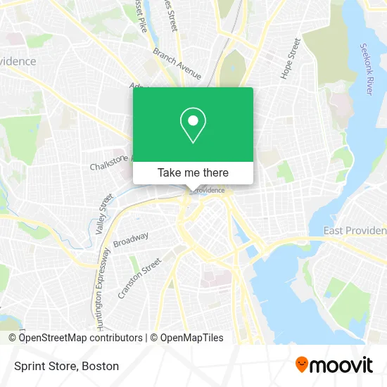
See Sprint Store, Boston, on the map
Public Transit to Sprint Store in Boston
Wondering how to get to Sprint Store in Boston? Moovit helps you find the best way to get to Sprint Store with step-by-step directions from the nearest public transit station.
Moovit provides free maps and live directions to help you navigate through your city. View schedules, routes, timetables, and find out how long does it take to get to Sprint Store in real time.
Looking for the nearest stop or station to Sprint Store? Check out this list of stops closest to your destination: Rhode Island Convention Center (Sabin); Francis After Finance; Fountain Before Union; Convention Center Providence Ri; Memorial After Exchange; Providence Station (Park Row W Before Exchange); Memorial Before Exchange; Exchange Terrace (Kennedy Plaza - Stop X); Kennedy Plaza (Stop Y); Providence.
Bus: 1, 21, 35, 54, R, 27, 28, 92, 9X, 10X, 50, 55, 56, 57, 6, 14.Train: PROVIDENCE/STOUGHTON, ACELA, NORTHEAST REGIONAL, PROVIDENCE LINE SHUTTLE, PROVIDENCE LINE SHUTTLE, PROVIDENCE LINE SHUTTLE, FOXBORO EVENT SERVICE.
Want to see if there’s another route that gets you there at an earlier time? Moovit helps you find alternative routes or times. Get directions from and directions to Sprint Store easily from the Moovit App or Website.
We make riding to Sprint Store easy, which is why over 1.7 million users, including users in Boston, trust Moovit as the best app for public transit. You don’t need to download an individual bus app or train app, Moovit is your all-in-one transit app that helps you find the best bus time or train time available.
For information on prices of bus and train, costs and ride fares to Sprint Store, please check the Moovit app.
Use the app to navigate to popular places including to the airport, hospital, stadium, grocery store, mall, coffee shop, school, college, and university.
Sprint Store Address: 1 Providence Pl 5610 street in Boston
- Pham Treats,
- Ardene,
- Naughty Waffles,
- COTTON ON,
- Mochi Dough,
- A & 1 Avail Locksmith,
- Soleply,
- Direct SAT TV,
- Lt Treats,
- Wireless Zone,
- Charley's Grilled Subs,
- China Wok,
- Tori Japan,
- GAP,
- Avocado's,
- Shell,
- STARBUCKS,
- Lovisa,
- Hempzilla,
- PANDORA
Places Near Sprint Store (Boston)
- Boston Common, Boston,
- Mgm Music Hall, Boston,
- Boston Convention & Exhibition Center, Boston,
- Wang Theater, Boston,
- Cheers, Boston,
- Massachusetts General Hospital, Boston,
- Castle Island, Boston,
- Td Garden, Boston,
- Prudential Center, Boston,
- Quincy Market, Boston,
- North End, Boston,
- Isabella Stewart Gardner Museum, Boston,
- Faneuil Hall, Boston,
- Boston Children's Hospital, Boston,
- Leader Bank Pavilion (Leader Bank Pavillion), Boston,
- Museum Of Science, Boston,
- Seaport District, Boston,
- House Of Blues, Boston,
- Boston Medical Center, Boston,
- Wilbur Theatre, Boston
How to get to popular places in Boston with public transit
Get around Boston by public transit!
Traveling around Boston has never been so easy. See step by step directions as you travel to any attraction, street or major public transit station. View bus and train schedules, arrival times, service alerts and detailed routes on a map, so you know exactly how to get to anywhere in Boston.
When traveling to any destination around Boston use Moovit's Live Directions with Get Off Notifications to know exactly where and how far to walk, how long to wait for your line, and how many stops are left. Moovit will alert you when it's time to get off — no need to constantly re-check whether yours is the next stop.
Wondering how to use public transit in Boston or how to pay for public transit in Boston? Moovit public transit app can help you navigate your way with public transit easily, and at minimum cost. It includes public transit fees, ticket prices, and costs. Looking for a map of Boston public transit lines? Moovit public transit app shows all public transit maps in Boston with all Bus, Train, Subway and Ferry routes and stops on an interactive map.
Boston has 4 transit type(s), including: Bus, Train, Subway and Ferry, operated by several transit agencies, including MBTA, Southeastern Regional Transit Authority, MetroWest Regional Transit Authority, Rhode Island Public Transit Authority, WRTA, Lowell Regional Transit Authority, Merrimack Valley Transit, Montachusett Regional Transit Authority, Cape Cod Regional Transit Authority, Brockton Area Transit Authority, Martha's Vineyard Transit Authority, the WAVE - Nantucket Regional Transit Authority, GATRA, Cape Ann Transportation Authority and Massport