Directions to Spruce Skin (Boston) with public transportation
The following transit lines have routes that pass near Spruce Skin
 Bus: 10, 11, 9.
- Train: FRAMINGHAM/WORCESTER, GREENBUSH, KINGSTON, COMMUTER RAIL SHUTTLE, FAIRMOUNT LINE SHUTTLE.
- Subway: RED LINE.
- Ferry: FAST FERRY.
How to get to Spruce Skin by bus?
Click on the bus route to see step by step directions with maps, line arrival times and updated time schedules.
From Vertex Pharmaceuticals, Inc., Boston
84 minFrom Boda Borg, Malden
90 minFrom Jamaica Plain V.A., Boston
41 minFrom Quincy Center Station, Quincy
101 minFrom Quincy, MA, Quincy
108 minFrom Sonia, Boston
66 minFrom Assembly Square, Somerville
98 minFrom Brighton Music Hall, Boston
56 minFrom MBTA / Alewife #6, Cambridge
95 minFrom Belmont, MA, Belmont
70 min
How to get to Spruce Skin by train?
Click on the train route to see step by step directions with maps, line arrival times and updated time schedules.
How to get to Spruce Skin by subway?
Click on the subway route to see step by step directions with maps, line arrival times and updated time schedules.
From Vertex Pharmaceuticals, Inc., Boston
73 minFrom Boda Borg, Malden
39 minFrom Jamaica Plain V.A., Boston
54 minFrom Quincy Center Station, Quincy
30 minFrom Quincy, MA, Quincy
36 minFrom Sonia, Boston
72 minFrom Assembly Square, Somerville
33 minFrom Brighton Music Hall, Boston
56 minFrom MBTA / Alewife #6, Cambridge
37 min
Bus stops near Spruce Skin in Boston
Subway station near Spruce Skin in Boston
- Broadway, 10 min walk,VIEW
Train station near Spruce Skin in Boston
- South Station, 13 min walk,VIEW
Ferry station near Spruce Skin in Boston
- World Trade Center Pier, Boston, MA, 35 min walk,VIEW
Bus lines to Spruce Skin in Boston
What are the closest stations to Spruce Skin?
The closest stations to Spruce Skin are:
- W Broadway @ E St is 61 yards away, 1 min walk.
- Dorchester St @ Broadway is 334 yards away, 5 min walk.
- W 6th St @ E St is 392 yards away, 5 min walk.
- Broadway is 760 yards away, 10 min walk.
- South Station is 1056 yards away, 13 min walk.
- World Trade Center Pier, Boston, MA is 2928 yards away, 35 min walk.
Which bus lines stop near Spruce Skin?
These bus lines stop near Spruce Skin: 10, 11, 9.
Which train lines stop near Spruce Skin?
These train lines stop near Spruce Skin: FRAMINGHAM/WORCESTER, GREENBUSH, KINGSTON.
Which subway line stops near Spruce Skin?
RED LINE (Ashmont/Braintree)
What’s the nearest subway station to Spruce Skin in Boston?
The nearest subway station to Spruce Skin in Boston is Broadway. It’s a 10 min walk away.
What’s the nearest train station to Spruce Skin in Boston?
The nearest train station to Spruce Skin in Boston is South Station. It’s a 13 min walk away.
What’s the nearest bus station to Spruce Skin in Boston?
The nearest bus station to Spruce Skin in Boston is W Broadway @ E St. It’s a 1 min walk away.
What time is the first subway to Spruce Skin in Boston?
The RED LINE is the first subway that goes to Spruce Skin in Boston. It stops nearby at 5:26 AM.
What time is the last subway to Spruce Skin in Boston?
The RED LINE is the last subway that goes to Spruce Skin in Boston. It stops nearby at 1:53 AM.
What time is the first train to Spruce Skin in Boston?
The PROVIDENCE/STOUGHTON is the first train that goes to Spruce Skin in Boston. It stops nearby at 4:20 AM.
What time is the last train to Spruce Skin in Boston?
The LAKE SHORE LIMITED is the last train that goes to Spruce Skin in Boston. It stops nearby at 8:32 PM.
What time is the first bus to Spruce Skin in Boston?
The SLW is the first bus that goes to Spruce Skin in Boston. It stops nearby at 4:19 AM.
What time is the last bus to Spruce Skin in Boston?
The 10 is the last bus that goes to Spruce Skin in Boston. It stops nearby at 1:36 AM.
What time is the first ferry to Spruce Skin in Boston?
The FAST FERRY is the first ferry that goes to Spruce Skin in Boston. It stops nearby at 8:30 AM.
What time is the last ferry to Spruce Skin in Boston?
The FAST FERRY is the last ferry that goes to Spruce Skin in Boston. It stops nearby at 9:05 PM.
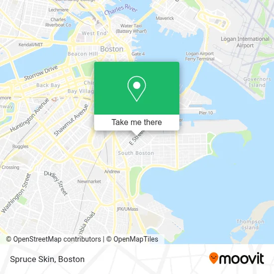
See Spruce Skin, Boston, on the map
Public Transit to Spruce Skin in Boston
Wondering how to get to Spruce Skin in Boston? Moovit helps you find the best way to get to Spruce Skin with step-by-step directions from the nearest public transit station.
Moovit provides free maps and live directions to help you navigate through your city. View schedules, routes, timetables, and find out how long does it take to get to Spruce Skin in real time.
Looking for the nearest stop or station to Spruce Skin? Check out this list of stops closest to your destination: W Broadway @ E St; Dorchester St @ Broadway; W 6th St @ E St; Broadway; South Station; World Trade Center Pier.
Bus: 10, 11, 9.Train: FRAMINGHAM/WORCESTER, GREENBUSH, KINGSTON, COMMUTER RAIL SHUTTLE, FAIRMOUNT LINE SHUTTLE, FRANKLIN LINE SHUTTLE, KINGSTON LINE SHUTTLE, SL1.Subway: RED LINE.Ferry: FAST FERRY.
Want to see if there’s another route that gets you there at an earlier time? Moovit helps you find alternative routes or times. Get directions from and directions to Spruce Skin easily from the Moovit App or Website.
We make riding to Spruce Skin easy, which is why over 1.7 million users, including users in Boston, trust Moovit as the best app for public transit. You don’t need to download an individual bus app or train app, Moovit is your all-in-one transit app that helps you find the best bus time or train time available.
For information on prices of bus, subway and train, costs and ride fares to Spruce Skin, please check the Moovit app.
Use the app to navigate to popular places including to the airport, hospital, stadium, grocery store, mall, coffee shop, school, college, and university.
Spruce Skin Address: 381 W Broadway street in Boston
- Pastel Nail Studio,
- Broadway Laundromat (Kays Laundromat),
- W 3rd St & E St,
- Lincoln Tavern & Restaurant,
- Lincoln,
- Orthodox Church (Holy Trinity Albanian Orthodox Ch),
- Sherwin-Williams,
- Capo Restaurant & Supper Club,
- Supper Club at Capo,
- 18x9 W 5th St,
- Capo,
- Condon James Elementary School,
- Brito Family Dental,
- Croke Park Whiteys (Croke Park Whitey's),
- The Goodwill Store,
- Lulu Green,
- Navy Federal Credit Union,
- Marion Manor,
- The Yoga and Dance Studio,
- P.S. Gourmet Coffee
Places Near Spruce Skin (Boston)
- Boston Common, Boston,
- Boston Medical Center, Boston,
- Td Garden, Boston,
- Seaport District, Boston,
- Massachusetts General Hospital, Boston,
- Castle Island, Boston,
- Museum Of Science, Boston,
- Boston Children's Hospital, Boston,
- Wilbur Theatre, Boston,
- Quincy Market, Boston,
- Cheers, Boston,
- House Of Blues, Boston,
- Wang Theater, Boston,
- Leader Bank Pavilion (Leader Bank Pavillion), Boston,
- Mgm Music Hall, Boston,
- Prudential Center, Boston,
- Isabella Stewart Gardner Museum, Boston,
- North End, Boston,
- Faneuil Hall, Boston,
- Boston Convention & Exhibition Center, Boston
How to get to popular places in Boston with public transit
Get around Boston by public transit!
Traveling around Boston has never been so easy. See step by step directions as you travel to any attraction, street or major public transit station. View bus and train schedules, arrival times, service alerts and detailed routes on a map, so you know exactly how to get to anywhere in Boston.
When traveling to any destination around Boston use Moovit's Live Directions with Get Off Notifications to know exactly where and how far to walk, how long to wait for your line, and how many stops are left. Moovit will alert you when it's time to get off — no need to constantly re-check whether yours is the next stop.
Wondering how to use public transit in Boston or how to pay for public transit in Boston? Moovit public transit app can help you navigate your way with public transit easily, and at minimum cost. It includes public transit fees, ticket prices, and costs. Looking for a map of Boston public transit lines? Moovit public transit app shows all public transit maps in Boston with all Bus, Train, Subway and Ferry routes and stops on an interactive map.
Boston has 4 transit type(s), including: Bus, Train, Subway and Ferry, operated by several transit agencies, including MBTA, Southeastern Regional Transit Authority, MetroWest Regional Transit Authority, Rhode Island Public Transit Authority, WRTA, Lowell Regional Transit Authority, Merrimack Valley Transit, Montachusett Regional Transit Authority, Cape Cod Regional Transit Authority, Brockton Area Transit Authority, Martha's Vineyard Transit Authority, the WAVE - Nantucket Regional Transit Authority, GATRA, Cape Ann Transportation Authority and Massport