Directions to Spy Bar (Boston) with public transportation
The following transit lines have routes that pass near Spy Bar
 Bus: 43, 501, 9, BB, SL4.
- Train: FITCHBURG, HAVERHILL, LOWELL, NEEDHAM, NEWBURYPORT/ROCKPORT.
- Subway: GREEN LINE B, ORANGE LINE, GREEN LINE C, GREEN LINE D, GREEN LINE E.
How to get to Spy Bar by bus?
Click on the bus route to see step by step directions with maps, line arrival times and updated time schedules.
From Four Points by Sheraton Boston Logan Airport, Revere
95 minFrom Faulkner Hospital, Boston
52 minFrom Market Basket, Revere
72 minFrom La Quinta Inn & Suites Boston Somerville, Somerville
86 minFrom Regent Theatre, Arlington
73 minFrom Chestnut Hill, Boston
60 minFrom Beth Israel Deaconess Hospital-Milton, Milton
79 minFrom Brattle St / Harvard Sq, Cambridge
43 minFrom Chelsea District Court, Chelsea
48 minFrom Melrose Wakefield Hospital, Malden
91 min
How to get to Spy Bar by train?
Click on the train route to see step by step directions with maps, line arrival times and updated time schedules.
How to get to Spy Bar by subway?
Click on the subway route to see step by step directions with maps, line arrival times and updated time schedules.
Bus stops near Spy Bar in Boston
Subway stations near Spy Bar in Boston
Train station near Spy Bar in Boston
- Back Bay - South End, 14 min walk,VIEW
Bus lines to Spy Bar in Boston
What are the closest stations to Spy Bar?
The closest stations to Spy Bar are:
- Dartmouth St @ Appleton St is 92 yards away, 2 min walk.
- Announcement #5 - Back Bay To Airport is 120 yards away, 2 min walk.
- Arlington is 152 yards away, 3 min walk.
- Arlington St @ Isabella St is 232 yards away, 4 min walk.
- Back Bay - Columbus Ave @ Dartmouth St is 257 yards away, 4 min walk.
- Tremont St @ Upton St is 285 yards away, 4 min walk.
- Tufts Medical Center is 631 yards away, 8 min walk.
- Back Bay - South End is 1120 yards away, 14 min walk.
Which bus lines stop near Spy Bar?
These bus lines stop near Spy Bar: 43, 501, 9, BB, SL4.
Which train lines stop near Spy Bar?
These train lines stop near Spy Bar: FITCHBURG, HAVERHILL, LOWELL, NEEDHAM, NEWBURYPORT/ROCKPORT.
Which subway lines stop near Spy Bar?
These subway lines stop near Spy Bar: GREEN LINE B, ORANGE LINE.
What’s the nearest subway station to Spy Bar in Boston?
The nearest subway station to Spy Bar in Boston is Arlington. It’s a 3 min walk away.
What’s the nearest train station to Spy Bar in Boston?
The nearest train station to Spy Bar in Boston is Back Bay - South End. It’s a 14 min walk away.
What’s the nearest bus station to Spy Bar in Boston?
The nearest bus stations to Spy Bar in Boston are Dartmouth St @ Appleton St and Announcement #5 - Back Bay To Airport. The closest one is a 2 min walk away.
What time is the first subway to Spy Bar in Boston?
The GREEN LINE D is the first subway that goes to Spy Bar in Boston. It stops nearby at 5:05 AM.
What time is the last subway to Spy Bar in Boston?
The GREEN LINE E is the last subway that goes to Spy Bar in Boston. It stops nearby at 2:14 AM.
What time is the first train to Spy Bar in Boston?
The PROVIDENCE/STOUGHTON is the first train that goes to Spy Bar in Boston. It stops nearby at 4:25 AM.
What time is the last train to Spy Bar in Boston?
The LAKE SHORE LIMITED is the last train that goes to Spy Bar in Boston. It stops nearby at 8:26 PM.
What time is the first bus to Spy Bar in Boston?
The BB is the first bus that goes to Spy Bar in Boston. It stops nearby at 5:01 AM.
What time is the last bus to Spy Bar in Boston?
The 10 is the last bus that goes to Spy Bar in Boston. It stops nearby at 1:19 AM.
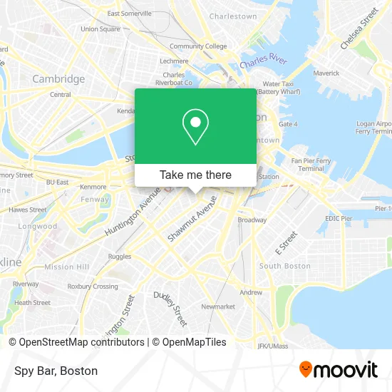
See Spy Bar, Boston, on the map
Public Transit to Spy Bar in Boston
Wondering how to get to Spy Bar in Boston? Moovit helps you find the best way to get to Spy Bar with step-by-step directions from the nearest public transit station.
Moovit provides free maps and live directions to help you navigate through your city. View schedules, routes, timetables, and find out how long does it take to get to Spy Bar in real time.
Looking for the nearest stop or station to Spy Bar? Check out this list of stops closest to your destination: Dartmouth St @ Appleton St; Announcement #5 - Back Bay To Airport; Arlington; Arlington St @ Isabella St; Back Bay - Columbus Ave @ Dartmouth St; Tremont St @ Upton St; Tufts Medical Center; Back Bay - South End.
Bus: 43, 501, 9, BB, SL4, 10.Train: FITCHBURG, HAVERHILL, LOWELL, NEEDHAM, NEWBURYPORT/ROCKPORT, FOXBORO EVENT SERVICE, FRAMINGHAM/WORCESTER, FRANKLIN/FOXBORO, PROVIDENCE/STOUGHTON.Subway: GREEN LINE B, ORANGE LINE, GREEN LINE C, GREEN LINE D, GREEN LINE E.
Want to see if there’s another route that gets you there at an earlier time? Moovit helps you find alternative routes or times. Get directions from and directions to Spy Bar easily from the Moovit App or Website.
We make riding to Spy Bar easy, which is why over 1.7 million users, including users in Boston, trust Moovit as the best app for public transit. You don’t need to download an individual bus app or train app, Moovit is your all-in-one transit app that helps you find the best bus time or train time available.
For information on prices of bus, subway and train, costs and ride fares to Spy Bar, please check the Moovit app.
Use the app to navigate to popular places including to the airport, hospital, stadium, grocery store, mall, coffee shop, school, college, and university.
Spy Bar Address: 40 Berkeley St street in Boston
- The Revolution Hotel Boston,
- Revolution Hotel,
- The Revolution Hotel (Wheelings Revolution),
- 40 Berkeley Hostel,
- Cornerstone Church,
- Benjamin Franklin Institute Of Technology,
- Atm,
- Atelier | 505 Garage,
- Berkeley St & Lawrence St,
- Atelier 505 (Atelier-Parking Garage 505),
- Life Alive Organic Cafe (Life Alive Urban Oasis and Organic Caf),
- Public Alley 705 & Tremont St,
- Blackbird Doughnuts,
- Staypineapple,
- Virginia Wimberly Theatre at the Calderwood Pavilion at the BCA,
- Picco,
- Calderwood Pavilion at the BCA,
- Cyclorama Building,
- Wink & Nod,
- Seaport West
Places Near Spy Bar (Boston)
- Boston Convention & Exhibition Center, Boston,
- Faneuil Hall, Boston,
- Museum Of Science, Boston,
- Wilbur Theatre, Boston,
- Td Garden, Boston,
- Quincy Market, Boston,
- Mgm Music Hall, Boston,
- Massachusetts General Hospital, Boston,
- Wang Theater, Boston,
- House Of Blues, Boston,
- Prudential Center, Boston,
- Castle Island, Boston,
- Boston Children's Hospital, Boston,
- Isabella Stewart Gardner Museum, Boston,
- Seaport District, Boston,
- Boston Medical Center, Boston,
- Cheers, Boston,
- Boston Common, Boston,
- North End, Boston,
- Leader Bank Pavilion (Leader Bank Pavillion), Boston
How to get to popular places in Boston with public transit
Get around Boston by public transit!
Traveling around Boston has never been so easy. See step by step directions as you travel to any attraction, street or major public transit station. View bus and train schedules, arrival times, service alerts and detailed routes on a map, so you know exactly how to get to anywhere in Boston.
When traveling to any destination around Boston use Moovit's Live Directions with Get Off Notifications to know exactly where and how far to walk, how long to wait for your line, and how many stops are left. Moovit will alert you when it's time to get off — no need to constantly re-check whether yours is the next stop.
Wondering how to use public transit in Boston or how to pay for public transit in Boston? Moovit public transit app can help you navigate your way with public transit easily, and at minimum cost. It includes public transit fees, ticket prices, and costs. Looking for a map of Boston public transit lines? Moovit public transit app shows all public transit maps in Boston with all Bus, Train, Subway and Ferry routes and stops on an interactive map.
Boston has 4 transit type(s), including: Bus, Train, Subway and Ferry, operated by several transit agencies, including MBTA, Southeastern Regional Transit Authority, MetroWest Regional Transit Authority, Rhode Island Public Transit Authority, WRTA, Lowell Regional Transit Authority, Merrimack Valley Transit, Montachusett Regional Transit Authority, Cape Cod Regional Transit Authority, Brockton Area Transit Authority, Martha's Vineyard Transit Authority, the WAVE - Nantucket Regional Transit Authority, GATRA, Cape Ann Transportation Authority and Massport