Directions to Spy Pond Playground (Winchester) with public transportation
The following transit lines have routes that pass near Spy Pond Playground
 Bus: 134, 95.
- Train: LOWELL.
- Subway: GREEN LINE E, GREEN LINE B, GREEN LINE C.
How to get to Spy Pond Playground by bus?
Click on the bus route to see step by step directions with maps, line arrival times and updated time schedules.
From Market Basket, Revere
73 minFrom Brighton Music Hall, Boston
81 minFrom Pizzeria Regina, Boston
43 minFrom Citizenm Boston North Station, Boston
43 minFrom The Esplanade (Charles River Esplanade), Boston
57 minFrom Hatch Shell, Boston
57 minFrom Brighton, Boston
83 minFrom Holiday Inn Express & Suites Boston - Cambridge, Cambridge
72 minFrom US Coast Guard Base Boston, Boston
50 minFrom Belmont, MA, Belmont
78 min
How to get to Spy Pond Playground by train?
Click on the train route to see step by step directions with maps, line arrival times and updated time schedules.
How to get to Spy Pond Playground by subway?
Click on the subway route to see step by step directions with maps, line arrival times and updated time schedules.
Bus stops near Spy Pond Playground in Winchester
Train station near Spy Pond Playground in Winchester
- West Medford, 10 min walk,VIEW
Subway station near Spy Pond Playground in Winchester
- Ball Square Station, 31 min walk,VIEW
Bus lines to Spy Pond Playground in Winchester
What are the closest stations to Spy Pond Playground?
The closest stations to Spy Pond Playground are:
- Main St Opp Highland Ave is 47 yards away, 1 min walk.
- Playstead Rd @ Osborne Rd is 574 yards away, 7 min walk.
- West Medford is 798 yards away, 10 min walk.
- Ball Square Station is 2567 yards away, 31 min walk.
Which bus lines stop near Spy Pond Playground?
These bus lines stop near Spy Pond Playground: 134, 95.
Which train line stops near Spy Pond Playground?
LOWELL (#323 | Lowell)
Which subway line stops near Spy Pond Playground?
GREEN LINE E (Lechmere)
What’s the nearest train station to Spy Pond Playground in Winchester?
The nearest train station to Spy Pond Playground in Winchester is West Medford. It’s a 10 min walk away.
What’s the nearest bus station to Spy Pond Playground in Winchester?
The nearest bus station to Spy Pond Playground in Winchester is Main St Opp Highland Ave. It’s a 1 min walk away.
What time is the first subway to Spy Pond Playground in Winchester?
The GREEN LINE E is the first subway that goes to Spy Pond Playground in Winchester. It stops nearby at 4:55 AM.
What time is the last subway to Spy Pond Playground in Winchester?
The GREEN LINE E is the last subway that goes to Spy Pond Playground in Winchester. It stops nearby at 2:41 AM.
What time is the first train to Spy Pond Playground in Winchester?
The LOWELL is the first train that goes to Spy Pond Playground in Winchester. It stops nearby at 5:27 AM.
What time is the last train to Spy Pond Playground in Winchester?
The LOWELL is the last train that goes to Spy Pond Playground in Winchester. It stops nearby at 12:20 AM.
What time is the first bus to Spy Pond Playground in Winchester?
The 95 is the first bus that goes to Spy Pond Playground in Winchester. It stops nearby at 5:24 AM.
What time is the last bus to Spy Pond Playground in Winchester?
The 95 is the last bus that goes to Spy Pond Playground in Winchester. It stops nearby at 1:39 AM.
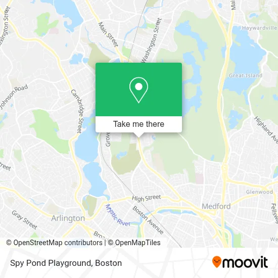
See Spy Pond Playground, Winchester, on the map
Public Transit to Spy Pond Playground in Winchester
Wondering how to get to Spy Pond Playground in Winchester? Moovit helps you find the best way to get to Spy Pond Playground with step-by-step directions from the nearest public transit station.
Moovit provides free maps and live directions to help you navigate through your city. View schedules, routes, timetables, and find out how long does it take to get to Spy Pond Playground in real time.
Looking for the nearest stop or station to Spy Pond Playground? Check out this list of stops closest to your destination: Main St Opp Highland Ave; Playstead Rd @ Osborne Rd; West Medford; Ball Square Station.
Bus: 134, 95.Train: LOWELL.Subway: GREEN LINE E, GREEN LINE B, GREEN LINE C.
Want to see if there’s another route that gets you there at an earlier time? Moovit helps you find alternative routes or times. Get directions from and directions to Spy Pond Playground easily from the Moovit App or Website.
We make riding to Spy Pond Playground easy, which is why over 1.7 million users, including users in Winchester, trust Moovit as the best app for public transit. You don’t need to download an individual bus app or train app, Moovit is your all-in-one transit app that helps you find the best bus time or train time available.
For information on prices of bus, subway and train, costs and ride fares to Spy Pond Playground, please check the Moovit app.
Use the app to navigate to popular places including to the airport, hospital, stadium, grocery store, mall, coffee shop, school, college, and university.
Spy Pond Playground Address: 99 Pond Ln street in Winchester
- The Cos Experience Toddler Program,
- Fichera Andrew J MD PC,
- Solo Home Designs,
- Oak Grove Cemetery,
- RT-38,
- Medford High,
- Cunningham Super Steam Cleaning,
- Gilbert Carey Painting,
- Medford High School (Medford Public Schools),
- Mystic Lakes,
- AAA Transcription Specialists,
- USPS Collection Box - Blue Box,
- Bistro 489,
- Friends of the Medford Family Network,
- Medford Community Media,
- MBTA Wedgemere Station,
- Wedgemere Station,
- Playstead Park,
- Steven M & Miriam Glassman,
- Ujenzi Trust
Places Near Spy Pond Playground (Winchester)
- Leader Bank Pavilion (Leader Bank Pavillion), Boston,
- House Of Blues, Boston,
- Boston Medical Center, Boston,
- Boston Common, Boston,
- Wang Theater, Boston,
- Boston Convention & Exhibition Center, Boston,
- Castle Island, Boston,
- Massachusetts General Hospital, Boston,
- Isabella Stewart Gardner Museum, Boston,
- Wilbur Theatre, Boston,
- Mgm Music Hall, Boston,
- Cheers, Boston,
- Td Garden, Boston,
- North End, Boston,
- Prudential Center, Boston,
- Boston Children's Hospital, Boston,
- Museum Of Science, Boston,
- Quincy Market, Boston,
- Seaport District, Boston,
- Faneuil Hall, Boston
How to get to popular places in Boston with public transit
Get around Winchester by public transit!
Traveling around Winchester has never been so easy. See step by step directions as you travel to any attraction, street or major public transit station. View bus and train schedules, arrival times, service alerts and detailed routes on a map, so you know exactly how to get to anywhere in Winchester.
When traveling to any destination around Winchester use Moovit's Live Directions with Get Off Notifications to know exactly where and how far to walk, how long to wait for your line, and how many stops are left. Moovit will alert you when it's time to get off — no need to constantly re-check whether yours is the next stop.
Wondering how to use public transit in Winchester or how to pay for public transit in Winchester? Moovit public transit app can help you navigate your way with public transit easily, and at minimum cost. It includes public transit fees, ticket prices, and costs. Looking for a map of Winchester public transit lines? Moovit public transit app shows all public transit maps in Winchester with all Bus, Train, Subway and Ferry routes and stops on an interactive map.
Boston has 4 transit type(s), including: Bus, Train, Subway and Ferry, operated by several transit agencies, including MBTA, Southeastern Regional Transit Authority, MetroWest Regional Transit Authority, Rhode Island Public Transit Authority, WRTA, Lowell Regional Transit Authority, Merrimack Valley Transit, Montachusett Regional Transit Authority, Cape Cod Regional Transit Authority, Brockton Area Transit Authority, Martha's Vineyard Transit Authority, the WAVE - Nantucket Regional Transit Authority, GATRA, Cape Ann Transportation Authority and Massport