Directions to Square Mfg Co (Boston) with public transportation
The following transit lines have routes that pass near Square Mfg Co
 Bus: 01, 11, FLIXBUS 2611, 10.
- Train: FRAMINGHAM/WORCESTER.
How to get to Square Mfg Co by bus?
Click on the bus route to see step by step directions with maps, line arrival times and updated time schedules.
From I-95 / Route 128 & Route 16 Interchange (Exit 21), Newton
58 minFrom Boston Marriott Newton, Newton
84 minFrom Wellesley, MA, Wellesley
55 minFrom Newton-Wellesley Hospital, Newton
61 minFrom Babson College, Wellesley
53 minFrom Bose Corp, Framingham
85 minFrom Lasell College, Newton
75 minFrom Newton Wellesley Hospital Green Building, Newton
61 minFrom Staples Corporate HQ, Framingham
73 minFrom Sheraton-Needham Hotel (Sheraton Boston Needham Hotel), Needham
178 min
How to get to Square Mfg Co by train?
Click on the train route to see step by step directions with maps, line arrival times and updated time schedules.
Bus stop near Square Mfg Co in Boston
- 9/27 Shopping Plaza, 21 min walk,VIEW
Train station near Square Mfg Co in Boston
- West Natick, 27 min walk,VIEW
What are the closest stations to Square Mfg Co?
The closest stations to Square Mfg Co are:
- 9/27 Shopping Plaza is 1728 yards away, 21 min walk.
- West Natick is 2238 yards away, 27 min walk.
Which bus lines stop near Square Mfg Co?
These bus lines stop near Square Mfg Co: 01, 11, FLIXBUS 2611.
Which train line stops near Square Mfg Co?
FRAMINGHAM/WORCESTER (#521 | Worcester)
What’s the nearest train station to Square Mfg Co in Boston?
The nearest train station to Square Mfg Co in Boston is West Natick. It’s a 27 min walk away.
What time is the first train to Square Mfg Co in Boston?
The FRAMINGHAM/WORCESTER is the first train that goes to Square Mfg Co in Boston. It stops nearby at 4:59 AM.
What time is the last train to Square Mfg Co in Boston?
The FRAMINGHAM/WORCESTER is the last train that goes to Square Mfg Co in Boston. It stops nearby at 12:41 AM.
What time is the first bus to Square Mfg Co in Boston?
The 11 is the first bus that goes to Square Mfg Co in Boston. It stops nearby at 7:09 AM.
What time is the last bus to Square Mfg Co in Boston?
The 11 is the last bus that goes to Square Mfg Co in Boston. It stops nearby at 7:55 PM.
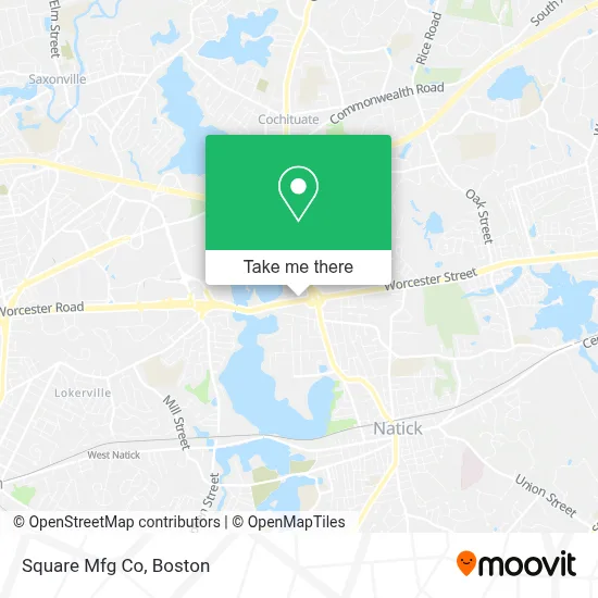
See Square Mfg Co, Boston, on the map
Public Transit to Square Mfg Co in Boston
Wondering how to get to Square Mfg Co in Boston? Moovit helps you find the best way to get to Square Mfg Co with step-by-step directions from the nearest public transit station.
Moovit provides free maps and live directions to help you navigate through your city. View schedules, routes, timetables, and find out how long does it take to get to Square Mfg Co in real time.
Looking for the nearest stop or station to Square Mfg Co? Check out this list of stops closest to your destination: 9/27 Shopping Plaza; West Natick.
Bus: 01, 11, FLIXBUS 2611, 10.Train: FRAMINGHAM/WORCESTER.
Want to see if there’s another route that gets you there at an earlier time? Moovit helps you find alternative routes or times. Get directions from and directions to Square Mfg Co easily from the Moovit App or Website.
We make riding to Square Mfg Co easy, which is why over 1.7 million users, including users in Boston, trust Moovit as the best app for public transit. You don’t need to download an individual bus app or train app, Moovit is your all-in-one transit app that helps you find the best bus time or train time available.
For information on prices of bus, train and subway, costs and ride fares to Square Mfg Co, please check the Moovit app.
Use the app to navigate to popular places including to the airport, hospital, stadium, grocery store, mall, coffee shop, school, college, and university.
Square Mfg Co Address: 935 Worcester St street in Boston
- Mail Handlers Union of New England Local 301 (National Postal Mail Handlers Union, Local 301),
- Bernardi Honda Natick,
- Alimony & Child Support,
- Natick Town Middle School,
- Mercedes-Benz,
- United Way Tri County,
- Mother USA,
- Oliver James Interiors,
- Startupselling,
- Route 9 & Route 27 Interchange,
- Natick Army Labs (Kansas St. and RT.27),
- DVG Tax Returns,
- U.S. Army Natick Soldier Systems Center,
- Mathworks,
- A & 1 Avail Locksmith,
- Dannin Management,
- MathWorks Lakeside Campus,
- Registry of Motor Vehicles,
- Fast Lane Natick Service Center,
- EZPass Service Center
Places Near Square Mfg Co (Boston)
- Castle Island, Boston,
- Faneuil Hall, Boston,
- Boston Common, Boston,
- Cheers, Boston,
- Boston Convention & Exhibition Center, Boston,
- House Of Blues, Boston,
- Boston Children's Hospital, Boston,
- Wilbur Theatre, Boston,
- Massachusetts General Hospital, Boston,
- Leader Bank Pavilion (Leader Bank Pavillion), Boston,
- Boston Medical Center, Boston,
- Quincy Market, Boston,
- Isabella Stewart Gardner Museum, Boston,
- Prudential Center, Boston,
- Td Garden, Boston,
- North End, Boston,
- Seaport District, Boston,
- Wang Theater, Boston,
- Museum Of Science, Boston,
- Mgm Music Hall, Boston
How to get to popular places in Boston with public transit
Get around Boston by public transit!
Traveling around Boston has never been so easy. See step by step directions as you travel to any attraction, street or major public transit station. View bus and train schedules, arrival times, service alerts and detailed routes on a map, so you know exactly how to get to anywhere in Boston.
When traveling to any destination around Boston use Moovit's Live Directions with Get Off Notifications to know exactly where and how far to walk, how long to wait for your line, and how many stops are left. Moovit will alert you when it's time to get off — no need to constantly re-check whether yours is the next stop.
Wondering how to use public transit in Boston or how to pay for public transit in Boston? Moovit public transit app can help you navigate your way with public transit easily, and at minimum cost. It includes public transit fees, ticket prices, and costs. Looking for a map of Boston public transit lines? Moovit public transit app shows all public transit maps in Boston with all Bus, Train, Subway and Ferry routes and stops on an interactive map.
Boston has 4 transit type(s), including: Bus, Train, Subway and Ferry, operated by several transit agencies, including MBTA, Southeastern Regional Transit Authority, MetroWest Regional Transit Authority, Rhode Island Public Transit Authority, WRTA, Lowell Regional Transit Authority, Merrimack Valley Transit, Montachusett Regional Transit Authority, Cape Cod Regional Transit Authority, Brockton Area Transit Authority, Martha's Vineyard Transit Authority, the WAVE - Nantucket Regional Transit Authority, GATRA, Cape Ann Transportation Authority and Massport