How to get to Squaresmiles by bus?
Click on the bus route to see step by step directions with maps, line arrival times and updated time schedules.
From West Roxbury, Boston
51 minFrom World Trade Center MBTA Station - Silver Line, Boston
95 minFrom WGBH, Boston
56 minFrom Yankee Lobster, Boston
83 minFrom AMC Theatres, Boston
47 minFrom Boston Ballet, Boston
74 minFrom Massachusetts College Of Pharmacy And Health Science, Boston
57 minFrom Huntington Theatre Company, Boston
57 minFrom Best Buy, Boston
57 min
How to get to Squaresmiles by train?
Click on the train route to see step by step directions with maps, line arrival times and updated time schedules.
From West Roxbury, Boston
104 minFrom World Trade Center MBTA Station - Silver Line, Boston
83 minFrom WGBH, Boston
89 minFrom AMC Theatres, Boston
108 minFrom Boston Ballet, Boston
83 minFrom Massachusetts College Of Pharmacy And Health Science, Boston
97 minFrom Huntington Theatre Company, Boston
90 minFrom Best Buy, Boston
111 min
How to get to Squaresmiles by subway?
Click on the subway route to see step by step directions with maps, line arrival times and updated time schedules.
From World Trade Center MBTA Station - Silver Line, Boston
68 minFrom WGBH, Boston
62 minFrom Yankee Lobster, Boston
74 minFrom AMC Theatres, Boston
56 minFrom Boston Ballet, Boston
63 minFrom Massachusetts College Of Pharmacy And Health Science, Boston
81 minFrom Huntington Theatre Company, Boston
70 minFrom Best Buy, Boston
56 min
Bus stops near Squaresmiles in Milton
Bus lines to Squaresmiles in Milton
What are the closest stations to Squaresmiles?
The closest stations to Squaresmiles are:
- Adams St @ Foster Ln is 10 yards away, 1 min walk.
- Adams St @ Granite Pl is 20 yards away, 1 min walk.
- North Quincy is 304 yards away, 4 min walk.
- Milton is 986 yards away, 12 min walk.
Which bus lines stop near Squaresmiles?
These bus lines stop near Squaresmiles: 215, 245.
Which train line stops near Squaresmiles?
GREENBUSH (#1061 | Greenbush)
Which subway line stops near Squaresmiles?
RED LINE (Ashmont/Braintree)
What’s the nearest subway station to Squaresmiles in Milton?
The nearest subway station to Squaresmiles in Milton is North Quincy. It’s a 4 min walk away.
What’s the nearest bus station to Squaresmiles in Milton?
The nearest bus stations to Squaresmiles in Milton are Adams St @ Foster Ln and Adams St @ Granite Pl. The closest one is a 1 min walk away.
What time is the first subway to Squaresmiles in Milton?
The MATTAPAN LINE is the first subway that goes to Squaresmiles in Milton. It stops nearby at 5:06 AM.
What time is the last subway to Squaresmiles in Milton?
The MATTAPAN LINE is the last subway that goes to Squaresmiles in Milton. It stops nearby at 2:35 AM.
What time is the first bus to Squaresmiles in Milton?
The 215 is the first bus that goes to Squaresmiles in Milton. It stops nearby at 5:17 AM.
What time is the last bus to Squaresmiles in Milton?
The 215 is the last bus that goes to Squaresmiles in Milton. It stops nearby at 1:07 AM.
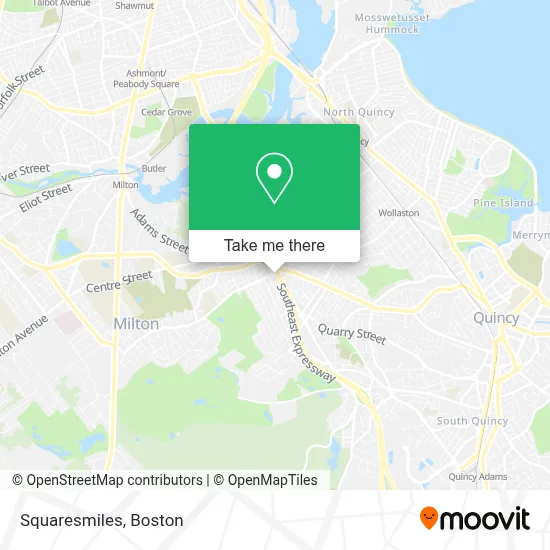
See Squaresmiles, Milton, on the map
Public Transit to Squaresmiles in Milton
Wondering how to get to Squaresmiles in Milton? Moovit helps you find the best way to get to Squaresmiles with step-by-step directions from the nearest public transit station.
Moovit provides free maps and live directions to help you navigate through your city. View schedules, routes, timetables, and find out how long does it take to get to Squaresmiles in real time.
Looking for the nearest stop or station to Squaresmiles? Check out this list of stops closest to your destination: Adams St @ Foster Ln; Adams St @ Granite Pl; North Quincy; Milton.
Bus: 215, 245, 217.Train: GREENBUSH.Subway: RED LINE, MATTAPAN LINE.
Want to see if there’s another route that gets you there at an earlier time? Moovit helps you find alternative routes or times. Get directions from and directions to Squaresmiles easily from the Moovit App or Website.
We make riding to Squaresmiles easy, which is why over 1.7 million users, including users in Milton, trust Moovit as the best app for public transit. You don’t need to download an individual bus app or train app, Moovit is your all-in-one transit app that helps you find the best bus time or train time available.
For information on prices of bus, subway and train, costs and ride fares to Squaresmiles, please check the Moovit app.
Use the app to navigate to popular places including to the airport, hospital, stadium, grocery store, mall, coffee shop, school, college, and university.
Squaresmiles Address: 25 Bryant Ave street in Milton
- AJ Virgilio Construction,
- Verge Therapy,
- Medical Record Associates,
- Sullivan Family Dentistry,
- Milton Handyman Locksmith Services,
- Roy C. Smith Bridge,
- Abbey Travel Service,
- El Barrio Mexican Grill,
- Two Locksmith,
- East Milton Post Office,
- East Milton Square,
- Roy Neblett Tax,
- Peel Pizza,
- Skinhealth by Nicole K,
- STARBUCKS,
- Bella in Boston,
- Santander CONSUMER BANK,
- Days Locksmith Seven,
- Town & Country Home Services,
- Fitness Unlimited for Women
Places Near Squaresmiles (Milton)
- Prudential Center, Boston,
- Leader Bank Pavilion (Leader Bank Pavillion), Boston,
- Td Garden, Boston,
- Wang Theater, Boston,
- Massachusetts General Hospital, Boston,
- Isabella Stewart Gardner Museum, Boston,
- Museum Of Science, Boston,
- Boston Children's Hospital, Boston,
- Mgm Music Hall, Boston,
- Quincy Market, Boston,
- Wilbur Theatre, Boston,
- Boston Convention & Exhibition Center, Boston,
- North End, Boston,
- Cheers, Boston,
- Seaport District, Boston,
- Faneuil Hall, Boston,
- House Of Blues, Boston,
- Boston Medical Center, Boston,
- Boston Common, Boston,
- Castle Island, Boston
How to get to popular places in Boston with public transit
Get around Milton by public transit!
Traveling around Milton has never been so easy. See step by step directions as you travel to any attraction, street or major public transit station. View bus and train schedules, arrival times, service alerts and detailed routes on a map, so you know exactly how to get to anywhere in Milton.
When traveling to any destination around Milton use Moovit's Live Directions with Get Off Notifications to know exactly where and how far to walk, how long to wait for your line, and how many stops are left. Moovit will alert you when it's time to get off — no need to constantly re-check whether yours is the next stop.
Wondering how to use public transit in Milton or how to pay for public transit in Milton? Moovit public transit app can help you navigate your way with public transit easily, and at minimum cost. It includes public transit fees, ticket prices, and costs. Looking for a map of Milton public transit lines? Moovit public transit app shows all public transit maps in Milton with all Bus, Train, Subway and Ferry routes and stops on an interactive map.
Boston has 4 transit type(s), including: Bus, Train, Subway and Ferry, operated by several transit agencies, including MBTA, Southeastern Regional Transit Authority, MetroWest Regional Transit Authority, Rhode Island Public Transit Authority, WRTA, Lowell Regional Transit Authority, Merrimack Valley Transit, Montachusett Regional Transit Authority, Cape Cod Regional Transit Authority, Brockton Area Transit Authority, Martha's Vineyard Transit Authority, the WAVE - Nantucket Regional Transit Authority, GATRA, Cape Ann Transportation Authority and Massport