How to get to Squeri Food Service by bus?
Click on the bus route to see step by step directions with maps, line arrival times and updated time schedules.
From Elkridge, MD, Howard County
74 minFrom Maryland Live! Casino, Anne Arundel County
84 minFrom Arundel Mills, Anne Arundel County
82 minFrom Walmart, Baltimore County
83 minFrom I-95 Exit 33 - Laurel/Burtonsville (Sandy Spring Rd/MD 198), Prince George's County
64 minFrom MD Live Casino Arundel Mills, Anne Arundel County
80 minFrom Laurel, Maryland, Prince George's County
63 minFrom Guinness Open Gate Brewery & Barrel House, Baltimore County
148 minFrom NSA Friendship Annex (FANX), Anne Arundel County
133 min
Bus stops near Squeri Food Service in Howard County
Bus lines to Squeri Food Service in Howard County
What are the closest stations to Squeri Food Service?
The closest stations to Squeri Food Service are:
- Patuxent Woods Dr / Community Resources Campus is 138 yards away, 3 min walk.
- Broken Land & Snowden River Sb is 429 yards away, 6 min walk.
- Broken Land Park & Ride is 875 yards away, 11 min walk.
- Guilford Rd / the Rivers Corporate Park (Westbound) is 2510 yards away, 30 min walk.
Which bus line stops near Squeri Food Service?
503 (Towne Centre Laurel)
What’s the nearest bus station to Squeri Food Service in Howard County?
The nearest bus station to Squeri Food Service in Howard County is Patuxent Woods Dr / Community Resources Campus. It’s a 3 min walk away.
What time is the first bus to Squeri Food Service in Howard County?
The 305 is the first bus that goes to Squeri Food Service in Howard County. It stops nearby at 4:46 AM.
What time is the last bus to Squeri Food Service in Howard County?
The 407 is the last bus that goes to Squeri Food Service in Howard County. It stops nearby at 9:38 PM.
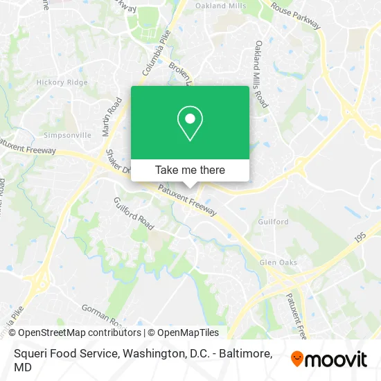
See Squeri Food Service, Howard County, on the map
Public Transit to Squeri Food Service in Howard County
Wondering how to get to Squeri Food Service in Howard County? Moovit helps you find the best way to get to Squeri Food Service with step-by-step directions from the nearest public transit station.
Moovit provides free maps and live directions to help you navigate through your city. View schedules, routes, timetables, and find out how long does it take to get to Squeri Food Service in real time.
Looking for the nearest stop or station to Squeri Food Service? Check out this list of stops closest to your destination: Patuxent Woods Dr / Community Resources Campus; Broken Land & Snowden River Sb; Broken Land Park & Ride; Guilford Rd / the Rivers Corporate Park (Westbound).
Bus: 503, 305, 315, 335, 345, 407.
Want to see if there’s another route that gets you there at an earlier time? Moovit helps you find alternative routes or times. Get directions from and directions to Squeri Food Service easily from the Moovit App or Website.
We make riding to Squeri Food Service easy, which is why over 1.5 million users, including users in Howard County, trust Moovit as the best app for public transit. You don’t need to download an individual bus app or train app, Moovit is your all-in-one transit app that helps you find the best bus time or train time available.
For information on prices of bus, costs and ride fares to Squeri Food Service, please check the Moovit app.
Get to Squeri Food Service with public transit and pay for the ride in the Moovit app. In addition to all info you may need for your trip to Squeri Food Service, including live directions, real-time arrivals and fare prices, you can also buy public transit passes for your rides. No need for cash or paper tickets to get to Squeri Food Service - everything you need is accessible in the app with a click of the button.
Use the app to navigate to popular places including to the airport, hospital, stadium, grocery store, mall, coffee shop, school, college, and university.
Squeri Food Service Address: 9755 Patuxent Woods Dr Columbia, MD 21046 street in Howard County
- Careone Services,
- Nationwide Insurance,
- Hoco Board Of Elections,
- TronBucks Coffee,
- Association of Community Services,
- Makingchange Center,
- Heritage Housing Partners Corporation,
- Camp Attaway,
- Lindaben Foundation,
- Broken Land Parkway,
- 995 Southbound Commuter Bus,
- Digital Evangelism Strategies,
- Community Development and Urban Ministries,
- The Insufficient Project,
- Stewardship Jack,
- Kennedy Krieger Institute,
- Howard County Department of Community Resources and Services,
- Mary Keane, LCSW-C,
- The Fish Bowl,
- P+R West Lot
Places Near Squeri Food Service (Howard County)
- Georgetown, Washington,
- National Museum of African American History and Culture, Washington,
- Museum Of The Bible, Washington,
- M&T Bank Stadium, Baltimore,
- Washington National Cathedral, Washington,
- Washington DC VA Medical Center, Washington,
- National Theatre, Washington,
- Camden Yards, Baltimore,
- Capital One Arena, Washington,
- Basilica of the National Shrine, Washington,
- Marriott Marquis Washington, DC, Washington,
- Pennsylvania Ave NW (3rd st and pennsylvania), Washington,
- Warner Theatre, Washington,
- Amazon Hq2, Arlington County,
- Rock Creek Tennis Center, Washington,
- Sibley Memorial Hospital, Washington,
- PG Mall, Prince George's County,
- Westfield Montgomery Mall, Montgomery County,
- National Zoo, Washington,
- The Anthem, Washington
How to get to popular places in Washington, D.C. - Baltimore, MD with public transit
Get around Howard County by public transit!
Traveling around Howard County has never been so easy. See step by step directions as you travel to any attraction, street or major public transit station. View bus and train schedules, arrival times, service alerts and detailed routes on a map, so you know exactly how to get to anywhere in Howard County.
When traveling to any destination around Howard County use Moovit's Live Directions with Get Off Notifications to know exactly where and how far to walk, how long to wait for your line, and how many stops are left. Moovit will alert you when it's time to get off — no need to constantly re-check whether yours is the next stop.
Wondering how to use public transit in Howard County or how to pay for public transit in Howard County? Moovit public transit app can help you navigate your way with public transit easily, and at minimum cost. It includes public transit fees, ticket prices, and costs. Looking for a map of Howard County public transit lines? Moovit public transit app shows all public transit maps in Howard County with all Bus, Train, Metro, Light Rail and Ferry routes and stops on an interactive map.
Washington, D.C. - Baltimore, MD has 5 transit type(s), including: Bus, Train, Metro, Light Rail and Ferry, operated by several transit agencies, including WMATA, Montgomery County Ride On, Fairfax Connector, TheBus, PRTC, DASH - Alexandria, Arlington Transit (ART), RTA of Central Maryland, MDOT MTA, MDOT MTA Light RailLink, MDOT MTA Commuter Bus, MDOT MTA Local Bus, FXBGO!, Virginia Railway Express (VRE) and MARC