Directions to Sr Ext Construction Inc (Framingham) with public transportation
The following transit lines have routes that pass near Sr Ext Construction Inc
 Bus: 02, 04N, 04S, 05, 07C.
- Train: FRAMINGHAM/WORCESTER, LAKE SHORE LIMITED.
How to get to Sr Ext Construction Inc by bus?
Click on the bus route to see step by step directions with maps, line arrival times and updated time schedules.
How to get to Sr Ext Construction Inc by train?
Click on the train route to see step by step directions with maps, line arrival times and updated time schedules.
Bus stop near Sr Ext Construction Inc in Framingham
- Bethany Hill, 13 min walk,VIEW
Train stations near Sr Ext Construction Inc in Framingham
Bus lines to Sr Ext Construction Inc in Framingham
- 04S, Shaws Supermarket,VIEW
What are the closest stations to Sr Ext Construction Inc?
The closest stations to Sr Ext Construction Inc are:
- Bethany Hill is 1100 yards away, 13 min walk.
- Framingham Amtrak is 3313 yards away, 40 min walk.
- Framingham is 3313 yards away, 39 min walk.
Which bus lines stop near Sr Ext Construction Inc?
These bus lines stop near Sr Ext Construction Inc: 02, 04N, 04S, 05, 07C.
Which train line stops near Sr Ext Construction Inc?
FRAMINGHAM/WORCESTER (#530 | South Station)
What’s the nearest bus station to Sr Ext Construction Inc in Framingham?
The nearest bus station to Sr Ext Construction Inc in Framingham is Bethany Hill. It’s a 13 min walk away.
What time is the first train to Sr Ext Construction Inc in Framingham?
The FRAMINGHAM/WORCESTER is the first train that goes to Sr Ext Construction Inc in Framingham. It stops nearby at 4:54 AM.
What time is the last train to Sr Ext Construction Inc in Framingham?
The LAKE SHORE LIMITED is the last train that goes to Sr Ext Construction Inc in Framingham. It stops nearby at 8:00 PM.
What time is the first bus to Sr Ext Construction Inc in Framingham?
The 04S is the first bus that goes to Sr Ext Construction Inc in Framingham. It stops nearby at 6:23 AM.
What time is the last bus to Sr Ext Construction Inc in Framingham?
The 04S is the last bus that goes to Sr Ext Construction Inc in Framingham. It stops nearby at 9:58 PM.
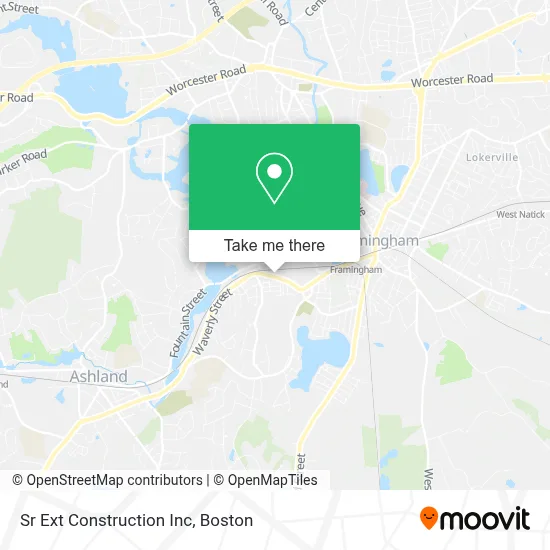
See Sr Ext Construction Inc, Framingham, on the map
Public Transit to Sr Ext Construction Inc in Framingham
Wondering how to get to Sr Ext Construction Inc in Framingham? Moovit helps you find the best way to get to Sr Ext Construction Inc with step-by-step directions from the nearest public transit station.
Moovit provides free maps and live directions to help you navigate through your city. View schedules, routes, timetables, and find out how long does it take to get to Sr Ext Construction Inc in real time.
Looking for the nearest stop or station to Sr Ext Construction Inc? Check out this list of stops closest to your destination: Bethany Hill; Framingham Amtrak; Framingham.
Bus: 02, 04N, 04S, 05, 07C.Train: FRAMINGHAM/WORCESTER, LAKE SHORE LIMITED.
Want to see if there’s another route that gets you there at an earlier time? Moovit helps you find alternative routes or times. Get directions from and directions to Sr Ext Construction Inc easily from the Moovit App or Website.
We make riding to Sr Ext Construction Inc easy, which is why over 1.7 million users, including users in Framingham, trust Moovit as the best app for public transit. You don’t need to download an individual bus app or train app, Moovit is your all-in-one transit app that helps you find the best bus time or train time available.
For information on prices of bus and train, costs and ride fares to Sr Ext Construction Inc, please check the Moovit app.
Use the app to navigate to popular places including to the airport, hospital, stadium, grocery store, mall, coffee shop, school, college, and university.
Sr Ext Construction Inc Address: 873 Waverly St street in Framingham
- Keefe Tech,
- Keefe Technical School (Keefe at Night, Continuing Education),
- Bonitalia Import,
- Belcher's Appliance Center,
- Capa Landscape & Construction,
- Service Products Co.,
- The Copper Pot and the Wooden Spoon,
- Shoprecycled,
- 135 Grill Steak House,
- Framingham Little League Complex,
- Dia Feliz Adult Day Health Center,
- Fpca,
- Nicoli Cleaning Services,
- Expresspax,
- Farm Pond Skatepark,
- Edward F Loring Skating Arena,
- Bethany Hill Place,
- Framingham 9/11 Memorial Park,
- Spentara,
- Shield Home Inspections
Places Near Sr Ext Construction Inc (Framingham)
- Faneuil Hall, Boston,
- Td Garden, Boston,
- Boston Convention & Exhibition Center, Boston,
- North End, Boston,
- Isabella Stewart Gardner Museum, Boston,
- Wilbur Theatre, Boston,
- Seaport District, Boston,
- Mgm Music Hall, Boston,
- Wang Theater, Boston,
- Boston Common, Boston,
- House Of Blues, Boston,
- Leader Bank Pavilion (Leader Bank Pavillion), Boston,
- Boston Children's Hospital, Boston,
- Cheers, Boston,
- Massachusetts General Hospital, Boston,
- Museum Of Science, Boston,
- Quincy Market, Boston,
- Prudential Center, Boston,
- Boston Medical Center, Boston,
- Castle Island, Boston
How to get to popular places in Boston with public transit
Get around Framingham by public transit!
Traveling around Framingham has never been so easy. See step by step directions as you travel to any attraction, street or major public transit station. View bus and train schedules, arrival times, service alerts and detailed routes on a map, so you know exactly how to get to anywhere in Framingham.
When traveling to any destination around Framingham use Moovit's Live Directions with Get Off Notifications to know exactly where and how far to walk, how long to wait for your line, and how many stops are left. Moovit will alert you when it's time to get off — no need to constantly re-check whether yours is the next stop.
Wondering how to use public transit in Framingham or how to pay for public transit in Framingham? Moovit public transit app can help you navigate your way with public transit easily, and at minimum cost. It includes public transit fees, ticket prices, and costs. Looking for a map of Framingham public transit lines? Moovit public transit app shows all public transit maps in Framingham with all Bus, Train, Subway and Ferry routes and stops on an interactive map.
Boston has 4 transit type(s), including: Bus, Train, Subway and Ferry, operated by several transit agencies, including MBTA, Southeastern Regional Transit Authority, MetroWest Regional Transit Authority, Rhode Island Public Transit Authority, WRTA, Lowell Regional Transit Authority, Merrimack Valley Transit, Montachusett Regional Transit Authority, Cape Cod Regional Transit Authority, Brockton Area Transit Authority, Martha's Vineyard Transit Authority, the WAVE - Nantucket Regional Transit Authority, GATRA, Cape Ann Transportation Authority and Massport