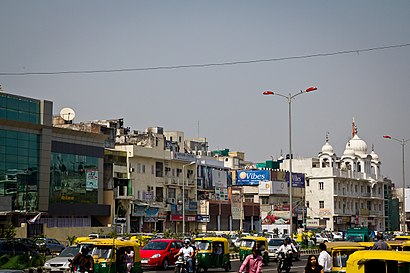
Directions to Sri Aurobindo Marg station (Delhi) with public transit
The following transit lines have routes that pass near Sri Aurobindo Marg
How to get to Sri Aurobindo Marg station by bus?
Click on the bus route to see step by step directions with maps, line arrival times and updated time schedules.
How to get to Sri Aurobindo Marg station by metro?
Click on the metro route to see step by step directions with maps, line arrival times and updated time schedules.
Bus stops near Sri Aurobindo Marg in Delhi
- IIT Gate (Aurobindo Marg), 1 min walk,
- IIT Gate, 4 min walk,
- I.I.T.Gate, 4 min walk,
- Hauz Khas (T), 7 min walk,
- Panchsheel Club / Sarvpriya Vihar, 7 min walk,
- Sarvpriya Vihar, 7 min walk,
Metro stations near Sri Aurobindo Marg in Delhi
- IIT, 10 min walk,
- Green Park, 19 min walk,
Bus lines to Sri Aurobindo Marg station in Delhi
- 505, Ajmeri Gate / Kamla Market,
- 507CL, Okhla Extension (Abul Fazl Encalve),
- 605, Mori Gate Terminal,
- 725, Inder Puri (Krishi Kunj),
- 511, Badarpur Border (T),
- 334, Delhi Sachivalaya (Rajghat Power House),
- 511A, Badarpur Border (T),
- 334, Mehrauli (T) - Delhi Secretariat (Rajghat Power House),
- 502, Mehrauli (T) - Kashmere Gate I.S.B.T (T),
- 0502 (NS), Mehrauli (T) - Old Delhi Railway Station,
- 502L, Mehrauli (T) - Kashmere Gate ISBT (T) Ladies Special,
- 511A, Dhaula Kuan - Nehru Place (T),
- 511A, Badarpur Border (T) - Dhaula Kuan,
- 516, Safdarjung (T) - Dera Village More,
- 516, Dera Village More To Safdarjung Hospital,
- 517, Safdarjung (T) - Aya Nagar (T),
- 519, Safdarjung (T) - Mandi Village,
- 536, RK Puram Sector 1 - Chattarpur Extension (Nanda Hospital),
- 605B, Safdarjung (T) - Nangal Dewat,
- 725, Mehrauli (T) - Krishi Kunj (Inderpuri),
What are the closest stations to Sri Aurobindo Marg?
The closest stations to Sri Aurobindo Marg are:
- IIT Gate (Aurobindo Marg) is 19 meters away, 1 min walk.
- IIT Gate is 260 meters away, 4 min walk.
- I.I.T.Gate is 301 meters away, 4 min walk.
- Hauz Khas (T) is 460 meters away, 7 min walk.
- Panchsheel Club / Sarvpriya Vihar is 506 meters away, 7 min walk.
- Sarvpriya Vihar is 523 meters away, 7 min walk.
- IIT is 749 meters away, 10 min walk.
- Green Park is 1433 meters away, 19 min walk.
Which bus lines stop near Sri Aurobindo Marg?
These bus lines stop near Sri Aurobindo Marg: 465A, 502, 505, 507CL, 511A, 519.
Which metro lines stop near Sri Aurobindo Marg?
These metro lines stop near Sri Aurobindo Marg: 2, 8.
What’s the nearest metro station to Sri Aurobindo Marg in Delhi?
The nearest metro station to Sri Aurobindo Marg in Delhi is IIT. It’s a 10 min walk away.
What’s the nearest bus stop to Sri Aurobindo Marg in Delhi?
The nearest bus stop to Sri Aurobindo Marg in Delhi is IIT Gate (Aurobindo Marg). It’s a 1 min walk away.
What time is the first metro to Sri Aurobindo Marg in Delhi?
The 2 is the first metro that goes to Sri Aurobindo Marg in Delhi. It stops nearby at 5:29 AM.
What time is the last metro to Sri Aurobindo Marg in Delhi?
The 2 is the last metro that goes to Sri Aurobindo Marg in Delhi. It stops nearby at 12:19 AM.
What time is the first bus to Sri Aurobindo Marg in Delhi?
The 0502 is the first bus that goes to Sri Aurobindo Marg in Delhi. It stops nearby at 3:18 AM.
What time is the last bus to Sri Aurobindo Marg in Delhi?
The 0502 is the last bus that goes to Sri Aurobindo Marg in Delhi. It stops nearby at 3:19 AM.
See Sri Aurobindo Marg, Delhi, on the map
Public Transit to Sri Aurobindo Marg in Delhi
Wondering how to get to Sri Aurobindo Marg in Delhi, India? Moovit helps you find the best way to get to Sri Aurobindo Marg with step-by-step directions from the nearest public transit station.
Moovit provides free maps and live directions to help you navigate through your city. View schedules, routes, timetables, and find out how long does it take to get to Sri Aurobindo Marg in real time.
Looking for the nearest stop or station to Sri Aurobindo Marg? Check out this list of stops closest to your destination: IIT Gate (Aurobindo Marg); IIT Gate; I.I.T.Gate; Hauz Khas (T); Panchsheel Club / Sarvpriya Vihar; Sarvpriya Vihar; IIT; Green Park.
Bus: 465A, 502, 505, 507CL, 511A, 519, 605, 725, 511, 334, 0502 (NS), 502L, 334.Metro: 2, 8.
Want to see if there’s another route that gets you there at an earlier time? Moovit helps you find alternative routes or times. Get directions from and directions to Sri Aurobindo Marg easily from the Moovit App or Website.
We make riding to Sri Aurobindo Marg easy, which is why over 1.5 million users, including users in Delhi, trust Moovit as the best app for public transit. You don’t need to download an individual bus app or train app, Moovit is your all-in-one transit app that helps you find the best bus time or train time available.
For information on prices of bus and metro, costs and ride fares to Sri Aurobindo Marg, please check the Moovit app.
Use the app to navigate to popular places including to the airport, hospital, stadium, grocery store, mall, coffee shop, school, college, and university.
Sri Aurobindo Marg Address: Sri Aurobindo Marg, Block K, Hauz Khas Enclave, Hauz Khas, New Delhi, Delhi 110016, India street in Delhi
Places Near Sri Aurobindo Marg (Delhi)
Get around Delhi by public transit!
Traveling around Delhi has never been so easy. See step by step directions as you travel to any attraction, street or major public transit station. View bus and train schedules, arrival times, service alerts and detailed routes on a map, so you know exactly how to get to anywhere in Delhi.
When traveling to any destination around Delhi use Moovit's Live Directions with Get Off Notifications to know exactly where and how far to walk, how long to wait for your line, and how many stops are left. Moovit will alert you when it's time to get off — no need to constantly re-check whether yours is the next stop.
Wondering how to use public transit in Delhi or how to pay for public transit in Delhi? Moovit public transit app can help you navigate your way with public transit easily, and at minimum cost. It includes public transit fees, ticket prices, and costs. Looking for a map of Delhi public transit lines? Moovit public transit app shows all public transit maps in Delhi with all Bus, Train and Metro routes and stops on an interactive map.
New Delhi has 3 transit type(s), including: Bus, Train and Metro, operated by several transit agencies, including Delhi Metro Rail Corporation (DMRC), Delhi Transport Corporation (DTC), Northern Railways, Noida Metro Rail corporation, DTC Night Bus, GMCBL (Gurugram Metropolitan City Bus Limited), Delhi Integrated Multi-Modal Transit System Ltd., Delhi Metro Rail Corporation, DTC AC Services, DIMTS AC Buses, DTC Express Buses, DIMTS (Delhi Integrated Multi-Modal Transit System Ltd.), DMRC Feeder AC E-Buses, AC bus lines and Airport AC bus lines