Directions to St Agnes Parish (Arlington) with public transportation
The following transit lines have routes that pass near St Agnes Parish
 Bus: 67, 77, 80, 95, 87.
- Train: LOWELL, FITCHBURG.
- Subway: RED LINE, GREEN LINE B, GREEN LINE C, GREEN LINE E.
How to get to St Agnes Parish by bus?
Click on the bus route to see step by step directions with maps, line arrival times and updated time schedules.
From The Salty Pig, Boston
60 minFrom Raising Cane's, Boston
60 minFrom Downtown, Boston
69 minFrom Primark Boston, Boston
72 minFrom Endicott College Boston, Boston
63 minFrom Sanofi-aventis, Cambridge
50 minFrom Reelhouse, Boston
99 minFrom Coolidge Corner Theatre, Brookline
61 minFrom Macy's, Boston
70 minFrom MIT Lincoln Laboratory, Lexington
73 min
How to get to St Agnes Parish by train?
Click on the train route to see step by step directions with maps, line arrival times and updated time schedules.
How to get to St Agnes Parish by subway?
Click on the subway route to see step by step directions with maps, line arrival times and updated time schedules.
From The Salty Pig, Boston
69 minFrom Raising Cane's, Boston
90 minFrom Downtown, Boston
60 minFrom Primark Boston, Boston
60 minFrom Endicott College Boston, Boston
63 minFrom Sanofi-aventis, Cambridge
60 minFrom Reelhouse, Boston
83 minFrom Coolidge Corner Theatre, Brookline
88 minFrom Macy's, Boston
60 min
Bus stops near St Agnes Parish in Arlington
Train stations near St Agnes Parish in Arlington
Subway stations near St Agnes Parish in Arlington
Bus lines to St Agnes Parish in Arlington
What are the closest stations to St Agnes Parish?
The closest stations to St Agnes Parish are:
- Broadway @ Franklin St is 21 yards away, 1 min walk.
- Massachusetts Ave @ Franklin St is 86 yards away, 2 min walk.
- Massachusetts Ave @ Peg Spengler Way is 189 yards away, 3 min walk.
- Medford St @ Massachusetts Ave is 280 yards away, 4 min walk.
- Belmont is 2790 yards away, 33 min walk.
- West Medford is 3356 yards away, 39 min walk.
- Medford/Tufts Station is 3653 yards away, 43 min walk.
- Alewife is 4287 yards away, 51 min walk.
Which bus lines stop near St Agnes Parish?
These bus lines stop near St Agnes Parish: 67, 77, 80, 95.
Which train line stops near St Agnes Parish?
LOWELL (#327 | Lowell)
Which subway line stops near St Agnes Parish?
RED LINE (Alewife)
What’s the nearest bus station to St Agnes Parish in Arlington?
The nearest bus station to St Agnes Parish in Arlington is Broadway @ Franklin St. It’s a 1 min walk away.
What time is the first subway to St Agnes Parish in Arlington?
The GREEN LINE E is the first subway that goes to St Agnes Parish in Arlington. It stops nearby at 4:57 AM.
What time is the last subway to St Agnes Parish in Arlington?
The GREEN LINE E is the last subway that goes to St Agnes Parish in Arlington. It stops nearby at 2:41 AM.
What time is the first train to St Agnes Parish in Arlington?
The LOWELL is the first train that goes to St Agnes Parish in Arlington. It stops nearby at 5:31 AM.
What time is the last train to St Agnes Parish in Arlington?
The LOWELL is the last train that goes to St Agnes Parish in Arlington. It stops nearby at 12:20 AM.
What time is the first bus to St Agnes Parish in Arlington?
The 77 is the first bus that goes to St Agnes Parish in Arlington. It stops nearby at 4:53 AM.
What time is the last bus to St Agnes Parish in Arlington?
The 87 is the last bus that goes to St Agnes Parish in Arlington. It stops nearby at 1:43 AM.
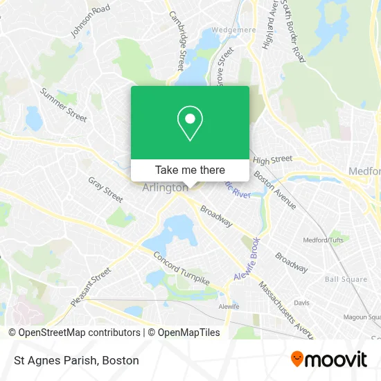
See St Agnes Parish, Arlington, on the map
Public Transit to St Agnes Parish in Arlington
Wondering how to get to St Agnes Parish in Arlington? Moovit helps you find the best way to get to St Agnes Parish with step-by-step directions from the nearest public transit station.
Moovit provides free maps and live directions to help you navigate through your city. View schedules, routes, timetables, and find out how long does it take to get to St Agnes Parish in real time.
Looking for the nearest stop or station to St Agnes Parish? Check out this list of stops closest to your destination: Broadway @ Franklin St; Massachusetts Ave @ Franklin St; Massachusetts Ave @ Peg Spengler Way; Medford St @ Massachusetts Ave; Belmont; West Medford; Medford/Tufts Station; Alewife.
Bus: 67, 77, 80, 95, 87, 350.Train: LOWELL, FITCHBURG.Subway: RED LINE, GREEN LINE B, GREEN LINE C, GREEN LINE E.
Want to see if there’s another route that gets you there at an earlier time? Moovit helps you find alternative routes or times. Get directions from and directions to St Agnes Parish easily from the Moovit App or Website.
We make riding to St Agnes Parish easy, which is why over 1.7 million users, including users in Arlington, trust Moovit as the best app for public transit. You don’t need to download an individual bus app or train app, Moovit is your all-in-one transit app that helps you find the best bus time or train time available.
For information on prices of bus, subway and train, costs and ride fares to St Agnes Parish, please check the Moovit app.
Use the app to navigate to popular places including to the airport, hospital, stadium, grocery store, mall, coffee shop, school, college, and university.
St Agnes Parish Address: 51 Medford St street in Arlington
- Arlington Catholic High School,
- St Agnes Grammar School (Saint Agnes School Arlington, MA),
- Real Money Casino. Play Online Slots with Real Money,
- Mls Property Information Network, Inc.,
- Klassical Kidz Music Studio,
- Regent Theatre,
- Locksmith Store In Arlington,
- Citizens Bank & Trust,
- Thai Style Combination,
- The Daily Bloom,
- Davis Squared,
- Mind's Eye Yarns,
- Pasciuto Frank - FFP Realty Corporation,
- Carpet Cleaning,
- STARBUCKS,
- Wireless Zone,
- Affordable Locksmith,
- Age Against the Machine,
- Robert Gilmore Landscape Design,
- Charlie's Barkery
Places Near St Agnes Parish (Arlington)
- Castle Island, Boston,
- Leader Bank Pavilion (Leader Bank Pavillion), Boston,
- Prudential Center, Boston,
- Seaport District, Boston,
- Boston Medical Center, Boston,
- North End, Boston,
- Mgm Music Hall, Boston,
- Faneuil Hall, Boston,
- Cheers, Boston,
- Boston Convention & Exhibition Center, Boston,
- Td Garden, Boston,
- Museum Of Science, Boston,
- Boston Common, Boston,
- Wang Theater, Boston,
- Massachusetts General Hospital, Boston,
- Wilbur Theatre, Boston,
- Boston Children's Hospital, Boston,
- Isabella Stewart Gardner Museum, Boston,
- House Of Blues, Boston,
- Quincy Market, Boston
How to get to popular places in Boston with public transit
Get around Arlington by public transit!
Traveling around Arlington has never been so easy. See step by step directions as you travel to any attraction, street or major public transit station. View bus and train schedules, arrival times, service alerts and detailed routes on a map, so you know exactly how to get to anywhere in Arlington.
When traveling to any destination around Arlington use Moovit's Live Directions with Get Off Notifications to know exactly where and how far to walk, how long to wait for your line, and how many stops are left. Moovit will alert you when it's time to get off — no need to constantly re-check whether yours is the next stop.
Wondering how to use public transit in Arlington or how to pay for public transit in Arlington? Moovit public transit app can help you navigate your way with public transit easily, and at minimum cost. It includes public transit fees, ticket prices, and costs. Looking for a map of Arlington public transit lines? Moovit public transit app shows all public transit maps in Arlington with all Bus, Train, Subway and Ferry routes and stops on an interactive map.
Boston has 4 transit type(s), including: Bus, Train, Subway and Ferry, operated by several transit agencies, including MBTA, Southeastern Regional Transit Authority, MetroWest Regional Transit Authority, Rhode Island Public Transit Authority, WRTA, Lowell Regional Transit Authority, Merrimack Valley Transit, Montachusett Regional Transit Authority, Cape Cod Regional Transit Authority, Brockton Area Transit Authority, Martha's Vineyard Transit Authority, the WAVE - Nantucket Regional Transit Authority, GATRA, Cape Ann Transportation Authority and Massport