Directions to St. James Theatre (Boston) with public transportation
The following transit lines have routes that pass near St. James Theatre
 Bus: 1, 39, 43, 9, GREEN LINE E SHUTTLE.
- Train: FITCHBURG, NEEDHAM, NEWBURYPORT/ROCKPORT.
- Subway: GREEN LINE D, GREEN LINE E, ORANGE LINE, GREEN LINE B, GREEN LINE C.
How to get to St. James Theatre by bus?
Click on the bus route to see step by step directions with maps, line arrival times and updated time schedules.
From Dorchester District Court, Boston
52 minFrom Canobie Lake Park, Chelsea
70 minFrom Highland Ave Somerville MA, Somerville
50 minFrom Beth Israel Deaconess Hospital-Milton, Milton
82 minFrom Uscis Biometrics Office, Revere
63 minFrom Arlington, MA, Arlington
69 minFrom Comfort Inn & Suites Logan International Airport, Revere
64 minFrom 7F Everett Street, Revere
63 minFrom Newton, MA, Newton
56 minFrom The Burren, Somerville
49 min
How to get to St. James Theatre by train?
Click on the train route to see step by step directions with maps, line arrival times and updated time schedules.
How to get to St. James Theatre by subway?
Click on the subway route to see step by step directions with maps, line arrival times and updated time schedules.
From Dorchester District Court, Boston
48 minFrom Highland Ave Somerville MA, Somerville
47 minFrom Beth Israel Deaconess Hospital-Milton, Milton
76 minFrom Uscis Biometrics Office, Revere
47 minFrom Comfort Inn & Suites Logan International Airport, Revere
48 minFrom 7F Everett Street, Revere
45 minFrom Newton, MA, Newton
43 minFrom The Burren, Somerville
35 min
Bus stops near St. James Theatre in Boston
Subway stations near St. James Theatre in Boston
Bus lines to St. James Theatre in Boston
- 9, Kenmore Via Boston Latin,VIEW
- 39, Haymarket Via Forest Hills,VIEW
- GREEN LINE E SHUTTLE, Park Street (Shuttle),VIEW
- GREEN LINE E SHUTTLE, Prudential (Shuttle),VIEW
- 1, Harvard,VIEW
- 55, West Fenway,VIEW
- 57, Watertown Via Kenmore,VIEW
- 1 BU (CHARLES RIVER-MEDICAL CAMPUS), Comm Ave @ Buick St,VIEW
- ORANGE LINE SHUTTLE, Ruggles - Copley,VIEW
- ORANGE LINE SHUTTLE, Forest Hills - Back Bay (Shuttle),VIEW
- ORANGE LINE SHUTTLE, Forest Hills - Copley,VIEW
- ORANGE LINE SHUTTLE, Forest Hills - Back Bay via Ruggles Busway (Shuttle),VIEW
- ORANGE LINE SHUTTLE, Ruggles - Back Bay,VIEW
- ORANGE LINE SHUTTLE, Jackson Square - Copley,VIEW
- ORANGE LINE SHUTTLE, Jackson Square - Back Bay,VIEW
- ORANGE LINE SHUTTLE, Forest Hills - Back Bay via Copley (Shuttle),VIEW
What are the closest stations to St. James Theatre?
The closest stations to St. James Theatre are:
- Huntington Ave @ Gainsborough St is 185 yards away, 3 min walk.
- Massachusetts Ave @ Huntington Ave is 313 yards away, 4 min walk.
- Hynes Convention Center is 390 yards away, 5 min walk.
- Northeastern University is 406 yards away, 5 min walk.
- Dalton St @ Belvidere St is 436 yards away, 6 min walk.
- Mass Ave T Station (To Crc) is 443 yards away, 6 min walk.
- Massachusetts Ave Station - Shuttle is 713 yards away, 9 min walk.
- Massachusetts Ave. is 959 yards away, 12 min walk.
Which bus lines stop near St. James Theatre?
These bus lines stop near St. James Theatre: 1, 39, 43.
Which train lines stop near St. James Theatre?
These train lines stop near St. James Theatre: FITCHBURG, NEEDHAM, NEWBURYPORT/ROCKPORT.
Which subway lines stop near St. James Theatre?
These subway lines stop near St. James Theatre: GREEN LINE D, GREEN LINE E, ORANGE LINE.
What’s the nearest subway station to St. James Theatre in Boston?
The nearest subway stations to St. James Theatre in Boston are Hynes Convention Center and Northeastern University. The closest one is a 5 min walk away.
What’s the nearest bus station to St. James Theatre in Boston?
The nearest bus station to St. James Theatre in Boston is Huntington Ave @ Gainsborough St. It’s a 3 min walk away.
What time is the first subway to St. James Theatre in Boston?
The GREEN LINE D is the first subway that goes to St. James Theatre in Boston. It stops nearby at 5:03 AM.
What time is the last subway to St. James Theatre in Boston?
The GREEN LINE D is the last subway that goes to St. James Theatre in Boston. It stops nearby at 2:15 AM.
What time is the first bus to St. James Theatre in Boston?
The 1 is the first bus that goes to St. James Theatre in Boston. It stops nearby at 4:47 AM.
What time is the last bus to St. James Theatre in Boston?
The 1 is the last bus that goes to St. James Theatre in Boston. It stops nearby at 2:35 AM.
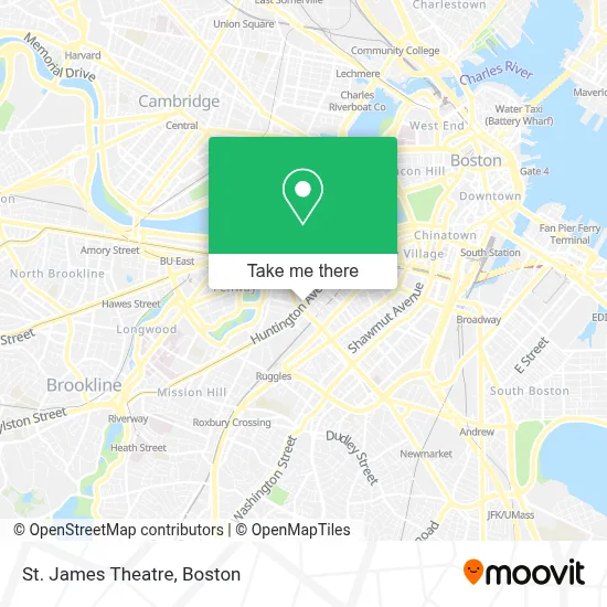
See St. James Theatre, Boston, on the map
Public Transit to St. James Theatre in Boston
Wondering how to get to St. James Theatre in Boston? Moovit helps you find the best way to get to St. James Theatre with step-by-step directions from the nearest public transit station.
Moovit provides free maps and live directions to help you navigate through your city. View schedules, routes, timetables, and find out how long does it take to get to St. James Theatre in real time.
Looking for the nearest stop or station to St. James Theatre? Check out this list of stops closest to your destination: Huntington Ave @ Gainsborough St; Massachusetts Ave @ Huntington Ave; Hynes Convention Center; Northeastern University; Dalton St @ Belvidere St; Mass Ave T Station (To Crc); Massachusetts Ave Station - Shuttle; Massachusetts Ave..
Bus: 1, 39, 43, 9, GREEN LINE E SHUTTLE, GREEN LINE E SHUTTLE, 55, 57.Train: FITCHBURG, NEEDHAM, NEWBURYPORT/ROCKPORT.Subway: GREEN LINE D, GREEN LINE E, ORANGE LINE, GREEN LINE B, GREEN LINE C.
Want to see if there’s another route that gets you there at an earlier time? Moovit helps you find alternative routes or times. Get directions from and directions to St. James Theatre easily from the Moovit App or Website.
We make riding to St. James Theatre easy, which is why over 1.7 million users, including users in Boston, trust Moovit as the best app for public transit. You don’t need to download an individual bus app or train app, Moovit is your all-in-one transit app that helps you find the best bus time or train time available.
For information on prices of bus, subway and train, costs and ride fares to St. James Theatre, please check the Moovit app.
Use the app to navigate to popular places including to the airport, hospital, stadium, grocery store, mall, coffee shop, school, college, and university.
St. James Theatre Address: Belvidere Parking Garage street in Boston
- Christian Science Plaza Parking Garage,
- SemaConnect,
- Boston Symphony Orchestra,
- Huntington Avenue & Massachusetts Avenue,
- Tanglewood Music Center,
- MBTA Bus Route CT1,
- Christian Science Plaza,
- The Midtown Hotel,
- The First Church of Christ Scientist,
- Symphony Hall,
- Boston Pops Concert,
- Blick Art Materials,
- Caffe Bene (Caffe Peace),
- Christian Science Reflecting Pool,
- Caffe Bene,
- Symphony Station,
- Fenway Construction and Masonry,
- Lincoln Heritage,
- The Westland,
- Oakleaf Cakes
Places Near St. James Theatre (Boston)
- Wang Theater, Boston,
- Museum Of Science, Boston,
- Massachusetts General Hospital, Boston,
- Isabella Stewart Gardner Museum, Boston,
- Seaport District, Boston,
- Boston Common, Boston,
- Wilbur Theatre, Boston,
- Boston Medical Center, Boston,
- Td Garden, Boston,
- House Of Blues, Boston,
- Boston Convention & Exhibition Center, Boston,
- Leader Bank Pavilion (Leader Bank Pavillion), Boston,
- North End, Boston,
- Castle Island, Boston,
- Cheers, Boston,
- Prudential Center, Boston,
- Mgm Music Hall, Boston,
- Faneuil Hall, Boston,
- Quincy Market, Boston,
- Boston Children's Hospital, Boston
How to get to popular places in Boston with public transit
Get around Boston by public transit!
Traveling around Boston has never been so easy. See step by step directions as you travel to any attraction, street or major public transit station. View bus and train schedules, arrival times, service alerts and detailed routes on a map, so you know exactly how to get to anywhere in Boston.
When traveling to any destination around Boston use Moovit's Live Directions with Get Off Notifications to know exactly where and how far to walk, how long to wait for your line, and how many stops are left. Moovit will alert you when it's time to get off — no need to constantly re-check whether yours is the next stop.
Wondering how to use public transit in Boston or how to pay for public transit in Boston? Moovit public transit app can help you navigate your way with public transit easily, and at minimum cost. It includes public transit fees, ticket prices, and costs. Looking for a map of Boston public transit lines? Moovit public transit app shows all public transit maps in Boston with all Bus, Train, Subway and Ferry routes and stops on an interactive map.
Boston has 4 transit type(s), including: Bus, Train, Subway and Ferry, operated by several transit agencies, including MBTA, Southeastern Regional Transit Authority, MetroWest Regional Transit Authority, Rhode Island Public Transit Authority, WRTA, Lowell Regional Transit Authority, Merrimack Valley Transit, Montachusett Regional Transit Authority, Cape Cod Regional Transit Authority, Brockton Area Transit Authority, Martha's Vineyard Transit Authority, the WAVE - Nantucket Regional Transit Authority, GATRA, Cape Ann Transportation Authority and Massport