Directions to St. John-St. Paul Catholic Collaborative (Wellesley) with public transportation
The following transit lines have routes that pass near St. John-St. Paul Catholic Collaborative
 Bus: 01, 558, 59.
- Train: FRAMINGHAM/WORCESTER.
- Subway: GREEN LINE D.
How to get to St. John-St. Paul Catholic Collaborative by bus?
Click on the bus route to see step by step directions with maps, line arrival times and updated time schedules.
From FOUR POINTS BY SHERATON Boston Newton, Newton
55 minFrom Watertown, MA, Watertown Town
82 minFrom Spaulding Rehabilitation Center, Boston
84 minFrom Warren St, Boston
78 minFrom New Balance, Boston
84 minFrom Boston Children's Hospital at Waltham, Waltham
49 minFrom VA Hospital, Boston
105 minFrom AC Hotel by Marriott Boston Cleveland Circle, Boston
106 minFrom Sonia, Boston
84 minFrom The TJX Companies Inc., Framingham
60 min
How to get to St. John-St. Paul Catholic Collaborative by train?
Click on the train route to see step by step directions with maps, line arrival times and updated time schedules.
How to get to St. John-St. Paul Catholic Collaborative by subway?
Click on the subway route to see step by step directions with maps, line arrival times and updated time schedules.
Bus stop near St. John-St. Paul Catholic Collaborative in Wellesley
- Lower Falls (Washington St/Concord St), 3 min walk,VIEW
Train station near St. John-St. Paul Catholic Collaborative in Wellesley
- Wellesley Hills, 30 min walk,VIEW
Subway station near St. John-St. Paul Catholic Collaborative in Wellesley
- Woodland, 50 min walk,VIEW
Bus lines to St. John-St. Paul Catholic Collaborative in Wellesley
- 01, Natick Mall - Wegmans,VIEW
What are the closest stations to St. John-St. Paul Catholic Collaborative?
The closest stations to St. John-St. Paul Catholic Collaborative are:
- Lower Falls (Washington St/Concord St) is 225 yards away, 3 min walk.
- Wellesley Hills is 2473 yards away, 30 min walk.
- Woodland is 4274 yards away, 50 min walk.
Which bus lines stop near St. John-St. Paul Catholic Collaborative?
These bus lines stop near St. John-St. Paul Catholic Collaborative: 01, 558, 59.
Which train line stops near St. John-St. Paul Catholic Collaborative?
FRAMINGHAM/WORCESTER (#521 | Worcester)
Which subway line stops near St. John-St. Paul Catholic Collaborative?
GREEN LINE D (Riverside)
What’s the nearest train station to St. John-St. Paul Catholic Collaborative in Wellesley?
The nearest train station to St. John-St. Paul Catholic Collaborative in Wellesley is Wellesley Hills. It’s a 30 min walk away.
What’s the nearest bus station to St. John-St. Paul Catholic Collaborative in Wellesley?
The nearest bus station to St. John-St. Paul Catholic Collaborative in Wellesley is Lower Falls (Washington St/Concord St). It’s a 3 min walk away.
What time is the first subway to St. John-St. Paul Catholic Collaborative in Wellesley?
The GREEN LINE D is the first subway that goes to St. John-St. Paul Catholic Collaborative in Wellesley. It stops nearby at 4:45 AM.
What time is the last subway to St. John-St. Paul Catholic Collaborative in Wellesley?
The GREEN LINE D is the last subway that goes to St. John-St. Paul Catholic Collaborative in Wellesley. It stops nearby at 2:48 AM.
What time is the first train to St. John-St. Paul Catholic Collaborative in Wellesley?
The FRAMINGHAM/WORCESTER is the first train that goes to St. John-St. Paul Catholic Collaborative in Wellesley. It stops nearby at 5:09 AM.
What time is the last train to St. John-St. Paul Catholic Collaborative in Wellesley?
The FRAMINGHAM/WORCESTER is the last train that goes to St. John-St. Paul Catholic Collaborative in Wellesley. It stops nearby at 12:29 AM.
What time is the first bus to St. John-St. Paul Catholic Collaborative in Wellesley?
The 01 is the first bus that goes to St. John-St. Paul Catholic Collaborative in Wellesley. It stops nearby at 6:12 AM.
What time is the last bus to St. John-St. Paul Catholic Collaborative in Wellesley?
The 01 is the last bus that goes to St. John-St. Paul Catholic Collaborative in Wellesley. It stops nearby at 8:39 PM.
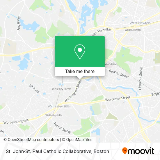
See St. John-St. Paul Catholic Collaborative, Wellesley, on the map
Public Transit to St. John-St. Paul Catholic Collaborative in Wellesley
Wondering how to get to St. John-St. Paul Catholic Collaborative in Wellesley? Moovit helps you find the best way to get to St. John-St. Paul Catholic Collaborative with step-by-step directions from the nearest public transit station.
Moovit provides free maps and live directions to help you navigate through your city. View schedules, routes, timetables, and find out how long does it take to get to St. John-St. Paul Catholic Collaborative in real time.
Looking for the nearest stop or station to St. John-St. Paul Catholic Collaborative? Check out this list of stops closest to your destination: Lower Falls (Washington St/Concord St); Wellesley Hills; Woodland.
Bus: 01, 558, 59.Train: FRAMINGHAM/WORCESTER.Subway: GREEN LINE D.
Want to see if there’s another route that gets you there at an earlier time? Moovit helps you find alternative routes or times. Get directions from and directions to St. John-St. Paul Catholic Collaborative easily from the Moovit App or Website.
We make riding to St. John-St. Paul Catholic Collaborative easy, which is why over 1.7 million users, including users in Wellesley, trust Moovit as the best app for public transit. You don’t need to download an individual bus app or train app, Moovit is your all-in-one transit app that helps you find the best bus time or train time available.
For information on prices of bus, train and subway, costs and ride fares to St. John-St. Paul Catholic Collaborative, please check the Moovit app.
Use the app to navigate to popular places including to the airport, hospital, stadium, grocery store, mall, coffee shop, school, college, and university.
St. John-St. Paul Catholic Collaborative Address: 39 Washington St street in Wellesley
- St. John Parish Center,
- Oasis Wealth Advisors - Ameriprise Financial Services, Llc,
- Accountable Healthcare Staffing,
- Datamart,
- Cav Insurance Agency, Inc.,
- Wellesley Dental Arts,
- Shawn Avery, Crpc,
- David Reilly - Financial Advisor, Ameriprise Financial Services, Llc,
- Smr It Consulting,
- Patti Ayer,
- A Iga,
- Brett Swanson - Ameriprise Financial Advisor,
- Richmond Stephen,
- The Coleman Institute,
- Flourish Medical Aesthetics,
- Lmml,
- New England Private Wealth Advisors, Llc,
- Winnick Insurance Inc,
- All State Endoscopy, Llc,
- Waypoint Medical
Places Near St. John-St. Paul Catholic Collaborative (Wellesley)
- Museum Of Science, Boston,
- Wilbur Theatre, Boston,
- Td Garden, Boston,
- Quincy Market, Boston,
- Wang Theater, Boston,
- Boston Convention & Exhibition Center, Boston,
- Boston Common, Boston,
- Faneuil Hall, Boston,
- Mgm Music Hall, Boston,
- Seaport District, Boston,
- Leader Bank Pavilion (Leader Bank Pavillion), Boston,
- Cheers, Boston,
- Isabella Stewart Gardner Museum, Boston,
- Boston Medical Center, Boston,
- Boston Children's Hospital, Boston,
- Castle Island, Boston,
- North End, Boston,
- House Of Blues, Boston,
- Prudential Center, Boston,
- Massachusetts General Hospital, Boston
How to get to popular places in Boston with public transit
Get around Wellesley by public transit!
Traveling around Wellesley has never been so easy. See step by step directions as you travel to any attraction, street or major public transit station. View bus and train schedules, arrival times, service alerts and detailed routes on a map, so you know exactly how to get to anywhere in Wellesley.
When traveling to any destination around Wellesley use Moovit's Live Directions with Get Off Notifications to know exactly where and how far to walk, how long to wait for your line, and how many stops are left. Moovit will alert you when it's time to get off — no need to constantly re-check whether yours is the next stop.
Wondering how to use public transit in Wellesley or how to pay for public transit in Wellesley? Moovit public transit app can help you navigate your way with public transit easily, and at minimum cost. It includes public transit fees, ticket prices, and costs. Looking for a map of Wellesley public transit lines? Moovit public transit app shows all public transit maps in Wellesley with all Bus, Train, Subway and Ferry routes and stops on an interactive map.
Boston has 4 transit type(s), including: Bus, Train, Subway and Ferry, operated by several transit agencies, including MBTA, Southeastern Regional Transit Authority, MetroWest Regional Transit Authority, Rhode Island Public Transit Authority, WRTA, Lowell Regional Transit Authority, Merrimack Valley Transit, Montachusett Regional Transit Authority, Cape Cod Regional Transit Authority, Brockton Area Transit Authority, Martha's Vineyard Transit Authority, the WAVE - Nantucket Regional Transit Authority, GATRA, Cape Ann Transportation Authority and Massport