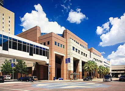
See St Joseph Medical Center, Houston, on the map
Directions to St Joseph Medical Center (Houston) with public transportation
The following transit lines have routes that pass near St Joseph Medical Center
 Bus:
Bus: - Light Rail:
How to get to St Joseph Medical Center by bus?
Click on the bus route to see step by step directions with maps, line arrival times and updated time schedules.
Bus stations near St Joseph Medical Center in Houston
- Austin & Jefferson,2 min walk,
- St Joseph Pkwy @ La Branch St,2 min walk,
- Pierce St @ La Branch St,3 min walk,
- San Jacinto St @ Leeland St,5 min walk,
- San Jacinto St @ St Joseph Pkwy,6 min walk,
- St Joseph Pkwy @ San Jacinto St,6 min walk,
Light Rail stations near St Joseph Medical Center in Houston
- Main Street Square (Southbound),4 min walk,
Bus lines to St Joseph Medical Center in Houston
- 244,Downtown / Via Eastwood Tc - Inbound,
- 247,Downtown - Inbound,
- 249,Downtown / Via Eastwood Tc - Inbound,
- 11,Gellhorn & 610 - Northbound,
- 51,Lbj Hospital - Northbound,
- 52,Mesa Tc - Northbound,
- 137,Denver Harbor Tc - Eastbound,
- 6,Greenspoint Tc - Northbound,
- 44,Louetta Rd - Northbound,
- 102,Terminal C - Outbound,
What are the closest stations to St Joseph Medical Center?
The closest stations to St Joseph Medical Center are:
- Austin & Jefferson is 52 yards away, 2 min walk.
- St Joseph Pkwy @ La Branch St is 83 yards away, 2 min walk.
- Pierce St @ La Branch St is 197 yards away, 3 min walk.
- Main Street Square (Southbound) is 278 yards away, 4 min walk.
- San Jacinto St @ Leeland St is 294 yards away, 5 min walk.
- San Jacinto St @ St Joseph Pkwy is 372 yards away, 6 min walk.
- St Joseph Pkwy @ San Jacinto St is 373 yards away, 6 min walk.
Which bus lines stop near St Joseph Medical Center?
These bus lines stop near St Joseph Medical Center: 11, 161, 32, 51, 52.
Which light rail line stops near St Joseph Medical Center?
700
What’s the nearest light rail station to St Joseph Medical Center in Houston?
The nearest light rail station to St Joseph Medical Center in Houston is Main Street Square (Southbound). It’s a 4 min walk away.
What’s the nearest bus stop to St Joseph Medical Center in Houston?
The nearest bus stops to St Joseph Medical Center in Houston are Austin & Jefferson and St Joseph Pkwy @ La Branch St. The closest one is a 2 min walk away.
What time is the first light rail to St Joseph Medical Center in Houston?
The 700 is the first light rail that goes to St Joseph Medical Center in Houston. It stops nearby at 3:50 AM.
What time is the last light rail to St Joseph Medical Center in Houston?
The 700 is the last light rail that goes to St Joseph Medical Center in Houston. It stops nearby at 12:53 AM.
What time is the first bus to St Joseph Medical Center in Houston?
The 6 is the first bus that goes to St Joseph Medical Center in Houston. It stops nearby at 4:21 AM.
What time is the last bus to St Joseph Medical Center in Houston?
The 137 is the last bus that goes to St Joseph Medical Center in Houston. It stops nearby at 12:55 AM.
How much is the bus fare to St Joseph Medical Center?
The bus fare to St Joseph Medical Center costs about $1.25.
How much is the light rail fare to St Joseph Medical Center?
The light rail fare to St Joseph Medical Center costs about $1.25.
See St Joseph Medical Center, Houston, on the map
Public Transit to St Joseph Medical Center in Houston
Wondering how to get to St Joseph Medical Center in Houston, United States? Moovit helps you find the best way to get to St Joseph Medical Center with step-by-step directions from the nearest public transit station.
Moovit provides free maps and live directions to help you navigate through your city. View schedules, routes, timetables, and find out how long does it take to get to St Joseph Medical Center in real time.
Looking for the nearest stop or station to St Joseph Medical Center? Check out this list of stops closest to your destination: Austin & Jefferson; St Joseph Pkwy @ La Branch St; Pierce St @ La Branch St; Main Street Square (Southbound); San Jacinto St @ Leeland St; San Jacinto St @ St Joseph Pkwy; St Joseph Pkwy @ San Jacinto St.
Bus:Light Rail:
Want to see if there’s another route that gets you there at an earlier time? Moovit helps you find alternative routes or times. Get directions from and directions to St Joseph Medical Center easily from the Moovit App or Website.
We make riding to St Joseph Medical Center easy, which is why over 1.5 million users, including users in Houston, trust Moovit as the best app for public transit. You don’t need to download an individual bus app or train app, Moovit is your all-in-one transit app that helps you find the best bus time or train time available.
For information on prices of bus and light rail, costs and ride fares to St Joseph Medical Center, please check the Moovit app.
Use the app to navigate to popular places including to the airport, hospital, stadium, grocery store, mall, coffee shop, school, college, and university.
Location: Houston
Attractions near St Joseph Medical Center
St Joseph Pkwy @ Austin St,St. Joseph's Hospital,Saint Joseph Medical Center,Stacey Wells, MD,Fernando Bueso, M.D., P.A. and Francisco J. Bueso, M.D,Sports Medicine & Joint Preservation Center: Michael Trice, MD,Gulf Coast Urology,Rosemary Buckle, MD,Majaz Khan, do,Farris Blount, MD,Biggs & Collins Aesthetic Plastic Surgery,Canaan L Harris,Ava Waskho, DPM,Joslin Diabetes Center Affiliated at St. Joseph Medical Center,Leo Lapuerta, MD,1711 Caroline,St. Joseph Womens Medical Center,Island1515 Kitchen & Rhum Bar,Prosperity Bank,Pierce St @ Austin StHow to get to popular attractions in Houston with public transit
Memorial City Mall, Houston,Jollibee, Houston,ISKCON Houston, Houston,Beltway 8 & Hwy 59, Houston,Cesar E Chavez High School, Houston,Metro Fallbrook Operations Facility, Houston,EZ Tag Store, Houston,Lupe Tortilla Mexican Restaurant, Houston,Downtown Houston, Houston,610 & McCarty, Houston,Sam Houston Tollway & 249,Intersection of Treaschwig Road & FM 1960, Houston,Almeda-Genoa Rd & 288 South Fwy, Houston,Pappasito's Cantina, Houston,Ecopark Shuttle Bus, Houston,FKM, Houston,FM 1960 at Kuykendahl, Houston,Golden Corral, Houston,Hwy 249 Tomball Parkway / Sam Houston Tollway, Houston,METRO Cypress Park & RideGet around Houston by public transit!
Traveling around Houston has never been so easy. See step by step directions as you travel to any attraction, street or major public transit station. View bus and train schedules, arrival times, service alerts and detailed routes on a map, so you know exactly how to get to anywhere in Houston.
When traveling to any destination around Houston use Moovit's Live Directions with Get Off Notifications to know exactly where and how far to walk, how long to wait for your line, and how many stops are left. Moovit will alert you when it's time to get off — no need to constantly re-check whether yours is the next stop.
Wondering how to use public transit in Houston or how to pay for public transit in Houston? Moovit public transit app can help you navigate your way with public transit easily, and at minimum cost. It includes public transit fees, ticket prices, and costs. Looking for a map of Houston public transit lines? Moovit public transit app shows all public transit maps in Houston with all bus or light rail routes and stops on an interactive map.
Houston has 2 transit type(s), including: bus or light rail, operated by several transit agencies, including METRO, METRO, Greyhound-us, FlixBus-us and Megabus