Train station near St Mary Catholic Church in Foxborough
- Mansfield, 18 min walk,VIEW
- O'Sullivan Brick and Stone,
- Hall's Property Management,
- Aldrich Stone,
- Ymca,
- 43 Fox Ln,
- Foxy Nails,
- Ups Access Point Location,
- Phyllis Rd,
- Foxboro Animal Control,
- Stop & Shop #494,
- Neponset Reservoir Conservation,
- 92 Thurston St,
- 2 Highland St,
- Fisler Electric Inc,
- William E Lewis School,
- 54 Sunrise Rd,
- K&M Construction Inc,
- James D Edd Deleppo,
- Ernie George Field,
- 31 Lewis Rd
Places Near St Mary Catholic Church (Foxborough)
- Wang Theater, Boston,
- Boston Children's Hospital, Boston,
- Mgm Music Hall, Boston,
- Wilbur Theatre, Boston,
- Prudential Center, Boston,
- Museum Of Science, Boston,
- Quincy Market, Boston,
- Td Garden, Boston,
- Castle Island, Boston,
- Leader Bank Pavilion (Leader Bank Pavillion), Boston,
- Cheers, Boston,
- Boston Medical Center, Boston,
- Isabella Stewart Gardner Museum, Boston,
- Faneuil Hall, Boston,
- North End, Boston,
- Boston Convention & Exhibition Center, Boston,
- Boston Common, Boston,
- House Of Blues, Boston,
- Seaport District, Boston,
- Massachusetts General Hospital, Boston
How to get to popular places in Boston with public transit
What are the closest stations to St Mary Catholic Church?
The closest stations to St Mary Catholic Church are:
- Mansfield is 1503 yards away, 18 min walk.
What’s the nearest train station to St Mary Catholic Church in Foxborough?
The nearest train station to St Mary Catholic Church in Foxborough is Mansfield. It’s a 18 min walk away.
What time is the first train to St Mary Catholic Church in Foxborough?
The PROVIDENCE/STOUGHTON is the first train that goes to St Mary Catholic Church in Foxborough. It stops nearby at 4:42 AM.
What time is the last train to St Mary Catholic Church in Foxborough?
The PROVIDENCE/STOUGHTON is the last train that goes to St Mary Catholic Church in Foxborough. It stops nearby at 12:39 AM.
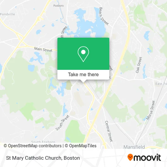
See St Mary Catholic Church, Foxborough, on the map
Public Transit to St Mary Catholic Church in Foxborough
Wondering how to get to St Mary Catholic Church in Foxborough? Moovit helps you find the best way to get to St Mary Catholic Church with step-by-step directions from the nearest public transit station.
Moovit provides free maps and live directions to help you navigate through your city. View schedules, routes, timetables, and find out how long does it take to get to St Mary Catholic Church in real time.
Looking for the nearest stop or station to St Mary Catholic Church? Check out this list of stops closest to your destination: Mansfield.
Want to see if there’s another route that gets you there at an earlier time? Moovit helps you find alternative routes or times. Get directions from and directions to St Mary Catholic Church easily from the Moovit App or Website.
We make riding to St Mary Catholic Church easy, which is why over 1.7 million users, including users in Foxborough, trust Moovit as the best app for public transit. You don’t need to download an individual bus app or train app, Moovit is your all-in-one transit app that helps you find the best bus time or train time available.
Use the app to navigate to popular places including to the airport, hospital, stadium, grocery store, mall, coffee shop, school, college, and university.
St Mary Catholic Church Address: 83 Central St street in Foxborough
Get around Foxborough by public transit!
Traveling around Foxborough has never been so easy. See step by step directions as you travel to any attraction, street or major public transit station. View bus and train schedules, arrival times, service alerts and detailed routes on a map, so you know exactly how to get to anywhere in Foxborough.
When traveling to any destination around Foxborough use Moovit's Live Directions with Get Off Notifications to know exactly where and how far to walk, how long to wait for your line, and how many stops are left. Moovit will alert you when it's time to get off — no need to constantly re-check whether yours is the next stop.
Wondering how to use public transit in Foxborough or how to pay for public transit in Foxborough? Moovit public transit app can help you navigate your way with public transit easily, and at minimum cost. It includes public transit fees, ticket prices, and costs. Looking for a map of Foxborough public transit lines? Moovit public transit app shows all public transit maps in Foxborough with all Bus, Train, Subway and Ferry routes and stops on an interactive map.
Boston has 4 transit type(s), including: Bus, Train, Subway and Ferry, operated by several transit agencies, including MBTA, Southeastern Regional Transit Authority, MetroWest Regional Transit Authority, Rhode Island Public Transit Authority, WRTA, Lowell Regional Transit Authority, Merrimack Valley Transit, Montachusett Regional Transit Authority, Cape Cod Regional Transit Authority, Brockton Area Transit Authority, Martha's Vineyard Transit Authority, the WAVE - Nantucket Regional Transit Authority, GATRA, Cape Ann Transportation Authority and Massport