The Most Popular Urban Mobility App in Ireland.
All local mobility options in one app
| Line | Direction | Time |
|---|---|---|
| 215 | Mahon Pt. S.C. | 6:30 AM |
| 215 | Mahon Pt. S.C. | 7:00 AM |
| 215 | Mahon Pt. S.C. | 7:21 AM |
| 207 | Donnybrook | 7:24 AM |
| 215 | Mahon Pt. S.C. | 7:51 AM |
| 207 | Donnybrook | 8:03 AM |
| 215 | Mahon Pt. S.C. | 8:19 AM |
| 207 | Donnybrook | 8:33 AM |
| 215 | Mahon Pt. S.C. | 8:49 AM |
| 207 | Donnybrook | 9:03 AM |
| 215 | Mahon Pt. S.C. | 9:16 AM |
| 207 | Donnybrook | 9:33 AM |
| 215 | Mahon Pt. S.C. | 9:51 AM |
| 207 | Donnybrook | 9:56 AM |
| 215 | Mahon Pt. S.C. | 10:21 AM |
| 207 | Donnybrook | 10:26 AM |
| 215 | Mahon Pt. S.C. | 10:51 AM |
| 207 | Donnybrook | 10:56 AM |
| 215 | Mahon Pt. S.C. | 11:21 AM |
| 207 | Donnybrook | 11:26 AM |
| 215 | Mahon Pt. S.C. | 11:53 AM |
| 207 | Donnybrook | 11:56 AM |
| 215 | Mahon Pt. S.C. | 12:23 PM |
| 207 | Donnybrook | 12:26 PM |
| 215 | Mahon Pt. S.C. | 12:54 PM |
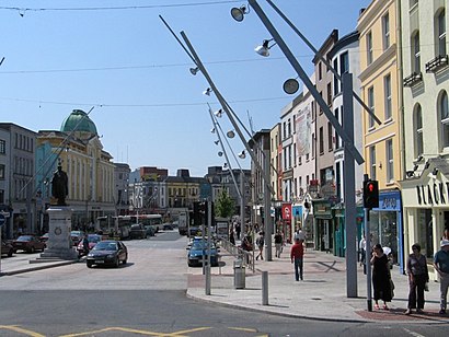
The following transit lines have routes that pass near St Patrick's Street
Click on the Bus route to see step by step directions with maps, line arrival times and updated time schedules.
Click on the Train route to see step by step directions with maps, line arrival times and updated time schedules.
The closest stations to St Patrick's Street are:
These Bus lines stop near St Patrick's Street: 202, 205, 220, 245X, 251, 51
These Train lines stop near St Patrick's Street: INTERCITY, RAIL
The nearest bus stops to St Patrick's Street in Ireland are Merchant's Quay, Merchants Quay, Drawbridge Street, St Patrick's Street and St. Patrick's Street. The closest one is a 2 min walk away.
The RAIL is the first Train that goes to St Patrick's Street in Ireland. It stops nearby at 8:00 AM.
The INTERCITY is the last Train that goes to St Patrick's Street in Ireland. It stops nearby at 3:10 AM.
The 220 is the first Bus that goes to St Patrick's Street in Ireland. It stops nearby at 3:02 AM.
The 220 is the last Bus that goes to St Patrick's Street in Ireland. It stops nearby at 3:00 AM.
The Bus fare to St Patrick's Street costs about €1.55.
Looking for directions to St Patrick's Street in Ireland, Ireland?
Download the Moovit App to find the current schedule and step-by-step directions for Bus or Train routes that pass through St Patrick's Street.
Looking for the nearest stops closest to St Patrick's Street ? Check out this list of closest stops to your destination: Merchant's Quay; Merchants Quay; Drawbridge Street; St Patrick's Street; St. Patrick's Street; Parnell Place; South Mall; Cork (Kent).
Bus:Train:
We make riding on public transit to St Patrick's Street easy, which is why over 1.5 million users, including users in Ireland trust Moovit as the best app for public transit.
Use the app to navigate to popular places including to the airport, hospital, stadium, grocery store, mall, coffee shop, school, college, and university.
St Patrick's Street stop’s code is 241201
The first line to this stop is 215, at 6:30 AM, and the last line is 215 at 11:53 PM.
Saint Patrick Street, Cork, Ireland
This stop serves Bus Éireann’s lines