See St. Peter am Perlach, Augsburg, on the map
Directions to St. Peter am Perlach (Augsburg) with public transportation
The following transit lines have routes that pass near St. Peter am Perlach
 Train:
 - Light Rail:
- Bus:
How to get to St. Peter am Perlach by train?
Click on the train route to see step by step directions with maps, line arrival times and updated time schedules.
Bus stations near St. Peter am Perlach in Augsburg
- Augsburg, Pilgerhausstraße,2 min walk,
- Augsburg, Moritzplatz,2 min walk,
- Augsburg, Pilgerhausstraße 31 A,2 min walk,
- Augsburg, Karlstraße,4 min walk,
- Augsburg, Königsplatz,5 min walk,
Light Rail stations near St. Peter am Perlach in Augsburg
- Augsburg Hbf,10 min walk,
Bus lines to St. Peter am Perlach in Augsburg
- 35,Augsburg, Pfersee Süd,
- 1,Göggingen,
- 2,Stadtbergen, Augsburg West P+R,
- 22,Augsburg Hbf,
- 32,Augsburg, Uniklinik Bkh,
- 90,Augsburg, Rud.-Diesel-Gym.,
- 91,Steppach, West,
- 94,Haunstetten, Süd,
- 23,Augsburg, Königsplatz - Augsburg, Firnhaberau,
- 93,Augsburg, Lechhausen Schlößle - Augsburg, Hochzoll Süd,
- 210,Friedberg (b Augsburg) - Augsburg Hbf,
- 211,Derching, Siebenbrünnelstraße - Augsburg Hbf,
- 212,Derching, Abzweigung Stätzling - Augsburg Hbf,
- 225,Mainbach, Abzweigung - Augsburg Hbf,
- 301,Pöttmes, Sportplatz - Augsburg, Staatstheater,
- 302,Ebenried - Augsburg, Staatstheater,
- 303,Gebenhofen - Augsburg, Staatstheater,
- 305,Augsburg Hbf - Oberach, Kobeswiesen,
- 210,Friedberg, Bahnhof,
- 211,Derching, Siebenbrünnelstraße,
What are the closest stations to St. Peter am Perlach?
The closest stations to St. Peter am Perlach are:
- Augsburg, Pilgerhausstraße is 81 meters away, 2 min walk.
- Augsburg, Moritzplatz is 107 meters away, 2 min walk.
- Augsburg, Pilgerhausstraße 31 A is 110 meters away, 2 min walk.
- Augsburg, Karlstraße is 234 meters away, 4 min walk.
- Augsburg, Königsplatz is 359 meters away, 5 min walk.
- Augsburg Hbf is 741 meters away, 10 min walk.
Which train lines stop near St. Peter am Perlach?
These train lines stop near St. Peter am Perlach: 18, RB67, RB87, RE9.
Which light rail line stops near St. Peter am Perlach?
2
What’s the nearest light rail station to St. Peter am Perlach in Augsburg?
The nearest light rail station to St. Peter am Perlach in Augsburg is Augsburg Hbf. It’s a 10 min walk away.
What’s the nearest bus stop to St. Peter am Perlach in Augsburg?
The nearest bus stops to St. Peter am Perlach in Augsburg are Augsburg, Pilgerhausstraße, Augsburg, Moritzplatz and Augsburg, Pilgerhausstraße 31 A. The closest one is a 2 min walk away.
What time is the first light rail to St. Peter am Perlach in Augsburg?
The 2 is the first light rail that goes to St. Peter am Perlach in Augsburg. It stops nearby at 4:39 AM.
What time is the last light rail to St. Peter am Perlach in Augsburg?
The 2 is the last light rail that goes to St. Peter am Perlach in Augsburg. It stops nearby at 12:49 AM.
What time is the first bus to St. Peter am Perlach in Augsburg?
The 94 is the first bus that goes to St. Peter am Perlach in Augsburg. It stops nearby at 3:00 AM.
What time is the last bus to St. Peter am Perlach in Augsburg?
The 32 is the last bus that goes to St. Peter am Perlach in Augsburg. It stops nearby at 12:02 AM.
How much is the bus fare to St. Peter am Perlach?
The bus fare to St. Peter am Perlach costs about €1.90 - €5.80.
How much is the train fare to St. Peter am Perlach?
The train fare to St. Peter am Perlach costs about €1.90 - €11.60.
See St. Peter am Perlach, Augsburg, on the map
Public Transit to St. Peter am Perlach in Augsburg
Wondering how to get to St. Peter am Perlach in Augsburg, Germany? Moovit helps you find the best way to get to St. Peter am Perlach with step-by-step directions from the nearest public transit station.
Moovit provides free maps and live directions to help you navigate through your city. View schedules, routes, timetables, and find out how long does it take to get to St. Peter am Perlach in real time.
Looking for the nearest stop or station to St. Peter am Perlach? Check out this list of stops closest to your destination: Augsburg, Pilgerhausstraße; Augsburg, Moritzplatz; Augsburg, Pilgerhausstraße 31 A; Augsburg, Karlstraße; Augsburg, Königsplatz; Augsburg Hbf.
Train:Light Rail:Bus:
Want to see if there’s another route that gets you there at an earlier time? Moovit helps you find alternative routes or times. Get directions from and directions to St. Peter am Perlach easily from the Moovit App or Website.
We make riding to St. Peter am Perlach easy, which is why over 1.5 million users, including users in Augsburg, trust Moovit as the best app for public transit. You don’t need to download an individual bus app or train app, Moovit is your all-in-one transit app that helps you find the best bus time or train time available.
For information on prices of train, bus and light rail, costs and ride fares to St. Peter am Perlach, please check the Moovit app.
Use the app to navigate to popular places including to the airport, hospital, stadium, grocery store, mall, coffee shop, school, college, and university.
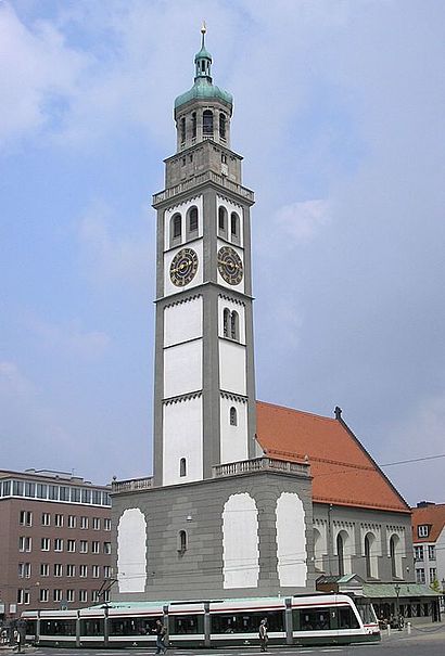
St. Peter am Perlach Address: Am Hinteren Perlachberg street in Augsburg
Attractions near St. Peter am Perlach
Perlachstüble,H. Jaufmann,Perlachturm,Eingang Perlachturm,Fischmarkt,Steinker's,O2,Strickmodenecke,Hotel am Rathaus,Hemdenstadl,Nebeneingang Rathaus,Sultanahmet Köftecisi,Europabüro,Il Tartufo,Atelier Eidel,Kabul City Markt,Den Ermordeten Jüdischen Augsburgern Zum Gedenken,Personal Hofmann,Singold,Kind HörgeräteHow to get to popular attractions in Augsburg with public transit
Gaststätte Großmarkthalle, Sendling,Star Inn Hotel München Schwabing, Alte Heide,Allianz Technology SE, Neuperlach,BMW Motorrad, Am Hart,S Vaterstetten, Vaterstetten,Stadion an der Schleißheimer Straße, Maxvorstadt,S Baldham, Vaterstetten,BMW Forschung und Technik GmbH, Moosach,Stark Verlag, Goldach,Herrsching am Ammersee, Herrsching,Waldwirtschaft Großhesselohe, Großhesselohe,Munich Marriott Hotel, Alte Heide,Gauting, Gauting,S Harthaus, Germering,Cafe Hasi, Poing,MS Weitblick - Casino Sapporobogen, Westfriedhof,Lindwurmstüberl, München - Innenstadt,KPMG AG, Schwanthalerhöhe,Georg-Freundorfer-Platz, Schwanthalerhöhe,Naturbad Maria EinsiedelGet around Augsburg by public transit!
Traveling around Augsburg has never been so easy. See step by step directions as you travel to any attraction, street or major public transit station. View bus and train schedules, arrival times, service alerts and detailed routes on a map, so you know exactly how to get to anywhere in Augsburg.
When traveling to any destination around Augsburg use Moovit's Live Directions with Get Off Notifications to know exactly where and how far to walk, how long to wait for your line, and how many stops are left. Moovit will alert you when it's time to get off — no need to constantly re-check whether yours is the next stop.
Wondering how to use public transit in Augsburg or how to pay for public transit in Augsburg? Moovit public transit app can help you navigate your way with public transit easily, and at minimum cost. It includes public transit fees, ticket prices, and costs. Looking for a map of Augsburg public transit lines? Moovit public transit app shows all public transit maps in Augsburg with all train, bus or light rail routes and stops on an interactive map.
Augsburg has 3 transit type(s), including: train, bus or light rail, operated by several transit agencies, including MVG, Münchner Verkehrsgesellschaft (SWM), Münchner Verkehrsgesellschaft (SWM), U-Bahn Nürnberg, Tram Nürnberg, MVV, MVV-Regionalbus, Bus Nürnberg, VGN, AVV, Erlanger Stadtverkehr, Stadtverkehr Fürth, Meridian, DB RegioNetz Verkehrs GmbH Südostbayernbahn and DB Regio AG Südost