Directions to Stack's Bowers Boston with public transportation
The following transit lines have routes that pass near Stack's Bowers Boston
 Bus: 354, 504, 92, 93, SL4.
- Train: FAIRMOUNT, FITCHBURG, FRAMINGHAM/WORCESTER, GREENBUSH, HAVERHILL.
- Subway: GREEN LINE B, GREEN LINE D, ORANGE LINE, BLUE LINE, GREEN LINE C.
- Ferry: CHARLESTOWN FERRY.
How to get to Stack's Bowers Boston by bus?
Click on the bus route to see step by step directions with maps, line arrival times and updated time schedules.
From John F. Kennedy Presidential Library And Museum
71 minFrom Arlington, MA
76 minFrom FOUR POINTS BY SHERATON Boston Newton
38 minFrom The Mall At Chestnut Hill
82 minFrom Harvard University
59 minFrom Qea
106 minFrom Vertex Pharmaceuticals, Inc.
70 minFrom Lemuel Shattuck Hospital
68 minFrom Codman Square
66 minFrom Melrose, MA
64 min
How to get to Stack's Bowers Boston by train?
Click on the train route to see step by step directions with maps, line arrival times and updated time schedules.
How to get to Stack's Bowers Boston by subway?
Click on the subway route to see step by step directions with maps, line arrival times and updated time schedules.
Bus stops near Stack's Bowers Boston
- Government Center (Congress St @ North St), 3 min walk,VIEW
- State, 3 min walk,VIEW
- Congress St Opp North St, 3 min walk,VIEW
- Haymarket - Congress St Opp Hanover St, 4 min walk,VIEW
- Aquarium - State St Opp Mckinley Sq, 4 min walk,VIEW
- Aquarium - Surface Rd @ State St, 4 min walk,VIEW
- State St @ Washington Mall - State St Sta, 4 min walk,VIEW
Ferry station near Stack's Bowers Boston
- Long Wharf (South), 8 min walk,VIEW
Bus lines to Stack's Bowers Boston
- 4, North Station Via South Station,VIEW
- 15, Haymarket Via Fields Corner & Nubian,VIEW
- 39, Haymarket Via Forest Hills,VIEW
- 57, Haymarket Via Kenmore,VIEW
- 92, Sullivan,VIEW
- 93, Sullivan Via Navy Yard,VIEW
- ORANGE LINE SHUTTLE, State (Shuttle),VIEW
- RED LINE SHUTTLE, Harvard - JFK/UMass via Congress Street,VIEW
- RED LINE SHUTTLE, Harvard - Broadway,VIEW
- RED LINE SHUTTLE, Kendall/MIT - JFK/UMass,VIEW
- RED LINE SHUTTLE, JFK/UMass - Kendall/MIT (Shuttle),VIEW
- GREEN LINE SHUTTLE, North Station - Government Center,VIEW
- GREEN LINE SHUTTLE, Union Square - Government Center,VIEW
- BLUE LINE SHUTTLE, Airport - Government Center (Express),VIEW
- BLUE LINE SHUTTLE, Airport - Government Center via Maverick,VIEW
- BLUE LINE SHUTTLE, Orient Heights - Government Center (Local),VIEW
- BLUE LINE SHUTTLE, Orient Heights - Government Center (Express),VIEW
- BLUE LINE SHUTTLE, Airport - Government Center (Local),VIEW
- BLUE LINE SHUTTLE, Government Center (Shuttle),VIEW
- 116, Wonderland Via Maverick,VIEW
What are the closest stations to Stack's Bowers Boston?
The closest stations to Stack's Bowers Boston are:
- Government Center (Congress St @ North St) is 137 yards away, 3 min walk.
- State is 224 yards away, 3 min walk.
- Congress St Opp North St is 227 yards away, 3 min walk.
- State Street is 230 yards away, 3 min walk.
- Haymarket is 249 yards away, 4 min walk.
- Haymarket - Congress St Opp Hanover St is 262 yards away, 4 min walk.
- Aquarium - State St Opp Mckinley Sq is 266 yards away, 4 min walk.
- Aquarium - Surface Rd @ State St is 285 yards away, 4 min walk.
- State St @ Washington Mall - State St Sta is 313 yards away, 4 min walk.
- Long Wharf (South) is 623 yards away, 8 min walk.
Which bus lines stop near Stack's Bowers Boston?
These bus lines stop near Stack's Bowers Boston: 354, 504, 92, 93, SL4, SL5.
Which train lines stop near Stack's Bowers Boston?
These train lines stop near Stack's Bowers Boston: FAIRMOUNT, FITCHBURG, FRAMINGHAM/WORCESTER, GREENBUSH, HAVERHILL, NEEDHAM.
Which subway lines stop near Stack's Bowers Boston?
These subway lines stop near Stack's Bowers Boston: GREEN LINE B, GREEN LINE D, ORANGE LINE.
What’s the nearest subway station to Stack's Bowers Boston?
The nearest subway station to Stack's Bowers Boston is State Street. It’s a 3 min walk away.
What’s the nearest bus station to Stack's Bowers Boston?
The nearest bus stations to Stack's Bowers Boston are Government Center (Congress St @ North St), State and Congress St Opp North St. The closest one is a 3 min walk away.
What’s the nearest ferry station to Stack's Bowers Boston?
The nearest ferry station to Stack's Bowers Boston is Long Wharf (South). It’s a 8 min walk away.
What time is the first subway to Stack's Bowers Boston?
The GREEN LINE E is the first subway that goes to Stack's Bowers Boston. It stops nearby at 5:03 AM.
What time is the last subway to Stack's Bowers Boston?
The GREEN LINE E is the last subway that goes to Stack's Bowers Boston. It stops nearby at 2:22 AM.
What time is the first bus to Stack's Bowers Boston?
The 57 is the first bus that goes to Stack's Bowers Boston. It stops nearby at 5:03 AM.
What time is the last bus to Stack's Bowers Boston?
The 116 is the last bus that goes to Stack's Bowers Boston. It stops nearby at 1:58 AM.
What time is the first ferry to Stack's Bowers Boston?
The CHARLESTOWN FERRY is the first ferry that goes to Stack's Bowers Boston. It stops nearby at 6:30 AM.
What time is the last ferry to Stack's Bowers Boston?
The CHARLESTOWN FERRY is the last ferry that goes to Stack's Bowers Boston. It stops nearby at 8:25 PM.
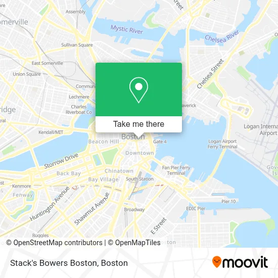
See Stack's Bowers Boston on the map
Public Transportation to Stack's Bowers Boston
Wondering how to get to Stack's Bowers Boston? Moovit helps you find the best way to get to Stack's Bowers Boston with step-by-step directions from the nearest public transit station.
Moovit provides free maps and live directions to help you navigate through your city. View schedules, routes, timetables, and find out how long does it take to get to Stack's Bowers Boston in real time.
Looking for the nearest stop or station to Stack's Bowers Boston? Check out this list of stops closest to your destination: Government Center (Congress St @ North St); State; Congress St Opp North St; State Street; Haymarket; Haymarket - Congress St Opp Hanover St; Aquarium - State St Opp Mckinley Sq; Aquarium - Surface Rd @ State St; State St @ Washington Mall - State St Sta; Long Wharf (South).
Bus: 354, 504, 92, 93, SL4, SL5, 4, 15, 39, 57, ORANGE LINE SHUTTLE, RED LINE SHUTTLE, RED LINE SHUTTLE, RED LINE SHUTTLE, RED LINE SHUTTLE.Train: FAIRMOUNT, FITCHBURG, FRAMINGHAM/WORCESTER, GREENBUSH, HAVERHILL, NEEDHAM.Subway: GREEN LINE B, GREEN LINE D, ORANGE LINE, BLUE LINE, GREEN LINE C, GREEN LINE E.Ferry: CHARLESTOWN FERRY.
Want to see if there’s another route that gets you there at an earlier time? Moovit helps you find alternative routes or times. Get directions from and directions to Stack's Bowers Boston easily from the Moovit App or Website.
We make riding to Stack's Bowers Boston easy, which is why over 1.7 million users, including users in Boston, trust Moovit as the best app for public transit. You don’t need to download an individual bus app or train app, Moovit is your all-in-one transit app that helps you find the best bus time or train time available.
For information on prices of bus, subway and train, costs and ride fares to Stack's Bowers Boston, please check the Moovit app.
Use the app to navigate to popular places including to the airport, hospital, stadium, grocery store, mall, coffee shop, school, college, and university.
Stack's Bowers Boston Address: 84 State St street in Boston
- Bertucci's,
- Psychic Connections,
- 60 State Street Parking Garage,
- Abercrombie & Fitch (Abercrombie Kids),
- Ghirardelli Chocolate,
- Human Care Systems,
- World Cup Boston,
- Larry Bird Plaque (Bill Rodgers Plaque),
- Boston Doghouse (Dog House Boston),
- Office Positions,
- Monkey Bar,
- Statue of Red Auerbach,
- SP+ Parking @ 75 State Street Garage at 5 Broad St,
- 60 State St,
- Shann Kerner,
- Lisa Cameron,
- 1 Day Demolition,
- Chris Farley Rehab,
- Robert W Mahoney Lawyer,
- Boston Consulting Group
Places Near Stack's Bowers Boston
- Mgm Music Hall, Boston,
- Boston Common, Boston,
- Boston Convention & Exhibition Center, Boston,
- Prudential Center, Boston,
- Td Garden, Boston,
- Wilbur Theatre, Boston,
- Isabella Stewart Gardner Museum, Boston,
- Castle Island, Boston,
- Faneuil Hall, Boston,
- Cheers, Boston,
- House Of Blues, Boston,
- Boston Children's Hospital, Boston,
- Wang Theater, Boston,
- North End, Boston,
- Boston Medical Center, Boston,
- Seaport District, Boston,
- Leader Bank Pavilion (Leader Bank Pavillion), Boston,
- Quincy Market, Boston,
- Massachusetts General Hospital, Boston,
- Museum Of Science, Boston
How to get to popular places in Boston with public transit
Get around Boston by public transit!
Traveling around Boston has never been so easy. See step by step directions as you travel to any attraction, street or major public transit station. View bus and train schedules, arrival times, service alerts and detailed routes on a map, so you know exactly how to get to anywhere in Boston.
When traveling to any destination around Boston use Moovit's Live Directions with Get Off Notifications to know exactly where and how far to walk, how long to wait for your line, and how many stops are left. Moovit will alert you when it's time to get off — no need to constantly re-check whether yours is the next stop.
Wondering how to use public transit in Boston or how to pay for public transit in Boston? Moovit public transit app can help you navigate your way with public transit easily, and at minimum cost. It includes public transit fees, ticket prices, and costs. Looking for a map of Boston public transit lines? Moovit public transit app shows all public transit maps in Boston with all Bus, Train, Subway and Ferry routes and stops on an interactive map.
Boston has 4 transit type(s), including: Bus, Train, Subway and Ferry, operated by several transit agencies, including MBTA, Southeastern Regional Transit Authority, MetroWest Regional Transit Authority, Rhode Island Public Transit Authority, WRTA, Lowell Regional Transit Authority, Merrimack Valley Transit, Montachusett Regional Transit Authority, Cape Cod Regional Transit Authority, Brockton Area Transit Authority, Martha's Vineyard Transit Authority, the WAVE - Nantucket Regional Transit Authority, GATRA, Cape Ann Transportation Authority and Massport