Directions to Stanford Memorial Auditorium with public transportation
The following transit lines have routes that pass near Stanford Memorial Auditorium
How to get to Stanford Memorial Auditorium by bus?
Click on the bus route to see step by step directions with maps, line arrival times and updated time schedules.
How to get to Stanford Memorial Auditorium by train?
Click on the train route to see step by step directions with maps, line arrival times and updated time schedules.
Bus stops near Stanford Memorial Auditorium
- Jane Stanford Way @ Lasuen Mall, 2 min walk,
- Stanford Oval, 4 min walk,
- On Jane Stanford Way Across From Ch.E.M.-H. Building, 12 min walk,
- On Jane Stanford Way @ Ch.E.M.-H. Building, 12 min walk,
- Campus @ Li Ka Shing, 13 min walk,
Bus lines to Stanford Memorial Auditorium
- C LINE, On Clark Way @ VI at Palo Alto,
- C LINE LIMITED AM/PM, Stock Farm Garage,
- U, Fremont BART,
- DB, To Stanford University,
- Y, Y Line,
- YL-PM, Y Limited PM,
- 1050A, 1050 Arastradero,
- X, Tresidder Union (Island),
- XL-AM, On Campus Drive @ Panama Street,
- SE, Shopping Express,
- SE, Shopping Express - Weekend,
What are the closest stations to Stanford Memorial Auditorium?
The closest stations to Stanford Memorial Auditorium are:
- Jane Stanford Way @ Lasuen Mall is 118 yards away, 2 min walk.
- Stanford Oval is 312 yards away, 4 min walk.
- On Jane Stanford Way Across From Ch.E.M.-H. Building is 959 yards away, 12 min walk.
- On Jane Stanford Way @ Ch.E.M.-H. Building is 959 yards away, 12 min walk.
- Campus @ Li Ka Shing is 1049 yards away, 13 min walk.
Which bus lines stop near Stanford Memorial Auditorium?
These bus lines stop near Stanford Memorial Auditorium: 22, RAPID 522.
Which train line stops near Stanford Memorial Auditorium?
LOCAL
What’s the nearest bus stop to Stanford Memorial Auditorium?
The nearest bus stop to Stanford Memorial Auditorium is Jane Stanford Way @ Lasuen Mall. It’s a 2 min walk away.
See Stanford Memorial Auditorium on the map
Public Transportation to Stanford Memorial Auditorium
Wondering how to get to Stanford Memorial Auditorium, United States? Moovit helps you find the best way to get to Stanford Memorial Auditorium with step-by-step directions from the nearest public transit station.
Moovit provides free maps and live directions to help you navigate through your city. View schedules, routes, timetables, and find out how long does it take to get to Stanford Memorial Auditorium in real time.
Looking for the nearest stop or station to Stanford Memorial Auditorium? Check out this list of stops closest to your destination: Jane Stanford Way @ Lasuen Mall; Stanford Oval; On Jane Stanford Way Across From Ch.E.M.-H. Building; On Jane Stanford Way @ Ch.E.M.-H. Building; Campus @ Li Ka Shing.
Bus: 22, RAPID 522, C LINE, C LINE LIMITED AM/PM, U, DB, Y, YL-PM, 1050A, X, XL-AM, SE, SE.Train: LOCAL.
Want to see if there’s another route that gets you there at an earlier time? Moovit helps you find alternative routes or times. Get directions from and directions to Stanford Memorial Auditorium easily from the Moovit App or Website.
We make riding to Stanford Memorial Auditorium easy, which is why over 1.5 million users, including users in Stanford, trust Moovit as the best app for public transit. You don’t need to download an individual bus app or train app, Moovit is your all-in-one transit app that helps you find the best bus time or train time available.
For information on prices of bus and train, costs and ride fares to Stanford Memorial Auditorium, please check the Moovit app.
Use the app to navigate to popular places including to the airport, hospital, stadium, grocery store, mall, coffee shop, school, college, and university.
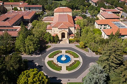
Stanford Memorial Auditorium Address: 551 Serra Mall street in Stanford
Attractions near Stanford Memorial Auditorium
胡佛塔,Serra St,Landau Economics Building,Hoover Tower,Library - on Kzsu 90.1 Stanford, CA,John A. And Cynthia Fry Gunn Building (Siepr),Stanford Art Gallery,John & Cynthia Fry Gunn Building (SIEPR),Memorial Way,Lathrop Tech Lounge,David & Joan Traitel Building,Serra Mall @ Lasuen Mall,East Wing,Cecil H. Green Library,Bing Wing,Serra @ Burnham,Burnham Pavilion & Ford Center,Stanford Institute for Economic Policy Research (Siepr),615 Crothers Way,Koret CourtHow to get to popular attractions in Stanford with public transit
City of Redwood City, Redwood City,Vik’s Chaat Corner, Berkeley,Lagunitas Brewing Company, Petaluma,VMware, Inc., Palo Alto,AMC Saratoga 14, San Jose,Nordstrom Valley Fair, San Jose,City of Gilroy, Gilroy,Microsoft SVC,City College Of San Francisco, San Francisco,24 Hour Fitness, Richmond,San Antonio Caltrain Station,Sfo, Sfo,Jelly Belly Factory, Fairfield,Fremont BART Station, Fremont,Pacific Commons, Fremont,City of Morgan Hill, Morgan Hill,Sunnyvale, CA, Sunnyvale,440 Castro, Castro/Upper Market,West Dublin / Pleasanton BART Station, Pleasanton,NASA Ames Research CenterGet around San Francisco - San Jose, CA by public transit!
Traveling around San Francisco - San Jose, CA has never been so easy. See step by step directions as you travel to any attraction, street or major public transit station. View bus and train schedules, arrival times, service alerts and detailed routes on a map, so you know exactly how to get to anywhere in San Francisco - San Jose, CA.
When traveling to any destination around San Francisco - San Jose, CA use Moovit's Live Directions with Get Off Notifications to know exactly where and how far to walk, how long to wait for your line, and how many stops are left. Moovit will alert you when it's time to get off — no need to constantly re-check whether yours is the next stop.
Wondering how to use public transit in San Francisco - San Jose, CA or how to pay for public transit in San Francisco - San Jose, CA? Moovit public transit app can help you navigate your way with public transit easily, and at minimum cost. It includes public transit fees, ticket prices, and costs. Looking for a map of San Francisco - San Jose, CA public transit lines? Moovit public transit app shows all public transit maps in San Francisco - San Jose, CA with all Bus, Train, BART, Light Rail, Ferry and Cable Car routes and stops on an interactive map.
San Francisco - San Jose, CA has 6 transit type(s), including: Bus, Train, BART, Light Rail, Ferry and Cable Car, operated by several transit agencies, including BART, Bay Area Rapid Transit, Muni Metro, Caltrain, VTA, Capitol Corridor, Sonoma Marin Area Rail Transit, MUNI, SF Cable Car, AC Transit, Dumbarton Express, Golden Gate Transit, County Connection, SamTrans, SamTrans / City of Menlo Park