How to get to Staples Travel Services by bus?
Click on the bus route to see step by step directions with maps, line arrival times and updated time schedules.
How to get to Staples Travel Services by train?
Click on the train route to see step by step directions with maps, line arrival times and updated time schedules.
How to get to Staples Travel Services by subway?
Click on the subway route to see step by step directions with maps, line arrival times and updated time schedules.
Bus stops near Staples Travel Services in Braintree Town
Train stations near Staples Travel Services in Braintree Town
Subway station near Staples Travel Services in Braintree Town
- Braintree, 17 min walk,VIEW
What are the closest stations to Staples Travel Services?
The closest stations to Staples Travel Services are:
- Washington St @ West St is 28 yards away, 1 min walk.
- Middle St @ River St is 230 yards away, 3 min walk.
- Braintree is 1225 yards away, 15 min walk.
- Weymouth Landing/East Braintree is 4324 yards away, 51 min walk.
Which bus lines stop near Staples Travel Services?
These bus lines stop near Staples Travel Services: 230, 236.
Which train lines stop near Staples Travel Services?
These train lines stop near Staples Travel Services: FALL RIVER/NEW BEDFORD, KINGSTON.
Which subway line stops near Staples Travel Services?
RED LINE (Ashmont/Braintree)
What’s the nearest subway station to Staples Travel Services in Braintree Town?
The nearest subway station to Staples Travel Services in Braintree Town is Braintree. It’s a 17 min walk away.
What’s the nearest train station to Staples Travel Services in Braintree Town?
The nearest train station to Staples Travel Services in Braintree Town is Braintree. It’s a 15 min walk away.
What’s the nearest bus station to Staples Travel Services in Braintree Town?
The nearest bus station to Staples Travel Services in Braintree Town is Washington St @ West St. It’s a 1 min walk away.
What time is the first subway to Staples Travel Services in Braintree Town?
The RED LINE is the first subway that goes to Staples Travel Services in Braintree Town. It stops nearby at 5:09 AM.
What time is the last subway to Staples Travel Services in Braintree Town?
The RED LINE is the last subway that goes to Staples Travel Services in Braintree Town. It stops nearby at 2:00 AM.
What time is the first train to Staples Travel Services in Braintree Town?
The FALL RIVER/NEW BEDFORD is the first train that goes to Staples Travel Services in Braintree Town. It stops nearby at 5:27 AM.
What time is the last train to Staples Travel Services in Braintree Town?
The KINGSTON is the last train that goes to Staples Travel Services in Braintree Town. It stops nearby at 12:25 AM.
What time is the first bus to Staples Travel Services in Braintree Town?
The 230 is the first bus that goes to Staples Travel Services in Braintree Town. It stops nearby at 4:59 AM.
What time is the last bus to Staples Travel Services in Braintree Town?
The 230 is the last bus that goes to Staples Travel Services in Braintree Town. It stops nearby at 12:11 AM.
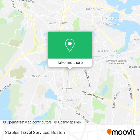
See Staples Travel Services, Braintree Town, on the map
Public Transit to Staples Travel Services in Braintree Town
Wondering how to get to Staples Travel Services in Braintree Town? Moovit helps you find the best way to get to Staples Travel Services with step-by-step directions from the nearest public transit station.
Moovit provides free maps and live directions to help you navigate through your city. View schedules, routes, timetables, and find out how long does it take to get to Staples Travel Services in real time.
Looking for the nearest stop or station to Staples Travel Services? Check out this list of stops closest to your destination: Washington St @ West St; Middle St @ River St; Braintree; Weymouth Landing/East Braintree.
Bus: 230, 236.Train: FALL RIVER/NEW BEDFORD, KINGSTON, CAPEFLYER, GREENBUSH.Subway: RED LINE.
Want to see if there’s another route that gets you there at an earlier time? Moovit helps you find alternative routes or times. Get directions from and directions to Staples Travel Services easily from the Moovit App or Website.
We make riding to Staples Travel Services easy, which is why over 1.7 million users, including users in Braintree Town, trust Moovit as the best app for public transit. You don’t need to download an individual bus app or train app, Moovit is your all-in-one transit app that helps you find the best bus time or train time available.
For information on prices of bus, subway and train, costs and ride fares to Staples Travel Services, please check the Moovit app.
Use the app to navigate to popular places including to the airport, hospital, stadium, grocery store, mall, coffee shop, school, college, and university.
Staples Travel Services Address: 500 Grossman Drive street in Braintree Town
- Awaken Mind Center,
- Party City,
- Wevision Llc,
- Amazon Locker-Marcelina,
- ADT A D Security & Alarm,
- Alda Products,
- Handy Randy Home Services,
- Drake Design + Build,
- Pga Tour Superstore,
- Ups Alliance Shipping Partner,
- Ups Access Point Location,
- Bed Bath & Beyond,
- Staples Print & Marketing Services,
- Pga Tour Superstore Braintree,
- Mac Cosmetics,
- Ups Alliance Shipping Partner,
- Saks Off 5th,
- Geek Squad,
- 5.11 Tactical,
- Hollis Field
Places Near Staples Travel Services (Braintree Town)
- Boston Convention & Exhibition Center, Boston,
- Wang Theater, Boston,
- Mgm Music Hall, Boston,
- Quincy Market, Boston,
- Museum Of Science, Boston,
- Leader Bank Pavilion (Leader Bank Pavillion), Boston,
- Massachusetts General Hospital, Boston,
- Td Garden, Boston,
- North End, Boston,
- Wilbur Theatre, Boston,
- Boston Common, Boston,
- Isabella Stewart Gardner Museum, Boston,
- Prudential Center, Boston,
- Faneuil Hall, Boston,
- Boston Children's Hospital, Boston,
- Seaport District, Boston,
- Boston Medical Center, Boston,
- House Of Blues, Boston,
- Castle Island, Boston,
- Cheers, Boston
How to get to popular places in Boston with public transit
Get around Braintree Town by public transit!
Traveling around Braintree Town has never been so easy. See step by step directions as you travel to any attraction, street or major public transit station. View bus and train schedules, arrival times, service alerts and detailed routes on a map, so you know exactly how to get to anywhere in Braintree Town.
When traveling to any destination around Braintree Town use Moovit's Live Directions with Get Off Notifications to know exactly where and how far to walk, how long to wait for your line, and how many stops are left. Moovit will alert you when it's time to get off — no need to constantly re-check whether yours is the next stop.
Wondering how to use public transit in Braintree Town or how to pay for public transit in Braintree Town? Moovit public transit app can help you navigate your way with public transit easily, and at minimum cost. It includes public transit fees, ticket prices, and costs. Looking for a map of Braintree Town public transit lines? Moovit public transit app shows all public transit maps in Braintree Town with all Bus, Train, Subway and Ferry routes and stops on an interactive map.
Boston has 4 transit type(s), including: Bus, Train, Subway and Ferry, operated by several transit agencies, including MBTA, Southeastern Regional Transit Authority, MetroWest Regional Transit Authority, Rhode Island Public Transit Authority, WRTA, Lowell Regional Transit Authority, Merrimack Valley Transit, Montachusett Regional Transit Authority, Cape Cod Regional Transit Authority, Brockton Area Transit Authority, Martha's Vineyard Transit Authority, the WAVE - Nantucket Regional Transit Authority, GATRA, Cape Ann Transportation Authority and Massport