Directions to Star Fencing Academy (Needham) with public transportation
The following transit lines have routes that pass near Star Fencing Academy
 Bus: 59, NEEDHAM LINE SHUTTLE, NEEDHAM LINE SHUTTLE.
- Train: NEEDHAM.
- Subway: GREEN LINE D.
How to get to Star Fencing Academy by bus?
Click on the bus route to see step by step directions with maps, line arrival times and updated time schedules.
From FOUR POINTS BY SHERATON Boston Newton, Newton
46 minFrom Spaulding Rehabilitation Center, Boston
67 minFrom Sonia, Boston
65 minFrom Roadrunner, Boston
68 minFrom Watertown Mall, Watertown Town
48 minFrom Moderna, Norwood
158 minFrom Jamaica Pond, Boston
108 minFrom New Balance, Boston
67 minFrom West Roxbury, Boston
99 min
How to get to Star Fencing Academy by train?
Click on the train route to see step by step directions with maps, line arrival times and updated time schedules.
From FOUR POINTS BY SHERATON Boston Newton, Newton
101 minFrom Spaulding Rehabilitation Center, Boston
84 minFrom Sonia, Boston
85 minFrom Roadrunner, Boston
83 minFrom Moderna, Norwood
92 minFrom Academy Of the Pacific Rim Charter Public School, Boston
111 minFrom Jamaica Pond, Boston
58 minFrom New Balance, Boston
84 minFrom West Roxbury, Boston
29 min
Bus stops near Star Fencing Academy in Needham
Train station near Star Fencing Academy in Needham
- Needham Center, 18 min walk,VIEW
Subway station near Star Fencing Academy in Needham
- Eliot, 55 min walk,VIEW
Bus lines to Star Fencing Academy in Needham
What are the closest stations to Star Fencing Academy?
The closest stations to Star Fencing Academy are:
- Highland Ave @ Dana Pl is 472 yards away, 6 min walk.
- Needham Heights is 665 yards away, 9 min walk.
- Needham Center is 1494 yards away, 18 min walk.
- Eliot is 4665 yards away, 55 min walk.
Which bus line stops near Star Fencing Academy?
59 (Needham Junction Via Needham St)
Which train line stops near Star Fencing Academy?
NEEDHAM (#625 | Needham Heights)
What’s the nearest train station to Star Fencing Academy in Needham?
The nearest train station to Star Fencing Academy in Needham is Needham Center. It’s a 18 min walk away.
What’s the nearest bus station to Star Fencing Academy in Needham?
The nearest bus station to Star Fencing Academy in Needham is Highland Ave @ Dana Pl. It’s a 6 min walk away.
What time is the first subway to Star Fencing Academy in Needham?
The GREEN LINE D is the first subway that goes to Star Fencing Academy in Needham. It stops nearby at 4:48 AM.
What time is the last subway to Star Fencing Academy in Needham?
The GREEN LINE D is the last subway that goes to Star Fencing Academy in Needham. It stops nearby at 2:44 AM.
What time is the first train to Star Fencing Academy in Needham?
The NEEDHAM is the first train that goes to Star Fencing Academy in Needham. It stops nearby at 7:05 AM.
What time is the last train to Star Fencing Academy in Needham?
The NEEDHAM is the last train that goes to Star Fencing Academy in Needham. It stops nearby at 6:38 PM.
What time is the first bus to Star Fencing Academy in Needham?
The 59 is the first bus that goes to Star Fencing Academy in Needham. It stops nearby at 6:23 AM.
What time is the last bus to Star Fencing Academy in Needham?
The 59 is the last bus that goes to Star Fencing Academy in Needham. It stops nearby at 7:57 PM.
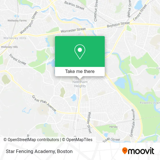
See Star Fencing Academy, Needham, on the map
Public Transit to Star Fencing Academy in Needham
Wondering how to get to Star Fencing Academy in Needham? Moovit helps you find the best way to get to Star Fencing Academy with step-by-step directions from the nearest public transit station.
Moovit provides free maps and live directions to help you navigate through your city. View schedules, routes, timetables, and find out how long does it take to get to Star Fencing Academy in real time.
Looking for the nearest stop or station to Star Fencing Academy? Check out this list of stops closest to your destination: Highland Ave @ Dana Pl; Needham Heights; Needham Center; Eliot.
Bus: 59, NEEDHAM LINE SHUTTLE, NEEDHAM LINE SHUTTLE.Train: NEEDHAM.Subway: GREEN LINE D.
Want to see if there’s another route that gets you there at an earlier time? Moovit helps you find alternative routes or times. Get directions from and directions to Star Fencing Academy easily from the Moovit App or Website.
We make riding to Star Fencing Academy easy, which is why over 1.7 million users, including users in Needham, trust Moovit as the best app for public transit. You don’t need to download an individual bus app or train app, Moovit is your all-in-one transit app that helps you find the best bus time or train time available.
For information on prices of bus and train, costs and ride fares to Star Fencing Academy, please check the Moovit app.
Use the app to navigate to popular places including to the airport, hospital, stadium, grocery store, mall, coffee shop, school, college, and university.
Location: Needham, Boston
- Mac Lean Carpet Cleaners,
- Belmont Landscape & Tree,
- Travel To Tenerife,
- USPS,
- WCVB-TV Channel 5,
- Carter Preschool,
- Outdoor Maintenance Company,
- 845 Highland Ave Parking,
- Amazon Locker-Telos,
- Needham Heights,
- Blue on Highland,
- House of Roshan,
- Community Health Partnership-Honduras,
- KBM America,
- STARBUCKS,
- Keller Williams Boston Southwest,
- Mahla Ellerin Real Estate,
- Seema Layne - Kaufman Realty Team,
- Independent Mortgage,
- Trader Joe's
Places Near Star Fencing Academy (Needham)
- Quincy Market, Boston,
- Wilbur Theatre, Boston,
- North End, Boston,
- Cheers, Boston,
- Td Garden, Boston,
- Faneuil Hall, Boston,
- Boston Convention & Exhibition Center, Boston,
- Boston Medical Center, Boston,
- Massachusetts General Hospital, Boston,
- Prudential Center, Boston,
- Castle Island, Boston,
- Boston Common, Boston,
- Seaport District, Boston,
- Wang Theater, Boston,
- House Of Blues, Boston,
- Mgm Music Hall, Boston,
- Isabella Stewart Gardner Museum, Boston,
- Leader Bank Pavilion (Leader Bank Pavillion), Boston,
- Boston Children's Hospital, Boston,
- Museum Of Science, Boston
How to get to popular places in Boston with public transit
Get around Needham by public transit!
Traveling around Needham has never been so easy. See step by step directions as you travel to any attraction, street or major public transit station. View bus and train schedules, arrival times, service alerts and detailed routes on a map, so you know exactly how to get to anywhere in Needham.
When traveling to any destination around Needham use Moovit's Live Directions with Get Off Notifications to know exactly where and how far to walk, how long to wait for your line, and how many stops are left. Moovit will alert you when it's time to get off — no need to constantly re-check whether yours is the next stop.
Wondering how to use public transit in Needham or how to pay for public transit in Needham? Moovit public transit app can help you navigate your way with public transit easily, and at minimum cost. It includes public transit fees, ticket prices, and costs. Looking for a map of Needham public transit lines? Moovit public transit app shows all public transit maps in Needham with all Bus, Train, Subway and Ferry routes and stops on an interactive map.
Boston has 4 transit type(s), including: Bus, Train, Subway and Ferry, operated by several transit agencies, including MBTA, Southeastern Regional Transit Authority, MetroWest Regional Transit Authority, Rhode Island Public Transit Authority, WRTA, Lowell Regional Transit Authority, Merrimack Valley Transit, Montachusett Regional Transit Authority, Cape Cod Regional Transit Authority, Brockton Area Transit Authority, Martha's Vineyard Transit Authority, the WAVE - Nantucket Regional Transit Authority, GATRA, Cape Ann Transportation Authority and Massport