Directions to Star Market #4568 (Newton) with public transportation
The following transit lines have routes that pass near Star Market #4568
 Bus: 505, 553, 558.
- Train: FRAMINGHAM/WORCESTER, FITCHBURG.
- Subway: GREEN LINE D.
How to get to Star Market #4568 by bus?
Click on the bus route to see step by step directions with maps, line arrival times and updated time schedules.
From Vertex Pharmaceuticals, Inc., Boston
73 minFrom Warrior Ice Arena, Boston
55 minFrom AC Hotel by Marriott Boston Cleveland Circle, Boston
57 minFrom Arsenal Mall, Watertown Town
51 minFrom Courtyard by Marriott Brookline, Brookline
66 minFrom MBTA Alewife Station, Cambridge
111 minFrom Regina Pizzeria, Boston
54 minFrom Coolidge Corner Theatre, Brookline
73 minFrom Conte Forum, Boston
70 min
How to get to Star Market #4568 by train?
Click on the train route to see step by step directions with maps, line arrival times and updated time schedules.
How to get to Star Market #4568 by subway?
Click on the subway route to see step by step directions with maps, line arrival times and updated time schedules.
From Vertex Pharmaceuticals, Inc., Boston
87 minFrom Warrior Ice Arena, Boston
80 minFrom AC Hotel by Marriott Boston Cleveland Circle, Boston
44 minFrom Apple Cinemas, Cambridge
105 minFrom Courtyard by Marriott Brookline, Brookline
65 minFrom MBTA Alewife Station, Cambridge
92 minFrom Regina Pizzeria, Boston
76 minFrom Coolidge Corner Theatre, Brookline
64 minFrom Conte Forum, Boston
55 min
Bus stop near Star Market #4568 in Newton
- Lexington St @ Freeman St, 6 min walk,VIEW
Train stations near Star Market #4568 in Newton
Subway station near Star Market #4568 in Newton
- Woodland, 28 min walk,VIEW
What are the closest stations to Star Market #4568?
The closest stations to Star Market #4568 are:
- Lexington St @ Freeman St is 440 yards away, 6 min walk.
- West Newton is 2048 yards away, 25 min walk.
- Woodland is 2349 yards away, 28 min walk.
- Brandeis/Roberts is 3497 yards away, 41 min walk.
Which bus lines stop near Star Market #4568?
These bus lines stop near Star Market #4568: 505, 553, 558.
Which train line stops near Star Market #4568?
FRAMINGHAM/WORCESTER (#521 | Worcester)
Which subway line stops near Star Market #4568?
GREEN LINE D (Riverside)
What’s the nearest subway station to Star Market #4568 in Newton?
The nearest subway station to Star Market #4568 in Newton is Woodland. It’s a 28 min walk away.
What’s the nearest train station to Star Market #4568 in Newton?
The nearest train station to Star Market #4568 in Newton is West Newton. It’s a 25 min walk away.
What’s the nearest bus station to Star Market #4568 in Newton?
The nearest bus station to Star Market #4568 in Newton is Lexington St @ Freeman St. It’s a 6 min walk away.
What time is the first subway to Star Market #4568 in Newton?
The GREEN LINE D is the first subway that goes to Star Market #4568 in Newton. It stops nearby at 4:45 AM.
What time is the last subway to Star Market #4568 in Newton?
The GREEN LINE D is the last subway that goes to Star Market #4568 in Newton. It stops nearby at 2:48 AM.
What time is the first train to Star Market #4568 in Newton?
The FRAMINGHAM/WORCESTER is the first train that goes to Star Market #4568 in Newton. It stops nearby at 5:19 AM.
What time is the last train to Star Market #4568 in Newton?
The FRAMINGHAM/WORCESTER is the last train that goes to Star Market #4568 in Newton. It stops nearby at 12:22 AM.
What time is the first bus to Star Market #4568 in Newton?
The 505 is the first bus that goes to Star Market #4568 in Newton. It stops nearby at 6:01 AM.
What time is the last bus to Star Market #4568 in Newton?
The 505 is the last bus that goes to Star Market #4568 in Newton. It stops nearby at 7:42 PM.
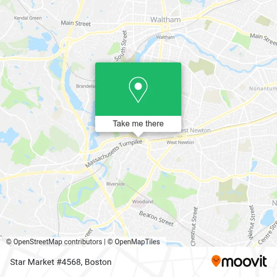
See Star Market #4568, Newton, on the map
Public Transit to Star Market #4568 in Newton
Wondering how to get to Star Market #4568 in Newton? Moovit helps you find the best way to get to Star Market #4568 with step-by-step directions from the nearest public transit station.
Moovit provides free maps and live directions to help you navigate through your city. View schedules, routes, timetables, and find out how long does it take to get to Star Market #4568 in real time.
Looking for the nearest stop or station to Star Market #4568? Check out this list of stops closest to your destination: Lexington St @ Freeman St; West Newton; Woodland; Brandeis/Roberts.
Bus: 505, 553, 558.Train: FRAMINGHAM/WORCESTER, FITCHBURG.Subway: GREEN LINE D.
Want to see if there’s another route that gets you there at an earlier time? Moovit helps you find alternative routes or times. Get directions from and directions to Star Market #4568 easily from the Moovit App or Website.
We make riding to Star Market #4568 easy, which is why over 1.7 million users, including users in Newton, trust Moovit as the best app for public transit. You don’t need to download an individual bus app or train app, Moovit is your all-in-one transit app that helps you find the best bus time or train time available.
For information on prices of bus, subway and train, costs and ride fares to Star Market #4568, please check the Moovit app.
Use the app to navigate to popular places including to the airport, hospital, stadium, grocery store, mall, coffee shop, school, college, and university.
Star Market #4568 Address: 2040 Commonwealth Ave street in Newton
- MBTA Bus Route 505,
- Norumbega Securities Services,
- Abbie L D'Amico - Financial Advisor Ameriprise Financial Services,
- Blackline Retail Group, LLC,
- Lexington St House Lockout,
- Care Solutions Personnel,
- Axerra Networks,
- Competency Manager,
- Cabem Technologies,
- Collegewise - Greater Boston,
- Accidents Chiropractors,
- Noble & Devine,
- Milano Jewelry,
- MGD+,
- DUNKIN',
- Ivy Boutique,
- Double Wall Stainless Coffee Cup Office,
- Ppai Suppliers Achievement Award,
- Feature Video Wireless Ear Buds Office,
- Newton MA Locksmith Shop
Places Near Star Market #4568 (Newton)
- Wilbur Theatre, Boston,
- Seaport District, Boston,
- Faneuil Hall, Boston,
- Massachusetts General Hospital, Boston,
- Prudential Center, Boston,
- House Of Blues, Boston,
- Castle Island, Boston,
- Museum Of Science, Boston,
- Boston Medical Center, Boston,
- Isabella Stewart Gardner Museum, Boston,
- Boston Common, Boston,
- Boston Children's Hospital, Boston,
- North End, Boston,
- Td Garden, Boston,
- Boston Convention & Exhibition Center, Boston,
- Leader Bank Pavilion (Leader Bank Pavillion), Boston,
- Cheers, Boston,
- Mgm Music Hall, Boston,
- Wang Theater, Boston,
- Quincy Market, Boston
How to get to popular places in Boston with public transit
Get around Newton by public transit!
Traveling around Newton has never been so easy. See step by step directions as you travel to any attraction, street or major public transit station. View bus and train schedules, arrival times, service alerts and detailed routes on a map, so you know exactly how to get to anywhere in Newton.
When traveling to any destination around Newton use Moovit's Live Directions with Get Off Notifications to know exactly where and how far to walk, how long to wait for your line, and how many stops are left. Moovit will alert you when it's time to get off — no need to constantly re-check whether yours is the next stop.
Wondering how to use public transit in Newton or how to pay for public transit in Newton? Moovit public transit app can help you navigate your way with public transit easily, and at minimum cost. It includes public transit fees, ticket prices, and costs. Looking for a map of Newton public transit lines? Moovit public transit app shows all public transit maps in Newton with all Bus, Train, Subway and Ferry routes and stops on an interactive map.
Boston has 4 transit type(s), including: Bus, Train, Subway and Ferry, operated by several transit agencies, including MBTA, Southeastern Regional Transit Authority, MetroWest Regional Transit Authority, Rhode Island Public Transit Authority, WRTA, Lowell Regional Transit Authority, Merrimack Valley Transit, Montachusett Regional Transit Authority, Cape Cod Regional Transit Authority, Brockton Area Transit Authority, Martha's Vineyard Transit Authority, the WAVE - Nantucket Regional Transit Authority, GATRA, Cape Ann Transportation Authority and Massport