Directions to Star Residential (Boston) with public transportation
The following transit lines have routes that pass near Star Residential
 Bus: 1, 10, 39, 43, 501.
- Train: ACELA, FRAMINGHAM/WORCESTER, HAVERHILL, NEEDHAM, FOXBORO EVENT SERVICE.
- Subway: GREEN LINE B, ORANGE LINE, GREEN LINE C, GREEN LINE D, GREEN LINE E.
How to get to Star Residential by bus?
Click on the bus route to see step by step directions with maps, line arrival times and updated time schedules.
From VFW Parkway, Boston
58 minFrom MBTA / Alewife #6, Cambridge
77 minFrom Assembly Square Mall Shopping Center, Somerville
63 minFrom West Roxbury, Boston
61 minFrom Beth Israel Deaconess Hospital-Milton, Milton
95 minFrom Conte Forum, Boston
56 minFrom Milton, MA, Milton
84 minFrom Spaulding Rehabilitation Center, Boston
53 minFrom Hampton Inn Boston Logan Airport, Revere
49 minFrom Melrose Wakefield Hospital, Malden
86 min
How to get to Star Residential by train?
Click on the train route to see step by step directions with maps, line arrival times and updated time schedules.
How to get to Star Residential by subway?
Click on the subway route to see step by step directions with maps, line arrival times and updated time schedules.
From Melrose Wakefield Hospital, Malden
34 minFrom MBTA / Alewife #6, Cambridge
34 minFrom Assembly Square Mall Shopping Center, Somerville
31 minFrom Beth Israel Deaconess Hospital-Milton, Milton
74 minFrom Conte Forum, Boston
59 minFrom Milton, MA, Milton
75 minFrom Spaulding Rehabilitation Center, Boston
56 minFrom Hampton Inn Boston Logan Airport, Revere
50 min
Bus stops near Star Residential in Boston
Subway station near Star Residential in Boston
- Copley, 5 min walk,VIEW
Train station near Star Residential in Boston
- Back Bay - South End, 9 min walk,VIEW
Bus lines to Star Residential in Boston
- ORANGE LINE SHUTTLE, Ruggles (Shuttle),VIEW
- ORANGE LINE SHUTTLE, Forest Hills (Shuttle),VIEW
- ORANGE LINE SHUTTLE, Copley (Shuttle),VIEW
- 10, Arlington via South Bay Center - City Point via South Bay Center,VIEW
- ORANGE LINE SHUTTLE, Ruggles - Back Bay,VIEW
- ORANGE LINE SHUTTLE, Jackson Square - Back Bay,VIEW
- ORANGE LINE SHUTTLE, Forest Hills - Back Bay (Shuttle),VIEW
- ORANGE LINE SHUTTLE, Forest Hills - Back Bay via Copley (Shuttle),VIEW
- ORANGE LINE SHUTTLE, Forest Hills - Back Bay via Ruggles Busway (Shuttle),VIEW
- 39, Back Bay,VIEW
- WORCESTER LINE SHUTTLE, Back Bay (Shuttle),VIEW
- BB, Back Bay,VIEW
- 43, Ruggles,VIEW
- 501, Downtown via Copley (Express) - Brighton via Copley (Express),VIEW
- 504, Downtown via Copley (Express) - Watertown via Copley and Newton Corner (Express),VIEW
- GREEN LINE B SHUTTLE, Babcock Street - Back Bay,VIEW
- GREEN LINE B SHUTTLE, Boston College - Back Bay (Shuttle),VIEW
- GREEN LINE B SHUTTLE, Kenmore - Back Bay via Copley (Shuttle),VIEW
- GREEN LINE B SHUTTLE, Babcock Street - Back Bay via Copley (Shuttle),VIEW
- GREEN LINE D SHUTTLE, Brookline Hills - Back Bay (Shuttle),VIEW
What are the closest stations to Star Residential?
The closest stations to Star Residential are:
- Back Bay - Columbus Ave @ Dartmouth St is 198 yards away, 3 min walk.
- Back Bay Station (Dartmouth Street) is 246 yards away, 3 min walk.
- Back Bay is 253 yards away, 4 min walk.
- Dartmouth Street Opposite Back Bay Station is 274 yards away, 4 min walk.
- Tremont St @ Upton St is 331 yards away, 4 min walk.
- Copley is 353 yards away, 5 min walk.
- Stuart St @ Dartmouth St is 661 yards away, 9 min walk.
- Back Bay - South End is 709 yards away, 9 min walk.
Which bus lines stop near Star Residential?
These bus lines stop near Star Residential: 1, 10, 39, 43, 501, 504, BB.
Which train lines stop near Star Residential?
These train lines stop near Star Residential: ACELA, FRAMINGHAM/WORCESTER, HAVERHILL, NEEDHAM.
Which subway lines stop near Star Residential?
These subway lines stop near Star Residential: GREEN LINE B, ORANGE LINE.
What’s the nearest subway station to Star Residential in Boston?
The nearest subway station to Star Residential in Boston is Copley. It’s a 5 min walk away.
What’s the nearest train station to Star Residential in Boston?
The nearest train station to Star Residential in Boston is Back Bay - South End. It’s a 9 min walk away.
What’s the nearest bus station to Star Residential in Boston?
The nearest bus stations to Star Residential in Boston are Back Bay - Columbus Ave @ Dartmouth St and Back Bay Station (Dartmouth Street). The closest one is a 3 min walk away.
What time is the first subway to Star Residential in Boston?
The GREEN LINE D is the first subway that goes to Star Residential in Boston. It stops nearby at 5:05 AM.
What time is the last subway to Star Residential in Boston?
The GREEN LINE E is the last subway that goes to Star Residential in Boston. It stops nearby at 2:14 AM.
What time is the first train to Star Residential in Boston?
The PROVIDENCE/STOUGHTON is the first train that goes to Star Residential in Boston. It stops nearby at 4:25 AM.
What time is the last train to Star Residential in Boston?
The LAKE SHORE LIMITED is the last train that goes to Star Residential in Boston. It stops nearby at 8:26 PM.
What time is the first bus to Star Residential in Boston?
The BB is the first bus that goes to Star Residential in Boston. It stops nearby at 5:01 AM.
What time is the last bus to Star Residential in Boston?
The 10 is the last bus that goes to Star Residential in Boston. It stops nearby at 1:20 AM.
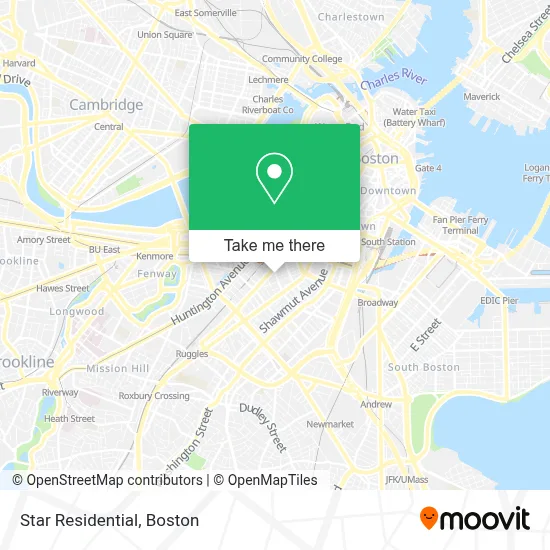
See Star Residential, Boston, on the map
Public Transit to Star Residential in Boston
Wondering how to get to Star Residential in Boston? Moovit helps you find the best way to get to Star Residential with step-by-step directions from the nearest public transit station.
Moovit provides free maps and live directions to help you navigate through your city. View schedules, routes, timetables, and find out how long does it take to get to Star Residential in real time.
Looking for the nearest stop or station to Star Residential? Check out this list of stops closest to your destination: Back Bay - Columbus Ave @ Dartmouth St; Back Bay Station (Dartmouth Street); Back Bay; Dartmouth Street Opposite Back Bay Station; Tremont St @ Upton St; Copley; Stuart St @ Dartmouth St; Back Bay - South End.
Bus: 1, 10, 39, 43, 501, 504, BB, ORANGE LINE SHUTTLE, ORANGE LINE SHUTTLE, ORANGE LINE SHUTTLE, ORANGE LINE SHUTTLE, ORANGE LINE SHUTTLE, ORANGE LINE SHUTTLE, ORANGE LINE SHUTTLE, WORCESTER LINE SHUTTLE.Train: ACELA, FRAMINGHAM/WORCESTER, HAVERHILL, NEEDHAM, FOXBORO EVENT SERVICE, FRANKLIN/FOXBORO, ORANGE LINE.Subway: GREEN LINE B, ORANGE LINE, GREEN LINE C, GREEN LINE D, GREEN LINE E.
Want to see if there’s another route that gets you there at an earlier time? Moovit helps you find alternative routes or times. Get directions from and directions to Star Residential easily from the Moovit App or Website.
We make riding to Star Residential easy, which is why over 1.7 million users, including users in Boston, trust Moovit as the best app for public transit. You don’t need to download an individual bus app or train app, Moovit is your all-in-one transit app that helps you find the best bus time or train time available.
For information on prices of subway, bus and train, costs and ride fares to Star Residential, please check the Moovit app.
Use the app to navigate to popular places including to the airport, hospital, stadium, grocery store, mall, coffee shop, school, college, and university.
Star Residential Address: 78 Dartmouth St street in Boston
- The South End Technology Center at Tent City,
- Clerys,
- Coda,
- Pure Oasis,
- Championscott Partners,
- Jessica B Massage (Boston Massage Therapist Ahlycea Faye),
- Discount Grocery Store,
- French Cleaners (French Dry Cleaners),
- Dog Eat Cake,
- Douzo,
- City Year,
- Dandelion Massage Boston (Nick Papavasiliou Massage),
- Susan Reardon Wellness,
- South End,
- Amtrak 179 BOS - NYC,
- Mbta Ticket Booth,
- Boston Ballet Headquarters & School,
- The Salty Pig,
- A. Philip Randolph,
- Taxi Stand
Places Near Star Residential (Boston)
- House Of Blues, Boston,
- Prudential Center, Boston,
- Boston Medical Center, Boston,
- Isabella Stewart Gardner Museum, Boston,
- North End, Boston,
- Faneuil Hall, Boston,
- Mgm Music Hall, Boston,
- Museum Of Science, Boston,
- Td Garden, Boston,
- Boston Children's Hospital, Boston,
- Cheers, Boston,
- Quincy Market, Boston,
- Leader Bank Pavilion (Leader Bank Pavillion), Boston,
- Castle Island, Boston,
- Boston Common, Boston,
- Massachusetts General Hospital, Boston,
- Wilbur Theatre, Boston,
- Seaport District, Boston,
- Wang Theater, Boston,
- Boston Convention & Exhibition Center, Boston
How to get to popular places in Boston with public transit
Get around Boston by public transit!
Traveling around Boston has never been so easy. See step by step directions as you travel to any attraction, street or major public transit station. View bus and train schedules, arrival times, service alerts and detailed routes on a map, so you know exactly how to get to anywhere in Boston.
When traveling to any destination around Boston use Moovit's Live Directions with Get Off Notifications to know exactly where and how far to walk, how long to wait for your line, and how many stops are left. Moovit will alert you when it's time to get off — no need to constantly re-check whether yours is the next stop.
Wondering how to use public transit in Boston or how to pay for public transit in Boston? Moovit public transit app can help you navigate your way with public transit easily, and at minimum cost. It includes public transit fees, ticket prices, and costs. Looking for a map of Boston public transit lines? Moovit public transit app shows all public transit maps in Boston with all Bus, Train, Subway and Ferry routes and stops on an interactive map.
Boston has 4 transit type(s), including: Bus, Train, Subway and Ferry, operated by several transit agencies, including MBTA, Southeastern Regional Transit Authority, MetroWest Regional Transit Authority, Rhode Island Public Transit Authority, WRTA, Lowell Regional Transit Authority, Merrimack Valley Transit, Montachusett Regional Transit Authority, Cape Cod Regional Transit Authority, Brockton Area Transit Authority, Martha's Vineyard Transit Authority, the WAVE - Nantucket Regional Transit Authority, GATRA, Cape Ann Transportation Authority and Massport