Directions to Starbucks (Boston) with public transportation
The following transit lines have routes that pass near Starbucks
 Bus: 88, BB, PETER PAN, SL1, 11.
- Subway: BLUE LINE.
- Ferry: HINGHAM/HULL FERRY, QUINCY FERRY, WINTHROP FERRY, WINTHROP/QUINCY FERRY.
How to get to Starbucks by bus?
Click on the bus route to see step by step directions with maps, line arrival times and updated time schedules.
From La Quinta, Somerville
71 minFrom Atlantic Fish Co, Boston
17 minFrom The Track at New Balance, Boston
73 minFrom YMCA of Greater Boston, Boston
38 minFrom Fresh Pond Mall, Cambridge
83 minFrom Harvard Square, Cambridge
44 minFrom Courtyard South Boston (COURTYARD by Marriott), Boston
53 minFrom Apple Cinemas, Cambridge
86 minFrom Warrior Ice Arena, Boston
74 min
How to get to Starbucks by subway?
Click on the subway route to see step by step directions with maps, line arrival times and updated time schedules.
From Warrior Ice Arena, Boston
81 minFrom La Quinta, Somerville
45 minFrom YMCA of Greater Boston, Boston
38 minFrom Staybridge Suites Boston-Quincy, Quincy
56 minFrom Atlantic Fish Co, Boston
39 minFrom Courtyard South Boston (COURTYARD by Marriott), Boston
49 minFrom Apple Cinemas, Cambridge
64 minFrom The Track at New Balance, Boston
81 minFrom Fresh Pond Mall, Cambridge
65 minFrom Harvard Square, Cambridge
51 min
Bus stops near Starbucks in Boston
Ferry stations near Starbucks in Boston
Subway station near Starbucks in Boston
- Wood Island, 24 min walk,VIEW
Bus lines to Starbucks in Boston
- 11, Terminal E - Arrivals,VIEW
- 66, Water Transportation Dock,VIEW
- 88, Economy Parking,VIEW
- BB, Back Bay,VIEW
- BT, Braintree,VIEW
- DV, Danvers,VIEW
- FH, Framingham,VIEW
- WO, Woburn,VIEW
- MANSFIELD TO LOGAN AIRPORT, Terminal E - Arrivals,VIEW
- 22, Conrac Rental Car Center, Drop Off - Conrac Rental Car Center, Pick Up,VIEW
- 55, Conrac Rental Car Center, Drop Off - Conrac Rental Car Center, Pick Up,VIEW
- 221, 221,VIEW
- 551, 551,VIEW
- 552, 552,VIEW
- 771, 270 Central Ave - Chelsea Garage - 270 Central Ave - Chelsea Garage,VIEW
- 772, 270 Central Ave - Chelsea Garage - 270 Central Ave - Chelsea Garage,VIEW
What are the closest stations to Starbucks?
The closest stations to Starbucks are:
- Terminal A - Arrivals is 2 yards away, 1 min walk.
- Terminal B Stop 1 – Lex Drop Off is 5 yards away, 1 min walk.
- Terminal B - Arrivals is 205 yards away, 3 min walk.
- Terminal B - Arrivals Stop 1 is 205 yards away, 3 min walk.
- Logan Airport Ferry Terminal is 1681 yards away, 20 min walk.
- Wood Island is 2013 yards away, 24 min walk.
- Lewis Mall Wharf is 2835 yards away, 34 min walk.
Which bus lines stop near Starbucks?
These bus lines stop near Starbucks: 88, BB, PETER PAN, SL1.
Which subway line stops near Starbucks?
BLUE LINE (Wonderland)
What’s the nearest subway station to Starbucks in Boston?
The nearest subway station to Starbucks in Boston is Wood Island. It’s a 24 min walk away.
What’s the nearest bus station to Starbucks in Boston?
The nearest bus stations to Starbucks in Boston are Terminal A - Arrivals and Terminal B Stop 1 – Lex Drop Off. The closest one is a 1 min walk away.
What’s the nearest ferry station to Starbucks in Boston?
The nearest ferry station to Starbucks in Boston is Logan Airport Ferry Terminal. It’s a 20 min walk away.
What time is the first subway to Starbucks in Boston?
The BLUE LINE is the first subway that goes to Starbucks in Boston. It stops nearby at 5:10 AM.
What time is the last subway to Starbucks in Boston?
The BLUE LINE is the last subway that goes to Starbucks in Boston. It stops nearby at 2:01 AM.
What time is the first bus to Starbucks in Boston?
The 88 is the first bus that goes to Starbucks in Boston. It stops nearby at 3:02 AM.
What time is the last bus to Starbucks in Boston?
The 771 is the last bus that goes to Starbucks in Boston. It stops nearby at 3:06 AM.
What time is the first ferry to Starbucks in Boston?
The EAST is the first ferry that goes to Starbucks in Boston. It stops nearby at 5:55 AM.
What time is the last ferry to Starbucks in Boston?
The HINGHAM/HULL FERRY is the last ferry that goes to Starbucks in Boston. It stops nearby at 10:05 PM.
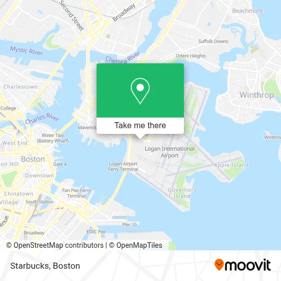
See Starbucks, Boston, on the map
Public Transit to Starbucks in Boston
Wondering how to get to Starbucks in Boston? Moovit helps you find the best way to get to Starbucks with step-by-step directions from the nearest public transit station.
Moovit provides free maps and live directions to help you navigate through your city. View schedules, routes, timetables, and find out how long does it take to get to Starbucks in real time.
Looking for the nearest stop or station to Starbucks? Check out this list of stops closest to your destination: Terminal A - Arrivals; Terminal B Stop 1 – Lex Drop Off; Terminal B - Arrivals; Terminal B - Arrivals Stop 1; Logan Airport Ferry Terminal; Wood Island; Lewis Mall Wharf.
Bus: 88, BB, PETER PAN, SL1, 11, 66, BT, DV, FH, WO, MANSFIELD TO LOGAN AIRPORT, 22, 55, 221, 551, 552.Subway: BLUE LINE.Ferry: HINGHAM/HULL FERRY, QUINCY FERRY, WINTHROP FERRY, WINTHROP/QUINCY FERRY.
Want to see if there’s another route that gets you there at an earlier time? Moovit helps you find alternative routes or times. Get directions from and directions to Starbucks easily from the Moovit App or Website.
We make riding to Starbucks easy, which is why over 1.7 million users, including users in Boston, trust Moovit as the best app for public transit. You don’t need to download an individual bus app or train app, Moovit is your all-in-one transit app that helps you find the best bus time or train time available.
For information on prices of bus, subway and train, costs and ride fares to Starbucks, please check the Moovit app.
Use the app to navigate to popular places including to the airport, hospital, stadium, grocery store, mall, coffee shop, school, college, and university.
Starbucks Address: Terminal A street in Boston
- Delta Sky Priority Check In Desk,
- Delta Air Lines Ticket Counter,
- Logan Airport Ma - Terminal A ,
- Alaska Airlines Terminal A,
- Wendy's,
- Terminal A Baggage Claim,
- Xpresspa,
- C&J Bus Lines,
- Plymouth & Brockton,
- Baggage Carousel 3,
- Gate A21,
- Terminal A Gates 13-22 Escalator,
- Logan Airport Central Parking,
- Silver Line Stop Terminal B,
- Spirit Airways (Spirit Airlines),
- Logan Int'l-Parking Pay Station,
- Spirit Airways,
- Boston's Logan Airport - Virgin American Airlines,
- Gate B6,
- Shoe Shine
Places Near Starbucks (Boston)
- Quincy Market, Boston,
- House Of Blues, Boston,
- Wang Theater, Boston,
- Boston Medical Center, Boston,
- North End, Boston,
- Museum Of Science, Boston,
- Wilbur Theatre, Boston,
- Prudential Center, Boston,
- Massachusetts General Hospital, Boston,
- Mgm Music Hall, Boston,
- Seaport District, Boston,
- Isabella Stewart Gardner Museum, Boston,
- Castle Island, Boston,
- Boston Convention & Exhibition Center, Boston,
- Td Garden, Boston,
- Leader Bank Pavilion (Leader Bank Pavillion), Boston,
- Boston Children's Hospital, Boston,
- Cheers, Boston,
- Boston Common, Boston,
- Faneuil Hall, Boston
How to get to popular places in Boston with public transit
Get around Boston by public transit!
Traveling around Boston has never been so easy. See step by step directions as you travel to any attraction, street or major public transit station. View bus and train schedules, arrival times, service alerts and detailed routes on a map, so you know exactly how to get to anywhere in Boston.
When traveling to any destination around Boston use Moovit's Live Directions with Get Off Notifications to know exactly where and how far to walk, how long to wait for your line, and how many stops are left. Moovit will alert you when it's time to get off — no need to constantly re-check whether yours is the next stop.
Wondering how to use public transit in Boston or how to pay for public transit in Boston? Moovit public transit app can help you navigate your way with public transit easily, and at minimum cost. It includes public transit fees, ticket prices, and costs. Looking for a map of Boston public transit lines? Moovit public transit app shows all public transit maps in Boston with all Bus, Train, Subway and Ferry routes and stops on an interactive map.
Boston has 4 transit type(s), including: Bus, Train, Subway and Ferry, operated by several transit agencies, including MBTA, Southeastern Regional Transit Authority, MetroWest Regional Transit Authority, Rhode Island Public Transit Authority, WRTA, Lowell Regional Transit Authority, Merrimack Valley Transit, Montachusett Regional Transit Authority, Cape Cod Regional Transit Authority, Brockton Area Transit Authority, Martha's Vineyard Transit Authority, the WAVE - Nantucket Regional Transit Authority, GATRA, Cape Ann Transportation Authority and Massport