Directions to Starbucks Coffee Company (Hingham) with public transportation
The following transit lines have routes that pass near Starbucks Coffee Company
 Bus: 220.
- Train: GREENBUSH.
- Ferry: BUMPKIN ISLAND FERRY, GEORGES ISLAND FERRY, HEWITT'S COVE FERRY, PEDDOCKS ISLAND FERRY, HINGHAM FERRY.
How to get to Starbucks Coffee Company by bus?
Click on the bus route to see step by step directions with maps, line arrival times and updated time schedules.
From Quincy Market, Quincy
23 minFrom Wollaston Beach, Quincy
76 minFrom South Shore Plaza, Braintree Town
72 minFrom Staybridge Suites Boston-Quincy, Quincy
47 minFrom Qea, Quincy
39 minFrom Encompass Health Rehabilitation Hospital of Braintree, Braintree Town
81 minFrom rmv Braintree, Braintree Town
82 minFrom Quincy Center Station, Quincy
23 minFrom South Shore Plaza Mbta Bus Stop, Braintree Town
67 minFrom Braintree, MA, Braintree Town
68 min
How to get to Starbucks Coffee Company by train?
Click on the train route to see step by step directions with maps, line arrival times and updated time schedules.
Bus stop near Starbucks Coffee Company in Hingham
- Downer Ave Opp Planters Field Ln, 2 min walk,VIEW
Ferry stations near Starbucks Coffee Company in Hingham
Train station near Starbucks Coffee Company in Hingham
- West Hingham, 27 min walk,VIEW
Bus lines to Starbucks Coffee Company in Hingham
- 220, Quincy Center Via Shipyard,VIEW
What are the closest stations to Starbucks Coffee Company?
The closest stations to Starbucks Coffee Company are:
- Downer Ave Opp Planters Field Ln is 107 yards away, 2 min walk.
- Hewitt's Cove is 2033 yards away, 24 min walk.
- Hingham is 2044 yards away, 24 min walk.
- West Hingham is 2265 yards away, 27 min walk.
Which bus line stops near Starbucks Coffee Company?
220 (Hingham Depot Via Shipyard)
Which train line stops near Starbucks Coffee Company?
GREENBUSH (#1061 | Greenbush)
What’s the nearest train station to Starbucks Coffee Company in Hingham?
The nearest train station to Starbucks Coffee Company in Hingham is West Hingham. It’s a 27 min walk away.
What’s the nearest bus station to Starbucks Coffee Company in Hingham?
The nearest bus station to Starbucks Coffee Company in Hingham is Downer Ave Opp Planters Field Ln. It’s a 2 min walk away.
What’s the nearest ferry station to Starbucks Coffee Company in Hingham?
The nearest ferry stations to Starbucks Coffee Company in Hingham are Hewitt's Cove and Hingham. The closest one is a 24 min walk away.
What time is the first train to Starbucks Coffee Company in Hingham?
The GREENBUSH is the first train that goes to Starbucks Coffee Company in Hingham. It stops nearby at 5:32 AM.
What time is the last train to Starbucks Coffee Company in Hingham?
The GREENBUSH is the last train that goes to Starbucks Coffee Company in Hingham. It stops nearby at 12:26 AM.
What time is the first bus to Starbucks Coffee Company in Hingham?
The 220 is the first bus that goes to Starbucks Coffee Company in Hingham. It stops nearby at 5:28 AM.
What time is the last bus to Starbucks Coffee Company in Hingham?
The 220 is the last bus that goes to Starbucks Coffee Company in Hingham. It stops nearby at 1:38 AM.
What time is the first ferry to Starbucks Coffee Company in Hingham?
The HINGHAM/HULL FERRY is the first ferry that goes to Starbucks Coffee Company in Hingham. It stops nearby at 5:40 AM.
What time is the last ferry to Starbucks Coffee Company in Hingham?
The HINGHAM/HULL FERRY is the last ferry that goes to Starbucks Coffee Company in Hingham. It stops nearby at 10:50 PM.
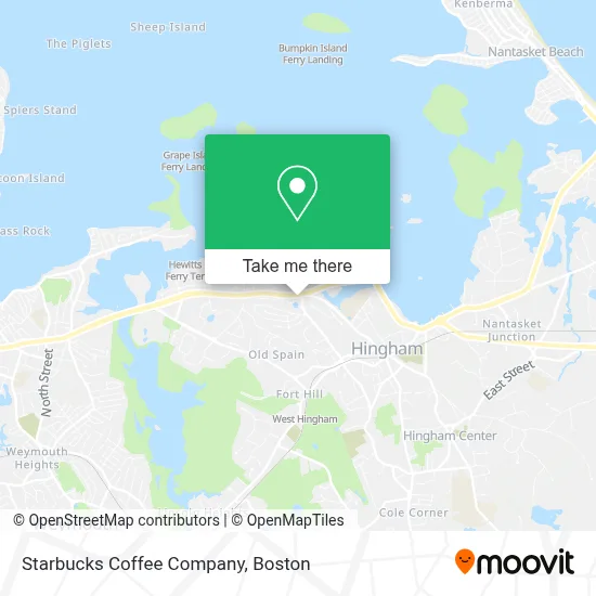
See Starbucks Coffee Company, Hingham, on the map
Public Transit to Starbucks Coffee Company in Hingham
Wondering how to get to Starbucks Coffee Company in Hingham? Moovit helps you find the best way to get to Starbucks Coffee Company with step-by-step directions from the nearest public transit station.
Moovit provides free maps and live directions to help you navigate through your city. View schedules, routes, timetables, and find out how long does it take to get to Starbucks Coffee Company in real time.
Looking for the nearest stop or station to Starbucks Coffee Company? Check out this list of stops closest to your destination: Downer Ave Opp Planters Field Ln; Hewitt's Cove; Hingham; West Hingham.
Bus: 220.Train: GREENBUSH.Ferry: BUMPKIN ISLAND FERRY, GEORGES ISLAND FERRY, HEWITT'S COVE FERRY, PEDDOCKS ISLAND FERRY, HINGHAM FERRY, HINGHAM/HULL FERRY.
Want to see if there’s another route that gets you there at an earlier time? Moovit helps you find alternative routes or times. Get directions from and directions to Starbucks Coffee Company easily from the Moovit App or Website.
We make riding to Starbucks Coffee Company easy, which is why over 1.7 million users, including users in Hingham, trust Moovit as the best app for public transit. You don’t need to download an individual bus app or train app, Moovit is your all-in-one transit app that helps you find the best bus time or train time available.
For information on prices of bus, train and subway, costs and ride fares to Starbucks Coffee Company, please check the Moovit app.
Use the app to navigate to popular places including to the airport, hospital, stadium, grocery store, mall, coffee shop, school, college, and university.
Starbucks Coffee Company Address: 184 Lincoln St street in Hingham
- Western Union,
- Lapels Cleaners Hingham,
- Integrity Locksmith,
- Western Union,
- Anderson Dentistry,
- Rees Loren,
- 7-Eleven - Closed,
- Weir River Water System,
- Hingham Speech & Language Therapy,
- The French Np,
- Divine Connection,
- Ajs Gulf Express,
- A.J.'s,
- Texture & Gloss,
- Healing With Spirit,
- 1 Dental Ja,
- Wu Healing,
- Liberty Bay Credit Union,
- Aj's Auto Repair,
- Mass Movement
Places Near Starbucks Coffee Company (Hingham)
- Quincy Market, Boston,
- Wang Theater, Boston,
- Mgm Music Hall, Boston,
- Boston Convention & Exhibition Center, Boston,
- Boston Common, Boston,
- Museum Of Science, Boston,
- Faneuil Hall, Boston,
- North End, Boston,
- House Of Blues, Boston,
- Prudential Center, Boston,
- Seaport District, Boston,
- Boston Children's Hospital, Boston,
- Cheers, Boston,
- Isabella Stewart Gardner Museum, Boston,
- Wilbur Theatre, Boston,
- Castle Island, Boston,
- Leader Bank Pavilion (Leader Bank Pavillion), Boston,
- Boston Medical Center, Boston,
- Td Garden, Boston,
- Massachusetts General Hospital, Boston
How to get to popular places in Boston with public transit
Get around Hingham by public transit!
Traveling around Hingham has never been so easy. See step by step directions as you travel to any attraction, street or major public transit station. View bus and train schedules, arrival times, service alerts and detailed routes on a map, so you know exactly how to get to anywhere in Hingham.
When traveling to any destination around Hingham use Moovit's Live Directions with Get Off Notifications to know exactly where and how far to walk, how long to wait for your line, and how many stops are left. Moovit will alert you when it's time to get off — no need to constantly re-check whether yours is the next stop.
Wondering how to use public transit in Hingham or how to pay for public transit in Hingham? Moovit public transit app can help you navigate your way with public transit easily, and at minimum cost. It includes public transit fees, ticket prices, and costs. Looking for a map of Hingham public transit lines? Moovit public transit app shows all public transit maps in Hingham with all Bus, Train, Subway and Ferry routes and stops on an interactive map.
Boston has 4 transit type(s), including: Bus, Train, Subway and Ferry, operated by several transit agencies, including MBTA, Southeastern Regional Transit Authority, MetroWest Regional Transit Authority, Rhode Island Public Transit Authority, WRTA, Lowell Regional Transit Authority, Merrimack Valley Transit, Montachusett Regional Transit Authority, Cape Cod Regional Transit Authority, Brockton Area Transit Authority, Martha's Vineyard Transit Authority, the WAVE - Nantucket Regional Transit Authority, GATRA, Cape Ann Transportation Authority and Massport